
Existed: 1926 – present Length 121.7 km | Constructed 1926 | |
 | ||
Counties Sebastian County, Arkansas, Franklin County, Arkansas, Logan County, Arkansas, Yell County, Arkansas | ||
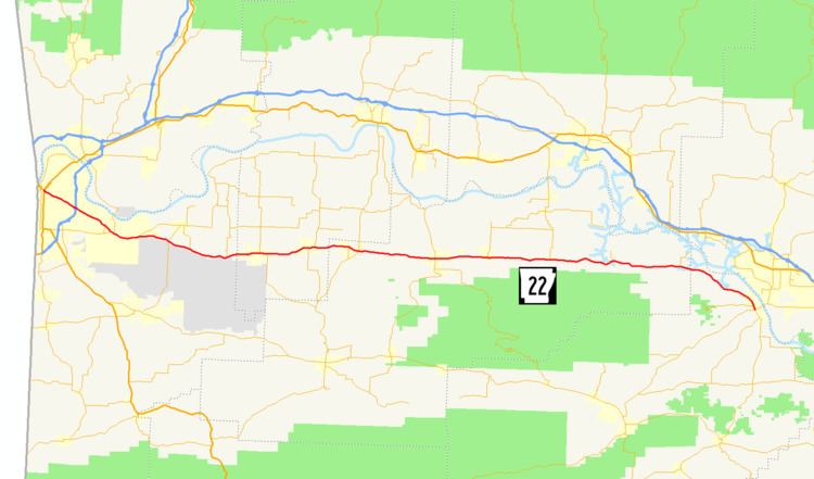
Highway 22 (AR 22, Ark. 22, and Hwy. 22) is an east–west state highway in the Arkansas River Valley. The highway runs 75.60 miles (121.67 km) from US 64/US 71B east to Highway 7 in Dardanelle. The highway is one of the original 1926 state highways, and is maintained by the Arkansas State Highway and Transportation Department (AHTD).
Contents
Map of AR-22, Arkansas, USA
Route description
The route begins in Fort Smith at US 64/US 71B. It runs east, crossing I-540/US 71. AR 22 concurs with AR 255 through Fort Chaffee and intersects AR 96 east of the installation. The route next enters Charleston where it meets AR 217 before crossing AR 41 in Branch. County Line High School is located on this highway near Branch.
Caulksville brings a junction with AR 23, and meetings with AR 109, AR 288, and AR 309 occur in Paris. AR 22/AR 109/AR 288 run together until Subiaco, when the route loses AR 288 but crosses AR 197. AR 22 eventually loses AR 109 at Midway, running alone to Dardanelle. The route terminates at AR 7 after a very brief concurrency with AR 155.
The road itself is fairly straight and in reasonably good repair. Passing can be safely accomplished in several stretches of Highway 22 despite a lack of constructed passing areas.
History
The route was one of the original 1926 Arkansas state highways. AR 22 ran from Fort Smith to Dardanelle along a routing very similar to the modern-day routing of AR 22. One surviving element of the original alignment survives in Yell County west of Dardanelle; it consists of CR 906, a 0.25-mile (0.40 km) stretch of concrete pavement 18 feet (5.5 m) wide. This segment was listed on the National Register of Historic Places in 2008. A surviving section built in 1930 is also found in New Blaine.