
Area 1,414 km² Population 127,342 (2013) | Founded 6 January 1851 | |
 | ||
Website www.sebastiancountyar.gov Cities Fort Smith, Greenwood, Barling, Lavaca, Hackett, Bonanza, Hartford, Huntington, Central City, Midland Points of interest Fort Smith Trolley Museum, Fort Smith National Historic S, Ben Geren Regional Park, Carol Ann Cross Park, River Valley Nature C | ||
Manhunt underway suspect shot at least 2 police officers sebastian county arkansas
Sebastian County is a county located in the U.S. state of Arkansas. As of the 2010 census, the population was 125,744, making it the fourth-most populous county in Arkansas. The county has two county seats, Greenwood and Fort Smith.
Contents
- Manhunt underway suspect shot at least 2 police officers sebastian county arkansas
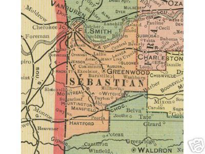
- Map of Sebastian County AR USA
- History
- Geography
- Adjacent counties
- National protected areas
- Demographics
- Education
- Towns
- Townships
- Notable people
- References
Map of Sebastian County, AR, USA
Sebastian County is part of the Fort Smith, AR-OK Metropolitan Statistical Area.
History
Sebastian County is Arkansas's 56th county, formed on January 6, 1851, and named for William K. Sebastian, United States Senator from Arkansas.
Geography
According to the U.S. Census Bureau, the county has a total area of 546 square miles (1,410 km2), of which 532 square miles (1,380 km2) is land and 14 square miles (36 km2) (2.6%) is water. It is the second-smallest county by area in Arkansas.
Adjacent counties
National protected areas
Demographics
As of the 2000 United States Census, there were 115,071 people, 45,300 households, and 30,713 families residing in the county. The population density was 215 people per square mile (83/km²). There were 49,311 housing units at an average density of 92 per square mile (36/km²). The racial makeup of the county was 82.34% White, 6.16% Black or African American, 1.57% Native American, 3.51% Asian, 0.05% Pacific Islander, 3.71% from other races, and 2.67% from two or more races. 6.70% of the population were Hispanic or Latino of any race. 19.6% were of American, 12.6% German, 11.0% Irish and 9.0% English ancestry according to Census 2000. 5.49% reported speaking Spanish at home, while 1.47% speak Vietnamese and 0.97% Lao.
In 2000 there were 45,300 households out of which 32.80% had children under the age of 18 living with them, 52.40% were married couples living together, 11.30% had a female householder with no husband present, and 32.20% were non-families. 27.50% of all households were made up of individuals and 10.00% had someone living alone who was 65 years of age or older. The average household size was 2.49 and the average family size was 3.04.
In the county, the population was spread out with 26.00% under the age of 18, 9.20% from 18 to 24, 29.50% from 25 to 44, 22.30% from 45 to 64, and 13.00% who were 65 years of age or older. The median age was 36 years. For every 100 females there were 95.30 males. For every 100 females age 18 and over, there were 92.10 males.
The median income for a household in the county was $33,889, and the median income for a family was $41,303. Males had a median income of $30,056 versus $22,191 for females. The per capita income for the county was $18,424. About 10.40% of families and 13.60% of the population were below the poverty line, including 18.60% of those under age 18 and 10.00% of those age 65 or over.
As of 2010 census the population of Sebastian County was 125,744. The racial makeup of the county was 72.83% Non-Hispanic white, 6.24% Non-Hispanic black, 1.88% Native American, 4.06% Asian, 0.09% Pacific Islander, 0.07% Non-Hispanics of some other race, 2.78% Non-Hispanics reporting two or more races and 12.82% Hispanics.
Education
Public education is provided by several school districts (listed below from largest to smallest):
Towns
Townships
Townships in Arkansas are the divisions of a county. Each township includes unincorporated areas; some may have incorporated cities or towns within part of their boundaries. Arkansas townships have limited purposes in modern times. However, the United States Census does list Arkansas population based on townships (sometimes referred to as "county subdivisions" or "minor civil divisions"). Townships are also of value for historical purposes in terms of genealogical research. Each town or city is within one or more townships in an Arkansas county based on census maps and publications. The townships of Sebastian County are listed below; listed in parentheses are the cities, towns, and/or census-designated places that are fully or partially inside the township.