
Population 392 (2001 census) Post town JEDBURGH Local time Thursday 3:19 AM | OS grid reference NT625245 Sovereign state United Kingdom Postcode district TD8 Dialling code 01835 | |
 | ||
Weather 0°C, Wind SW at 8 km/h, 93% Humidity Lieutenancy areas | ||
Ancrum handba game 2015
Ancrum (Scottish Gaelic: Alan Crom) is a village in the Borders area of Scotland, 5 km north west of Jedburgh.
Contents
- Ancrum handba game 2015
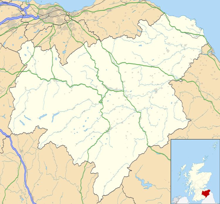
- Map of Ancrum Jedburgh UK
- Etymology
- Points of interest
- People from Ancrum
- References
Map of Ancrum, Jedburgh, UK
The village — which currently has a population of around 300 — is situated just off the A68 trunk road on the B6400 which runs through Ancrum. Lilliesleaf lies 7 miles (11 km) further along the B6400 and Denholm can be reached along the unclassified road which runs parallel to the River Teviot.
Etymology
William J. Watson derived Ancrum from the river-name Alne + Cumbric crwm or Gaelic crom, meaning 'bend of the river Alne'.
Points of interest
Two local landmarks which are visible from certain areas around the village are the Waterloo Monument and the Timpendean Tower.
Ancrum sits in a loop in the Ale Water which is where the name derives from (crooked land on the Ale). The Ale joins the River Teviot just to the south which in turn then flows past Monteviot House.
The area just north of the village was the site of the Battle of Ancrum Moor in 1545.