
 | ||
The best of altiplano full album lo mejor de altiplano de chile disco completo
The Altiplano (Spanish for "high plain"), Collao (Quechua and Aymara: Qullaw, meaning "place of the Qulla"), Andean Plateau or Bolivian Plateau, in west-central South America, is the area where the Andes are the widest. It is the most extensive area of high plateau on Earth outside Tibet. The bulk of the Altiplano lies in Bolivia, but its northern parts lie in Peru, and its southern parts lie in Chile and Argentina.
Contents
- The best of altiplano full album lo mejor de altiplano de chile disco completo
- Video el altiplano recorrido hasta la celda del chapo
- Location
- History
- Climatic zones
- Climate
- Geology
- Communities
- References
The plateau hosts several cities of these three nations, including El Alto, La Paz, Oruro, and Puno. The northeastern Altiplano is more humid than the southwestern area. The latter area has several salares, or salt flats, due to its aridity. At the Bolivia–Peru border lies Lake Titicaca, the largest lake in South America. South of that in Bolivia was Lake Poopó, which was declared dried up and defunct as of December 2015. It is unclear if this second-largest lake in Bolivia can be revitalized.
The Altiplano was the site of several pre-Columbian cultures, including the Chiripa, Tiawanaku and the Inca Empire. Spain conquered the region in the 16th century.
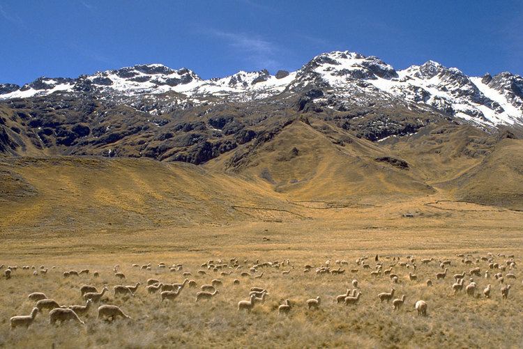
Major economic activities in the Altiplano include mining, llama and vicuña herding, and services in the cities. There is some international tourism.
Video el altiplano recorrido hasta la celda del chapo
Location
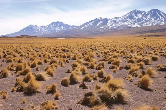
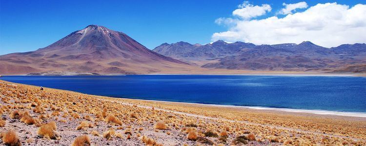
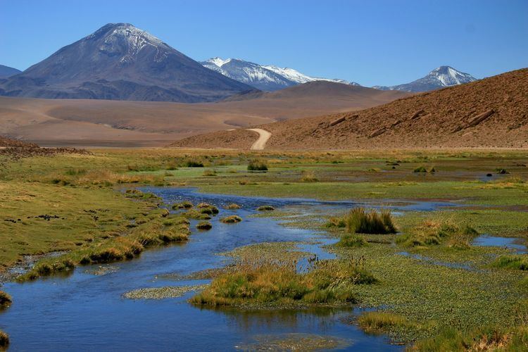
The Altiplano is an area of inland drainage (endorheism) lying in the central Andes, occupying parts of northern Chile and Argentina, western Bolivia and southern Peru. Its height averages about 3,750 meters (12,300 feet), slightly less than that of the Tibetan Plateau. Unlike conditions in Tibet, the Altiplano is dominated by massive active volcanoes of the Central Volcanic Zone to the west, such as Ampato (6288 m), Tutupaca (5,816 m), Parinacota (6348 m), Guallatiri (6071 m), Paruma (5,728 m), Uturunku (6,008 m) and Licancabur (5,916 m), and the Cordillera Real in the north east with Illampu (6,368 m), Huayna Potosí (6,088 m), Janq'u Uma (6,427 m) and Illimani (6,438 m). The Atacama Desert, one of the driest areas on the planet, lies to the southwest of the Altiplano; to the east lies the humid Amazon rainforest.
The Altiplano is noted for hypoxic air caused by very high elevation.
History
At various times during the Pleistocene epoch, both the southern and northern Altiplano were covered by vast pluvial lakes. Remnants are Lake Titicaca, straddling the Peru–Bolivia border, and Poopó, a salt lake that extends south of Oruro, Bolivia. Salar de Uyuni, locally known as Salar de Tunupa, and Salar de Coipasa are two large dry salt flats formed after the Altiplano paleolakes dried out.
Climatic zones
The term Altiplano is sometimes used to identify the altitude zone and the type of climate that prevails within it: it is colder than that of the tierra fría but not as cold as that of the tierra helada. Scientists classify the latter as commencing at an elevation of approximately 4,500 meters (or about 15,000 feet). Alternate names used in place of altiplano in this context include puna and páramos.
Climate
In extentum, the climate is cool and humid to semi-arid and even arid, with mean annual temperatures that vary from 3 °C near the western mountain range to 12 °C near Lake Titicaca; and total annual rainfall that ranges between less than 200 mm to the south west to more than 800 mm near and over Lake Titicaca. The diurnal cycle of temperature is very wide, with maximum temperatures in the order of 12 to 24 °C and the minimum in the order of -20 to 10 °C.
The coldest temperatures occur in the southwestern portion of the Altiplano during the months of June and July, which correspond to the austral winter. The seasonal cycle of rainfall is marked, with the rainy season concentrated between December and March. The rest of the year tends to be very dry, cool, windy and sunny. Snowfall may happen between April and September, especially to the north, but it is not very common (between one and five times a year).
Geology
Several mechanisms have been put forth for the formation of the Altiplano plateau; hypotheses try to explain why the topography in the Andes incorporates this large area of low relief at high altitude (high plateau) within the orogen:
- Existence of weaknesses in the Earth's crust prior to tectonic shortening. Such weaknesses would cause the partition of tectonic deformation and uplift into the eastern and western cordillera, leaving the necessary space for the formation of the altiplano basin.
- Magmatic processes rooted in the asthenosphere might have contributed to uplift of the plateau
- Climate has controlled the spatial distribution of erosion and sediment deposition, controlling the lubrication along the subducting Nazca Plate and hence influencing the transmission of tectonic forces into South America.
- Climate also determined the formation of internal drainage (endorheism) and sediment trapping within the Andes, potentially blocking tectonic deformation in the central area between the two cordilleras, and expelling deformation towards the flanks of the orogen
- Convective removal of the dense lower lithosphere beneath the Altiplano caused that region to isostatically 'float' higher