
Isolation 20 kilometres (12 mi) Mountain type Stratovolcano Last eruption 290 CE ± 300 years Elevation 6,348 m Prominence 1,989 m Listing Ultra-prominent peak | Location Bolivia – Chile border Volcanic arc/belt Central Volcanic Zone Easiest route snow/rock scramble First ascent 1928 Parent range Andes Mountain range Andes, Payachata | |
 | ||
Similar Pomerape, Nevado Sajama, Acotango, Guallatiri, Licancabur | ||
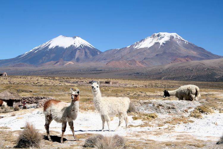
Parinacota (in Hispanicized spelling), Parina Quta or Parinaquta (Aymara parina flamingo, quta lake, "flamingo lake") is a massive dormant stratovolcano on the border of Chile and Bolivia. It is part of the Payachata volcanic group. The other major edifice in that group is the Pleistocene peak of Pomerape. Parinacota's last eruptive phase has been dated using the helium surface exposure technique, which ties the eruption to 290AD ± 300 years.
Contents
Map of Parinacota, Bolivia
One of the most dramatic eruptive events in the volcano's past was 8,000 years ago, when a major collapse of the edifice produced a 6 km³ (1.44 cubic miles) debris avalanche, which blocked nearby drainage patterns, creating Chungará Lake.
The volcano and Pomerape straddle the border between Sajama National Park (Bolivia) and Lauca National Park (Chile).
Climbing
Climbing the volcano is relatively easy, alpine F grade, on a snow/rubble slope of about 35 degrees. A camp can be established at 5,300 m at the saddle between Parinacota and Pomerape. Depending on the season, the main difficulty can be a snow formation called penitentes which make the ascent physically difficult or impossible. It is attempted by about one party per week in the season. If needed, guides and transport can be hired from Sajama village, 27 km away on the Bolivian side of the mountain.