
Province Pedro Domingo Murillo Elevation 4,150 m (13,620 ft) Population 903,080 (2015) | Municipality El Alto Municipality Time zone BOT (UTC−4) | |
 | ||
Weather 11°C, Wind NE at 11 km/h, 62% Humidity University Universidad Pública de El Alto Points of interest Museo de Arte Antonio P, Plaza Obelisco, LAVADO DE ARENA | ||
Mountain high cable car system to link bolivian cities of la paz and el alto
El Alto (Spanish for The Heights) is the second-largest city in Bolivia, located adjacent to La Paz in Pedro Domingo Murillo Province on the Altiplano highlands. El Alto is today one of Bolivia's fastest-growing urban centers, with a population of 974,754 in 2011. El Alto is the highest major metropolis in the world, with an average elevation of 4,150 m (13,615 ft).
Contents
- Mountain high cable car system to link bolivian cities of la paz and el alto
- Map of El Alto Bolivia
- In bolivia s el alto priests believers prepare pope s visit
- History
- El Altos districts
- Demographics
- Geography
- Climate
- Attractions
- Government
- Transportation
- References
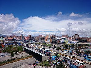
Map of El Alto, Bolivia
The El Alto-La Paz metropolitan area, formed by the cities of El Alto, La Paz, and Viacha, constitutes the most populous urban area of Bolivia, with a population of 2.3 million inhabitants (greater than the metropolitan area of the country's largest city of Santa Cruz de la Sierra).
In bolivia s el alto priests believers prepare pope s visit
History
The dry and inclement plain above La Paz was uninhabited until 1903, when the newly built railways from Lake Titicaca and Arica reached the rim of the canyon, where the La Paz terminus, railyards and depots were built along with a settlement of railway workers (a spur line down into the canyon opened in 1905). In 1925 the airfield was built as base for the new air force, which attracted additional settlement. In 1939 El Alto's first elementary school opened. El Alto started to grow tremendously in the 1950s, when the settlement was connected to La Paz's water supply (before that all water had to be transported from La Paz in tanker vehicles) and building land in the canyon became more and more scarce and expensive. In an administrative reform on March 6, 1985 the district of El Alto and surroundings was politically separated from the City of La Paz (this date is officially referred to and celebrated as the city's "founding day"). In 1987 El Alto was formally incorporated as a city. In 1994, the city became the seat of the Roman Catholic Diocese of El Alto.
El Alto, known for its teeming streets and traffic, broke gender barriers by hiring "cholitas" in December, 2013. These Aymara women dressed in traditional multi-layered Andean skirts and brightly embroidered vests, work as traffic cops to bring order to its road chaos. In recent years, Bolivia’s cholitas have been breaking social barriers, conducting television programs, working in offices, holding public posts and even participating in native fashion shows and beauty contests.
El Alto's districts
El Alto's autonomous government identifies 14 districts composing the andean city. On the web site of the municipality we find out besides other information the projects in infrastructure projected and under execution corresponding to each district.
Demographics
El Alto is the largest city in Latin America which has a mostly Amerindian population. About 76% of its inhabitants are Aymara, 9% are Quechua, 15% are Mestizo (descendants of Amerindian and White Europeans) and less than 0.1% are Criollos (White). El Alto was once known as La Paz's bedroom community, though recent growth of commerce and industry has led some local authorities to claim the title of "Bolivia's Economic Capital." Along with that industrial growth concern about water pollution by businesses including tanneries and slaughterhouse has become an issue for the city and communities downstream. Rapid population growth means the city struggles to bring potable water and sewer service to parts of the population, especially on the fringes of the expanding urban area.
Geography
The city contains La Paz’s El Alto International Airport. El Alto is one of the highest major cities in the world, up to 4,150 meters (13,615 feet) above mean sea level. It has a cold climate, with the highest average monthly maximum temperature being 17 °C (63 °F) in November. It is one of the fastest-growing cities in Bolivia, due to a trend in migration from Bolivia’s rural areas to the La Paz region that started with the rural reform of 1952 and increased in the last 10 years. Some migrants say the difficulty of growing crops in the countryside drove them to move to the city.
Climate
The Köppen-Geiger climate classification system classifies El Alto's climate as a rare cool summer variety of a subtropical highland climate (Cwc).
Attractions
Museo de Arte Antonio Paredes Candia opened in 2002. From 2003 to present times, access from La Paz to the international airport, as well to oil and gas supplies, has been frequently blocked by protesting El Alto social leaders, who have become some of the most powerful players in the politics of Bolivia. El Alto was - and remains - one of the major centers of the Bolivian gas conflict.
There is a large colorful open-air market.
Government
El Alto is a municipality within the province of Murillo. The government of the city is divided into the executive and legislative branches. The Mayor of El Alto is the head of the city government, elected for a term of five years by general election. The legislative branch consists of the Municipal Council, which elects a President, Vice President and Secretary from a group of eleven members.
The current mayor is Soledad Chapetón, who became the city's first female mayor in May 2015. The previous election was held April 4, 2010 and results of that regional election are given below:
Transportation
El Alto is connected to La Paz by two lines of the Mi Teleférico cable car system.