
Length 421 km Basin area 14,321 km² | Discharge 140 m³/s | |
 | ||
Main source Massif Central1,503 m (4,931 ft) Basin size 14,350 km (5,540 sq mi) | ||
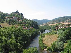
The Allier (Occitan: Alèir) is a river in central France. It is a left tributary of the Loire. Its source is in the Massif Central, in the Lozère department, east of Mende. It flows generally north. It joins the Loire west of the city of Nevers. It is 421 km (262 mi) long, and has a drainage basin of 14,350 km2 (5,540 sq mi).
Contents
- Map of Allier River France
- Departments and towns along the riverEdit
- Tributaries includeEdit
- EcologyEdit
- References
Map of Allier River, France
Departments and towns along the riverEdit
Tributaries includeEdit
EcologyEdit
The Allier River is one of the rare places in southern Europe where the freshwater grayling (Thymallus thymallus), known in French as ombre des rivières, occurs in a natural habitat.
Grayling like to live in shoals and are sensitive to pollution. In the Allier these fish are more abundant in the stretch between Langogne and Brioude. They are economically important, being appreciated for food and fished for sport.
References
Allier (river) Wikipedia(Text) CC BY-SA