
Region Auvergne Length 26 km | Mouth Monne | |
 | ||
Progression | ||
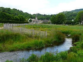
The Veyre is a left-bank affluent of the river Monne in the French region of Auvergne.
Contents
Map of La Veyre, France
Geography
The Veyre is 26.1 kilometres (16.2 mi) long. It has no concrete source given that it originates at the plateau des Monts Dore, from the confluence of two streams : la Narse et le Labadeau which begins at the Puy de Vedrine. La Veyre has the particularity of having had its flow breached around 10,000 years ago by a lava flow of the Puys de la Vache and the Lassolas which formed a volcanic reservoir, the lac d'Aydat. Shortly after the lac d’Aydat, the Veyre then disappears underneath the volcanic heath of la cheire d’Aydat, then reappears downstream of Saint-Saturnin. At Veyre-Monton, between Tallende and Veyre, it joins the Monne.
References
Veyre Wikipedia(Text) CC BY-SA