
 | ||
Similar | ||
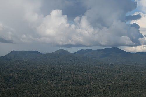
The Acarai Mountains (also, Akarai Mountains) (Portuguese: Serra Acaraí; French: Montes Acaraí) are a wet, forested highland region of low mountains located in the southern part of Guyana. This range lies along the common border between Guyana and Brazil. The Acarai Mountains is one of four mountain ranges in Guyana, the others being the Imataka, Kanuku and Pakaraima mountains. The headwaters of the Essequibo River, the longest river in Guyana, and the Courantyne River, have their sources in this range.
Map of Acarai Mountains, Guyana
This range is home to a single village of Wai-Wais, the descendants of surviving tribes that were once believed extinct.
The unnamed high point of this range is located at 1°22′N 59°11′W, and has an altitude of 1,009 metres (3,310 ft). This range extends to the east, where it becomes the Tumuk Humak Mountains along the border between French Guiana and Suriname.