
Mountains Mount Ayanganna | ||
 | ||
Similar | ||
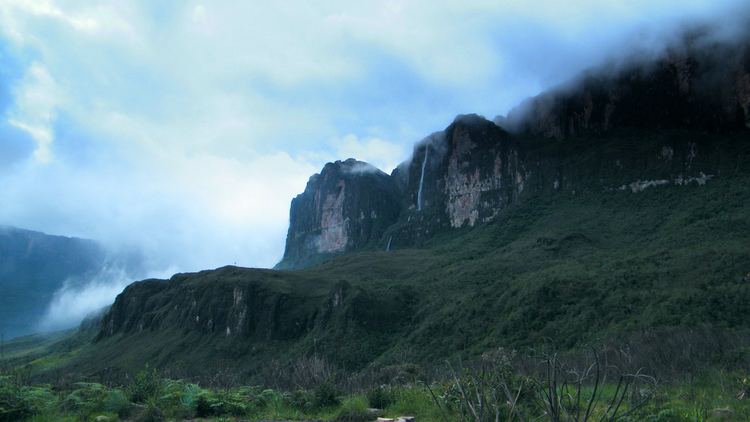
The Pacaraima or Pakaraima Mountains (Portuguese: Serra Pacaraima, Spanish: Sierra Pacaraima) are a mountain range in Guyana, lying in southwestern part of this country and shares borders with Brazil, Guyana, and Venezuela, extending from west to east for over 800 kilometres (500 mi). Its highest peak is Mount Roraima at 2,810 metres (9,220 ft) above sea level, surrounded by cliffs 300 metres (980 ft) high.
Map of Pacaraima Mountains, Bol%C3%ADvar, Venezuela
The mountains form the divide between the Orinoco Valley to the north and the Amazon Basin to the south. They also serve as a natural boundary in the east-west direction, where they extend 250 miles to form a border marker between Brazil and southeastern Venezuela and between Brazil and west central Guyana. Numerous rivers originate in these mountains and on their way down they plunge spectacularly to form some picturesque waterfalls. A beautiful example of this is the Kaieteur Falls in Guyana.
The 116,748 hectares (288,490 acres) Monte Roraima National Park covers part of the range in Roraima, Brazil.