
 | ||
Similar Casiquiare canal, Cerro Marahuaca, Pico da Neblina, Yapacana National Park, Pacaraima Mountains | ||
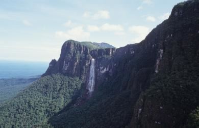
The Parima Mountains (span. Sierra Parima, port. Serra Parima) are a mountain range of the Guiana Shield in South America.
Map of Parima Mountains, Amazonas, Venezuela
The Parima Mountains are located in the western part of the Guiana Shield, there they run for approximately 320 km in a north–south direction in the border area of Brazil and Venezuela. They reach a maximum elevation of 1500 m and form the divide between the watersheds of the Amazon and the Orinoco. All the water on their western side drains into the Orinoco, which rises itself in the Parima Mountains as well. All the water on their eastern side drains into the Branco River, which ultimately empties into the Rio Negro, which in turn empties into the Amazon.
The Parima Mountains belong to the settlement areas of the Yanomami.