
Length 1,010 km | ||
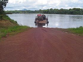 | ||
Parika guyana parika to bartica essequibo river
The Essequibo River (Spanish: Río Esequibo) is the largest river in Guyana, and the largest river between the Orinoco and Amazon. Rising in the Acarai Mountains near the Brazil-Guyana border, the Essequibo flows to the north for 1,010 kilometres (630 mi) through forest and savanna into the Atlantic Ocean.
Contents
- Parika guyana parika to bartica essequibo river
- Map of Essequibo River Guyana
- Geography
- Fauna
- History
- 183738
- 1908
- 2013
- References
Map of Essequibo River, Guyana
Geography
There are countless rapids and waterfalls (e. g., Kaieteur Falls on the Potaro river) along the route of the Essequibo, and its 20-kilometre (12 mi) wide estuary is dotted with numerous small islands. It enters the Atlantic 21 kilometres (13 mi) from Georgetown, the capital city of Guyana. The river features Murrays Fall, Pot Falls, and Kumaka Falls.
Its many tributaries include the Rupununi, Potaro, Mazaruni, Siparuni, Kiyuwini, Konawaruk and Cuyuni rivers. For over 30 kilometres (19 mi) from its mouth, the river's channel is divided by the large flat and fertile islands of Leguan, about 28 square kilometres (11 sq mi), Wakenaam, about 44 square kilometres (17 sq mi), and Hog Island, about 60 square kilometres (23 sq mi). Fort Island is off the eastern side of Hog Island. Fort Island was the seat of government of the country during the Dutch colonial era.
Fauna
The river has a very rich fauna. More than 300 fish species are known from the Essequibo basin, including almost 60 endemics.
History
The first European discovery was by the ships of Juan de Esquivel, deputy of Don Diego Columbus, son of Christopher Columbus. The Essequibo River is named after Esquivel. In 1499 Alonso de Ojeda explored the mouths of the Orinoco and allegedly was the first European to explore the Essequibo. Capuchin missionaries established missions in the territory before the Dutch settled along Esquivel's River. In 1596 Lawrence Kemys, serving as second-in-command of Walter Raleigh's British expedition to Guiana, led a force inland along the banks of the Essequibo River, reaching what he wrongly believed to be Lake Parime. The next year Kemys, in command of the Darling, continued the exploration of the Guiana coast and the Essequibo river.
The first European settlement in Guyana was built by the Dutch along the lower part of the Essequibo in 1615. The colonists remained on friendly terms with the Native American peoples of the area, establishing riverside sugar and cacao plantations. In a document detailing instructions for the Dutch Postholder in Cuyuni, it was mentioned that Indians (Venezuelan Amerindians) trading in Chinese slaves to sell to people who lived along the Essequibo river were to be allowed to conduct their business.
The Independence war of Venezuela beginning in the 19th century ended the missionary settlements. At this time, Britain needed to have a colony, besides Trinidad, to serve the large trade sailboats on their large travel trading route around South America. Venezuela claims that the Essequibo is the true border between it and Guyana, claiming all territory west of it. The boundary was set between Venezuela and Guyana's then colonial power, Great Britain in 1899 through an arbitration proceeding. A letter written by Venezuela's legal counsel, named partner Severo Mallet-Prevost of New York City law firm Curtis, Mallet-Prevost, Colt & Mosle alleged that the Russian and British judges on the tribunal had acted improperly and granted the lion's share of the dispute territory to Britain due to a political deal between Russia and the United Kingdom. As a result, Venezuela has revived its claim to the disputed territory.
Essequibo is also the name of a former Dutch colony founded in 1616 and located in the region of the Essequibo River that later became part of British Guiana.
In August 1995 there was an acid spill in the river by the Canadian mining company Cambior. An estimated 4 million cubic metres (140,000,000 cu ft) of waste laced with cyanide was released into the river causing much destruction.
1837/38
Sponsored by the Royal Geographical Society the German researcher Robert Hermann Schomburgk (1804-1865) investigated the river Essequibo and followed its course to the South -West, while Sipu River flows to a westerly direction. He specified the coordinates of the source at 0°41`northern latitude, while not giving a longitude.
1908
In 1908 the German-American ichthyologist Carl H. Eigenmann traveled on river Essequibo and confluent Potaro. He described 336 fish species in these rivers.
2013
A Guyanese-German expedition in Guyana in April and May 2013 followed the course of the Sipu River to detect the still unknown headwaters of the Essequibo. It was sponsored by the French-German TV Company ARTE and was organized by Duane De Freitas , Rupununi Trails and the film production team of Marion Pöllmann and Rainer Bergomaz, Blue Paw Artists. The responsible scientist for remote sensing, geodesy and mapping was Prof. Dr. Martin Oczipka from the University of Applied Scienes Dresden (HTW Dresden). The expedition was only realizable with the support of the Guyanese government and the indigenous tribe of Wai-Wai-Amerindian settling in the very South of Guyana.
With the support of the Wai-Wai, satellite maps, topographic maps, GPS and a small drone, the source valley was discovered in 2013. The coordinate determined by expedition teams in 2013 deviates by approximately 40`, which corresponds to a distance of at least 80 km north. This could be caused by calculation errors or other mistakes. Possibly he followed a different branch of the river more in the South of Guyana. To further investigate this, additional research is necessary, preferably in the original reports of Robert Hermann Schomburgk from his expedition in 1837/38. For the accurate determination of the headwaters and their proper classification, further extensive geological and hydrological studies are necessary.