
Length 295 km Mouth Rhine | ||
 | ||
Settlements Meiringen (BE), Interlaken (BE), Thun (BE), Münsingen, Muri bei Bern, Bern, Bremgarten bei Bern, Aarberg (BE), Büren a.A. (BE), Solothurn (SO), Aarwangen (BE), Aarburg (BE), Olten (SO), Niedergösgen (SO), Schönenwerd (SO), Aarau (AG), Wildegg (AG), Brugg (AG), Windisch (AG), Döttingen (AG), Klingnau (AG) Main source Unteraar Glacier, Bernese Highlands1,940 m (6,360 ft) River mouth Rhine below Koblenz, Aargau311 m (1,020 ft) Basin size 17,779 km (6,865 sq mi) Bridges Nydeggbrücke, Untertorbrücke, Kirchenfeldbrücke Similar | ||
The Aare ( [ˈaːrə]) or Aar is a tributary of the High Rhine and the longest river that both rises and ends entirely within Switzerland.
Contents
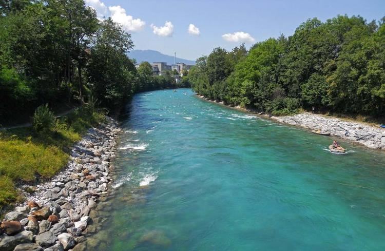
Map of Aare, Switzerland
Its total length from its source to its junction with the Rhine comprises about 295 kilometres (183 mi), during which distance it descends 1,565 m (5,135 ft), draining an area of 17,779 km2 (6,865 sq mi), almost entirely within Switzerland, and accounting for close to half the area of the country, including all of Central Switzerland.
There are more than 40 hydroelectric plants along the course of the Aare River.
The river's name dates to at least the La Tène period, and it is attested as Nantaror "Aare valley" in the Berne zinc tablet which dates back to Roman Gaul.
The name was Latinized as Arula/Arola/Araris.
CourseEdit
The Aare rises in the great Aargletschers (Aare Glaciers) of the Bernese Alps, in the canton of Bern and west of the Grimsel Pass. The Finsteraargletscher and Lauteraargletscher come together to form the Unteraargletscher (Lower Aare-Glacier), which is the main source of water for the Grimselsee. The Oberaargletscher (Upper Aare-Glacier) feeds the Oberaarsee, which also flows into the Grimselsee. The Aare river leaves the Grimselsee just to the east to the Grimsel Hospice, below the Grimsel Pass, and then flows northwest through the Haslital, forming on the way the magnificent Handegg Waterfall, 46 m (151 ft), past Guttannen.
Right after Innertkirchen it is joined by its first major tributary, the Gamderwasser. Less than 1 kilometre (0.62 mi) later the river carves through a limestone ridge in the Aare Gorge (German: Aareschlucht). It is here that the Aare proves itself to be more than just a river, as it attracts thousands of tourists annually to the causeways through the gorge. A little past Meiringen, near Brienz, the river expands into Lake Brienz. Near the west end of the lake it indirectly receives its first important tributary, the Lütschine, by the Lake of Brienz. It then runs across the swampy plain of the Bödeli between Interlaken and Unterseen before flowing into Lake Thun.
Near the west end of Lake Thun, the river indirectly receives the waters of the Kander, which has just been joined by the Simme, by the Lake of Thun. Lake Thun marks the head of navigation. On flowing out of the lake it passes through Thun, and then flows through the city of Bern, passing beneath eighteen bridges and around the steeply-flanked peninsula on which the Old City is located. The river soon changes its northwesterly flow for a due westerly direction, but after receiving the Saane or Sarine it turns north until it nears Aarberg. There, in one of the major Swiss engineering feats of the 19th century, the Jura water correction, the river, which had previously rendered the countryside north of Bern a swampland through frequent flooding, was diverted by the Hagneck Canal into the Lake of Bienne. From the upper end of the lake, at Nidau, the river issues through the Nidau-Büren Channel, also called the Aare Canal, and then runs east to Büren. The lake absorbs huge amounts of eroded gravel and snowmelt that the river brings from the Alps, and the former swamps have become fruitful plains: they are known as the "vegetable garden of Switzerland".
From here the Aare flows northeast for a long distance, past the ambassador town Solothurn (below which the Grosse Emme flows in on the right), Aarburg (where it is joined by the Wigger), Olten, Aarau, near which is the junction with the Suhre, and Wildegg, where the Seetaler Aabach falls in on the right. A short distance further, below Brugg it receives first the Reuss, its major tributary, and shortly afterwards the Limmat, its second strongest tributary. It now turns to north, and soon becomes itself a tributary of the Rhine, which it even surpasses in volume when the two rivers unite downsstreams from Koblenz (Switzerland), opposite Waldshut in Germany. The Rhine, in turn, empties into the North Sea after crossing into the Netherlands.