
Population 27,587 (Oct 2016) | Phone number 0261-22-0420 Local time Monday 1:34 AM | |
 | ||
Address 3887, Ōmachi, Ōmachi-shi, Nagano-ken 398-0002 Weather -3°C, Wind W at 3 km/h, 76% Humidity Points of interest | ||
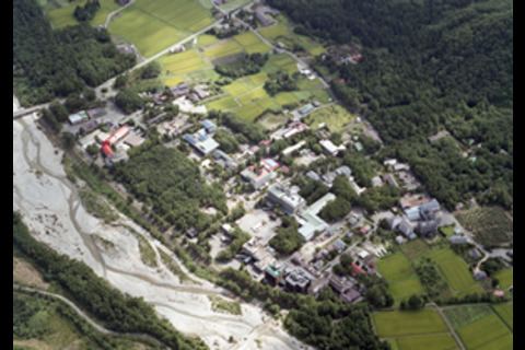
Ōmachi (大町市, Ōmachi-shi) is a city located in northwest Nagano Prefecture, in the Chūbu region of Japan. As of 1 October 2016, the city had an estimated population of 27,587 and a population density of 48.8 persons per km². Its total area was 565.15 square kilometres (218.21 sq mi).
Contents
- Map of Omachi Nagano Prefecture Japan
- Geography
- Surrounding municipalities
- Climate
- History
- Education
- Railway
- Highway
- International relations
- Local attractions
- References
Map of Omachi, Nagano Prefecture, Japan
Geography
Ōmachi is located west of Nagano, the capital of Nagano Prefecture, in the Daihoku District (大北地域, Daihoku-chiiki) of the prefecture. The 3000 meter Northern Japanese Alps (or Hida Mountains) are to the west ranges to the west of the city and mountains of around 1000 meters form the eastern border. The Takase River runs through the city, which is located in the northern Matsumoto basin.
The Itoigawa-Shizuoka Tectonic Line active fault system is also running through the city.
Surrounding municipalities
Climate
Due to its elevation, Omachi lies at the junction of three different climate types, namely the humid continental climate (Köppen Dfa/Dfb), humid subtropical climate (Köppen Cfa) and, uniquely for Japan, the subtropical highland climate (Köppen Cfb). Winters are cold and very snowy, while summers are very warm and wet.
History
The area of present-day Ōmachi was part of ancient Shinano Province. The area was part of the holdings of Matsumoto Domain during the Edo period. The modern town of Ōmachi was established with the creation of the municipalities system on April 1, 1889. It merged with the neighboring villages of Taira, Tokiwa and Yashiro on July 1, 1954 to form the city of Ōmachi. On January 1, 2006, the villages of Miasa and Yasaka (both from Kitaazumi District) were merged into Ōmachi.
Education
Ōmachi has five public elementary schools, three public middle schools and one combined elementary/middle school operated by the city government. There are two public high schools operated by the Nagano Prefectural Board of Education.