
Rural localities 5 Founded 10 December 1930 | rural okrug 4 Area 140,222 km² | |
 | ||
Municipally incorporated as | ||
Zhigansky District (Russian: Жига́нский улу́с; Yakut: Эдьигээн улууһа) is an administrative and municipal district (raion, or ulus), one of the thirty-four in the Sakha Republic, Russia. It is located in the northern central part of the republic and borders with Bulunsky District in the north, Eveno-Bytantaysky National District in the east, Kobyaysky District in the southeast, Vilyuysky District in the southwest, and with Olenyoksky District in the northwest. The area of the district is 140,200 square kilometers (54,100 sq mi). Its administrative center is the rural locality (a selo) of Zhigansk. Population: 4,296 (2010 Census); 4,312 (2002 Census); 5,678 (1989 Census). The population of Zhigansk accounts for 79.6% of the district's total population.
Contents
- Map of Zhiganskiy u Sakha Republic Russia
- Geography
- Climate
- History
- Demographics
- Inhabited localities
- References
Map of Zhiganskiy u., Sakha Republic, Russia
Geography
The main river in the district is the Lena. The largest lake is Lake Ulakhan-Kyuyol.
Climate
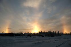
Average January temperature ranges from −36 °C (−33 °F) in the east to −40 °C (−40 °F) in the west and average July temperature ranges from +14 °C (57 °F) to +16 °C (61 °F). Annual precipitation ranges from 250–300 millimeters (9.8–11.8 in) in the west to 300–400 millimeters (12–16 in) in the east.
History
The district was established on December 10, 1930.
Demographics
As of the 1989 Census, the ethnic composition was as follows:
Inhabited localities
Divisional source:
Population source:
*Administrative centers are shown in bold
Note: The figures given in the table above include 2010 census reports of one person (male) living in the intersettlement territory, clarified in the regional census data as inhabiting Dzardzhan.