
Settlements 1 Area 55,193 km² | Towns under district jurisdiction 1 Rural okrugs 19 Founded 1930 | |
 | ||
Vilyuysky District (Russian: Вилю́йский улу́с; Yakut: Бүлүү улууһа, Bülüü uluuha, [bylyː uluːha]) is an administrative and municipal district (raion, or ulus), one of the thirty-four in the Sakha Republic, Russia. It is located in the western central part of the republic and borders with Zhigansky District in the northeast, Kobyaysky District in the east, Gorny District in the south, Verkhnevilyuysky District in the west, and with Olenyoksky District in the northwest. The area of the district is 55,200 square kilometers (21,300 sq mi). Its administrative center is the town of Vilyuysk. Population: 25,222 (2010 Census); 25,696 (2002 Census); 28,704 (1989 Census). The population of Vilyuysk accounts for 40.6% of the district's total population.
Contents
- Map of Vilyuysky District Sakha Republic Russia
- Geography
- History
- Demographics
- Economy
- Inhabited localities
- References
Map of Vilyuysky District, Sakha Republic, Russia
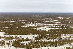
Geography
Main rivers in the district include the Vilyuy and its tributary the Tyung.
History
The district was established on January 9, 1930.
Demographics
As of the 1989 Census, the ethnic composition was as follows:
Economy
The economy of the district is mostly based on agriculture.
Inhabited localities
Divisional source:
Population source:
*Administrative centers are shown in bold