
Car plates DZG | Area 838.1 km² Team Turów Zgorzelec | |
 | ||
Gminas Total 7 (incl. 2 urban)ZawidówZgorzelecGmina BogatyniaGmina PieńskGmina SulikówGmina WęgliniecGmina Zgorzelec Points of interest Park Andrzeja Błachańca, Dom Jakob Böhme, Stift Joachimstein, Lausitzer Museum Destinations | ||
Zgorzelec County (Polish: powiat zgorzelecki) is a unit of territorial administration and local government (powiat) in Lower Silesian Voivodeship, Poland. It came into being on January 1, 1999, as a result of the Polish local government reforms passed in 1998. It is situated in the extreme south-west of Poland, bordering both Germany and the Czech Republic. The county covers an area of 838.1 square kilometres (323.6 sq mi). Its administrative seat is Zgorzelec, on the German border; the other towns in the county are Bogatynia, Pieńsk, Zawidów and Węgliniec.
Contents
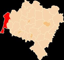
Map of Zgorzelec County, Poland
As at 2006 the total population of the county is 94,408, of which the population of Zgorzelec is 32,925, that of Bogatynia is 19,068, that of Pieńsk is 5,799, that of Zawidów is 4,412, that of Węgliniec is 3,072, and the rural population is 29,132.
Neighbouring counties
Zgorzelec County is bordered by Żary County and Żagań County to the north, and Bolesławiec County and Lubań County to the east. It also borders the Czech Republic to the south and Germany to the west.
Administrative division
The county is subdivided into seven gminas (two urban, three urban-rural and two rural). These are listed in the following table, in descending order of population.