
Car plates DLB Capital Lubań | Seat Lubań Area 428.2 km² | |
 | ||
Gminas Total 7 (incl. 2 urban)LubańŚwieradów-ZdrójGmina LeśnaGmina LubańGmina OlszynaGmina PlaterówkaGmina Siekierczyn Points of interest Czocha Castle, Park na Kamiennej Górze, Muzeum Regionalne w Lubaniu, Punkt Antygrawitacyjny, Zapora Leśniańska | ||
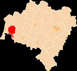
Lubań County (Polish: powiat lubański) is a unit of territorial administration and local government (powiat) in Lower Silesian Voivodeship, south-western Poland. It came into being on January 1, 1999, as a result of the Polish local government reforms passed in 1998. The county covers an area of 428.2 square kilometres (165.3 sq mi). Its administrative seat and largest town is Lubań. The county also contains the towns of Olszyna, Leśna and Świeradów-Zdrój.
Contents
Map of Luba%C5%84 County, Poland
As at 2006 the total population of the county is 57,061, out of which the population of Lubań is 22,137, that of Olszyna is 4,786, that of Leśna is 4,752, that of Świeradów-Zdrój is 4,554, and the rural population is 20,832.
Neighbouring counties
Lubań County is bordered by Zgorzelec County to the west, Bolesławiec County to the north-east and Lwówek Śląski County to the east. It also borders the Czech Republic to the south.
Administrative division
The county is subdivided into seven gminas (two urban, two urban-rural and three rural). These are listed in the following table, in descending order of population.