
World Heritage Site 304 Area 1,313 km² Established October 10, 1886 | Phone +1 250-343-6783 | |
 | ||
Location British Columbia, Canada Profiles | ||
Yoho national park canadian rockies
Yoho National Park is located in the Canadian Rocky Mountains along the western slope of the Continental Divide of the Americas in southeastern British Columbia. Yoho NP is bordered by Kootenay National Park on the southern side and Banff National Park on the eastern side in Alberta. The name Yoho comes from the Cree word for awe and wonder.
Contents
- Yoho national park canadian rockies
- Lake o hara alpine circuit yoho national park bc canada in 4k ultra hd
- HistoryEdit
- FaunaEdit
- ClimateEdit
- GeologyEdit
- MountainsEdit
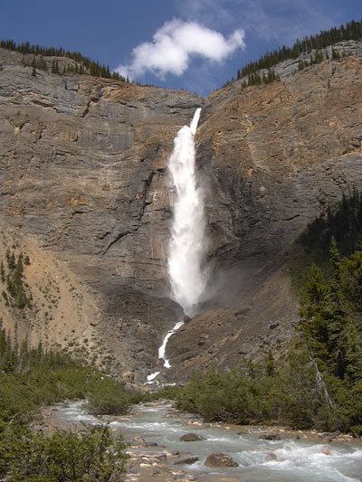
- WaterfallsEdit
- References
Yoho covers 1,313 km2 (507 mi2) and it is the smallest of the four contiguous national parks. Yoho, together with Jasper, Kootenay and Banff National Parks, along with three British Columbia provincial parks—Hamber Provincial Park, Mount Assiniboine Provincial Park, and Mount Robson Provincial Park—form the Canadian Rocky Mountain Parks World Heritage Site. The park's administrative and visitor centre are located in the town of Field, British Columbia, beside the Trans-Canada Highway.
Lake o hara alpine circuit yoho national park bc canada in 4k ultra hd
HistoryEdit
The park was created following a trip by Prime Minister John A. Macdonald and his wife Agnes through the Rockies on the newly completed Trancontinental Railway. Inspired on his return to Ottawa, Yoho National Park was created on October 10, 1886. Glacier National Park was created on the same day, becoming the second and third national parks in the country, after Banff.
The contiguous national parks of Banff, Jasper, Kootenay and Yoho, as well as the Mount Robson, Mount Assiniboine and Hamber provincial parks were declared a UNESCO World Heritage Site in 1984.
FaunaEdit
Common species of animals that roam in this park are the timber wolf, badger, moose, elk, mountain goat, golden-mantled ground squirrel, rufous hummingbird, hoary marmot, wolverine, cougar, pika, lynx, grizzly bear, and American black bear.
ClimateEdit
The weather in the park is localized and changeable. Being located on the west side of the continental divide, it receives more precipitation than areas east of the divide. Precipitation in the park increases with elevation. In winter, average temperatures are between 5 to −15 °C (41.0 to 5.0 °F) from the months November to April although temperatures can range between 10 to −35 °C (50.0 to −31.0 °F). The coldest weather usually occurs in the months December to February. In summer, mean temperatures average 12.5 °C (54.5 °F) with an average high of 20 °C (68.0 °F) and an average low of 5 °C (41.0 °F). Snowfall and freezing temperatures can occur during the summertime at altitudes above 1,500 m (4,900 ft).
GeologyEdit
The Kicking Horse River, a Canadian Heritage river, originates in the Wapta and Waputik icefields in the park. This river has created a natural bridge through solid rock. This formation is located 3 km west of Field, accessible from the road to Emerald Lake.
The Canadian Rockies consist of sedimentary rock, with numerous fossil deposits. In particular, the Burgess Shale, located in Yoho National Park, has among the world's richest deposits of rare fossils. The Burgess Shale was discovered in 1909 by Charles Doolittle Walcott. In the southeastern corner of the park is an igneous intrusion known as the Ice River Complex containing deposits of sodalite, an ornamental stone.