
Area 1,056 km² | ||
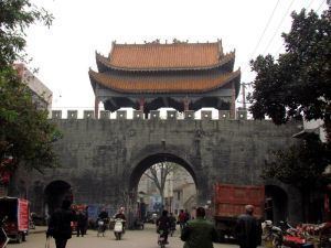 | ||
Xinye (Chinese: 新野; pinyin: Xīnyě; Wade–Giles: Hsin-yeh) is one of the counties of Nanyang that lies in the southwest of Henan province in central China. To the south lies Xiangfan city of Hubei province, to the east is Tanghe (唐河) county of Nanyang and to the west is county-level city Dengzhou of Nanyang. Xinye county has a population of 730,000. Its total area is 1062 square kilometres.
Contents
Map of Xinye, Nanyang, Henan, China
Erlianhot--Guangzhou Expressway (二连浩特—广州 高速公路) runs through Waizi town, which is the northmost town of Xinye. Both Nanyang airport and Xiangfan airport are about 60 kilometres away from Xinye.
History
Near the end of the Han Dynasty, the warlord Liu Bei used Xinye as a base, as a vassal under Liu Biao. Liu Biao himself had been residing in Xiangyang (today's Xiangfan). Liu Bei lost Xinye to Cao Cao in 208 and retreated to the southeast in prelude to the battle of the Red Cliffs.