
Area 19.04 km (7.35 sq mi) OS grid reference TG331152 Local time Wednesday 12:58 PM | Population 399 (2011) Civil parish Woodbastwick | |
 | ||
Weather 12°C, Wind NW at 23 km/h, 61% Humidity Points of interest The Broads, Ranworth Broad, Cockshoot Broad, All Saints Church - Panxwort, Bure Marshes National | ||
Woodbastwick river
Woodbastwick /ˈwʊdbæstwɪk/is a village and civil parish in the English county of Norfolk. It is located on the River Bure between Cockshoot Broad and Salhouse Broad, within The Broads and close to Bure Marshes NNR (national nature reserve). The city of Norwich lies 10 kilometres (6.2 mi) to the south-east.
Contents
- Woodbastwick river
- Map of Woodbastwick UK
- Club motorhome pub stopover videos fur and feather woodbastwick norfolk
- References
Map of Woodbastwick, UK
The village name relates to bast, a pliable substance found under the bark of the lime tree. Danish and Saxon invaders used bast as a form of binding to tie leggings and other items. As a consequence, Woodbastwick's village sign shows two invaders tying their leggings.
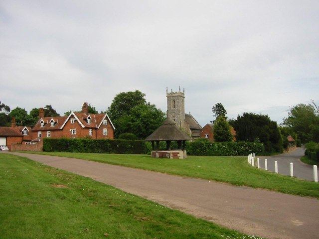
Woodbastwick is an attractive village with thatched houses set around a village green, and the church of St Fabian & St Sebastian, also thatched. The Woodforde Broadland Brewery is located in the village and produces cask ales such as Wherry Bitter, Nelson's Revenge, Norfolk Nog and Headcracker.
The civil parish has an area of 19.04 km2 (7.35 sq mi) and in the 2001 census had a population of 362 in 157 households, increasing to a population of 399 in 168 households at the 2011 Census. For the purposes of local government, the parish falls within the district of Broadland. Woodbastwick Hall is the seat of the Cator family.