
 | ||
Who is wilma dykeman and what is the wilma dykeman riverway plan
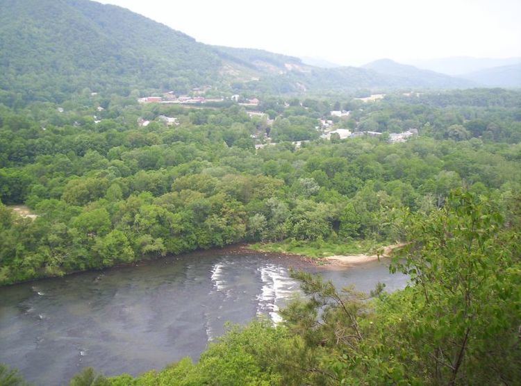
The Wilma Dykeman RiverWay Plan is RiverLink's design to redevelop the urban riverfront corridor of the U.S. City of Asheville, as a demonstration project for the entire French Broad River watershed by connecting a 17 miles (27 km) Greenway System along the French Broad and Swannanoa Rivers. It was built and expanded on a former Plan created by RiverLink in 1989, called the Asheville Riverfront Plan, which won the American Planning Association Award and represents the consolidation of over 20 years of community efforts and visioning. Since its inception in 1987, RiverLink, a regional non-profit organization, has spearheaded The RiverWay by gaining public support and partnering with local, state, regional and federal agencies, the public at large, private foundations, Buncombe County, and the City of Asheville for the plan's implementation.
Contents
- Who is wilma dykeman and what is the wilma dykeman riverway plan
- History Development along the French Broad River
- The RiverFront Plan
- The Wilma Dykeman RiverWay Plan
- Parks and greenways
- French Broad River Park Greenway System
- French Broad River Park
- French Broad River Park Greenway Extension
- Carrier Park
- References
Aside from providing environmental benefits, and recreational and wellness opportunities, the Wilma Dykeman RiverWay Plan is expected to revitalize the riverfront by encouraging economic development and job creation. Proponents of the plan say that with a cost benefit analysis, the essence of The Wilma Dykeman RiverWay Plan speaks for itself in terms of return on investment, tax base enhancement, bond rating improvement, job creation, mixed-use trails and sustainable development. Furthermore, the connectivity of The RiverWay would encourage multi-modal transportation opportunities like bicycling, and enhance access to the city's riverfronts.
However, the full implementation of The RiverWay is a daunting and expensive task due its breadth of complexities, and requirement of resources. Nevertheless, RiverLink has continued to further the plan by attaining riverfront parcels through conservation easement donations and property sales. In addition, state and federal governments have played a role in funding the Dykeman Plan, primarily through grants from the Department of Transportation.
As of now, by championing thousands of supporters and working with local government, RiverLink has contributed several popular parks and greenway extensions to The Wilma Dykeman Riverway Plan. The most notable of these achievements include the old Asheville-Weaverville Speedway – the most-used park in the region now known as Carrier Park – and the French Broad River Park & Greenway System. Asheville's greenway system currently boasts 4.5 miles (7.2 km) of contiguous trail.
History: Development along the French Broad River
Starting in the early-to-mid-19th century, the riverfront's even ground and untainted open-space made it a popular trade route. Soon farmers, homesteads, inns, and local small stores were drawn to take advantage of the economic opportunity. In the late 19th century, the Western North Carolina Railroad expanded along the French Broad River and the banks land value accumulated. The rivers natural attributes drew crowds and Asheville grew to be a small and economically adorned city.
By the very early 20th century, Asheville's extent of the French Broad Riverfront had matured as the destination point for travelers and was a pivotal recreational and leisure space for residents. The Asheville Electric Company created a small diversion off of the French Broad and named it Riverside Park. The park erected a carousel, a boat house and an outdoor movie screen that could only be viewed from a boat in the river. At the time, this type of entertainment was not only unique but it left an impression. Unfortunately, in 1915 a fire destroyed much of Riverside Park and just the following year came the flood.
In 1916 massive flooding not only destroyed whatever remained of Riverview Park but it swept away the watershed community. The many local industry and business owners – who for years had thrived along the French Broad River - abandoned their buildings and relocated to higher ground. Soon after the flood, Asheville's traffic system experienced rapid growth and new highways and roads cut off access points to the river. Over time, the French Broad was transformed into a dumping ground for unregulated pollution and the river was forgotten.
For over the next half a century, the French Broad River was abandoned and neglected. It was not until the 1970s when the federal government began to give attention to the deteriorating state of our nation's river-systems and passed the Clean Water Act. Under this new policy environmental regulation standards were raised and public interests were heightened. Citizen groups began to look at the river and the Land-of-Sky Regional Council (LOS) assembled a group of conservation advocates, called the French Broad River Foundation (FBRF), to help create a series of access parks along the 117 miles of the French Broad River.
In the 1980s, as efforts to clean up the river intensified with citizen advocacy groups like the FBRF, policy makers came to finally see what critical importance the French Broad River was to the region. For one, local economists began to recognize the riverfront's massive recreational and economic development potential. Also however, through a series of management studies and evaluations by the LOS and local government agencies, it was determined that in order for the region to grow, the French Broad would have to be Buncombe County's primary water source.
By advocating to regional policy analysts, politicians, and local agencies, conservation groups and economists had now set the agenda to develop and redevelop the French Broad's riverfront. In 1987 the Tennessee Valley Authority (TVA) and the Land of Sky managed to attain funding through a civil works planning grant. It was at this time that RiverLink, then a loosely knit group of volunteers and conservation advocates known as the French Broad Riverfront Planning Commission, were asked to team up with the French Broad River Foundation and Asheville's Chamber of Commerce to create the Asheville Riverfront Plan.
The RiverFront Plan
If the French Broad River was to be successfully revitalized, the final plan had to legitimately represent and incorporate the wants and needs of the entire community. Therefore, to gain a better understanding of the natural complexities that Asheville’s riverfront presented, RiverLink recruited members of the American Institute of Architects (AIA) & American Society of Landscape Architects (ASLA) to form a charette team. Peter Batchelor, the Chairman of the NC AIA, then divided the joint charette into three primary groups: The first team focused on how to effectively reestablish a connection between downtown Asheville and the riverfront. Another team concentrated on how far the river could extend within city limits. The third group analyzed the rivers prominent attributes in Asheville and Western North Carolina.
In 1989, after extensive planning and public discussion, the charette team completed The Asheville Riverfront Plan. The design included a detailed layout of the riverfront, complete with diagrams of the urban corridor, maps of future greenway space, and descriptions of the charrette’s findings and suggestions. More importantly however, the plan’s mixed use for revitalizing the French Broad River satisfied the needs of all the community – environmental, recreation and business constituents.
After the design was presented to the public it received nationwide recognition for its ingenuity and thoughtful craftsmanship. National Geographic featured the plan as a new greenway initiative for WNC in its June 1990 issue. Also, the Riverfront Plan received The American Planning Association’s Large Scale Planning Award, a highly sought and prestigious honor that is given to only the best designs in the nation.
Local governments soon adopted The Asheville Riverfront Plan to depict a unified vision for a revitalized riverfront. Buncombe County welcomed it as their new Master Plan for the river way and The City of Asheville encompassed the plan as an addendum to its award winning 2010 Comprehensive Plan. However, the implementation process could begin a design framework was needed for the entire revitalization of the riverfront.
During September in 1991, with influential support from local government authorities and the public, RiverLink received funding from the National Endowment for the Arts to develop what is now known as The Asheville Riverfront Open Space Design Guidelines. Once again RiverLink helped to assemble a charette team with ALSA/AIA, and groups were divided. This time issues such as signage, river access, public art, support facilities, structures, and landscaping were addressed. Through public forums it was agreed, by both the public and private constituents, that all open space development should accentuate the unique geographical aspects of Asheville and Western North Carolina. When completed, as like The Riverfront Plan, The Open Space Guidelines were well received by the public. Local governments immediately adopted the guidelines and the policy was approved by The Asheville Council. They are now part of The City of Asheville’s river zoning district and since the inception of Asheville’s river parks and greenways, the Design Guidelines have served as a blueprint for their development.
The Wilma Dykeman RiverWay Plan
Throughout the 1990s RiverLink strived to progressively bring the pieces of The Riverfront Plan together. Rousing mass amounts of donations with public support, the environmental organization acquired several large contaminated parcels along the French Broad River in West Asheville. Using both the power of their volunteers and their partnership with the City of Asheville, RiverLink was then able to convert the land into active-use parks and greenways.
Despite these accomplishments however, much of the original design remained unrealized. Not only was there a lack of funding to continue implementation but The Riverfront Plan had become outdated. Since the fifteen-year-old plan was first introduced, the zoning, demographics, and developments of Asheville’s riverfront had vastly changed. In order to reflect these new developments, diverging land use patterns, and new community needs and desires along the river, it would be necessary to modify the design.
By 2004, RiverLink had risen over $250,000 and was able to update The Riverfront Plan appropriately so that it accurately depicted the riverfront’s current conditions and demands. Among those who financially contributed to its creation were: North Carolina Department of Transportation (DOT), The City of Asheville, Buncombe County, The Asheville Merchants Association, Tennessee Valley Authority (TVA), and Progress Energy. The new plan built and expanded on The Riverfront Plan. It is a 17-mile greenway that will extend along the French Broad River from Broadway Avenue through the central riverfront, along the WECAN neighborhood, through the recreational areas to the Amboy Road Exit on I-240. The plan will also follow the Swannanoa from its confluence with the French Broad, through the Biltmore Village and up river to Tunnel Road and Azalea Park where it will end.
To put it in more concise terms, the updated plan “linked the French Broad and Swannanoa Rivers into a continuous pathway with separate walking and biking trails anchored on the south at the North Carolina Arboretum, on the east by the Blue Ridge Parkway, and on the north by the University of North Carolina Asheville (UNCA)”.
However, it is evident that the amended plan inhibits the intent of much bigger developments and ideas than just greenways. Similar to the original Riverfront Plan, although in significantly richer detail, the new design was centralized around three diverse focuses: First, with a road alignment study, it addressed specific development zones within the seventeen miles. Secondly, detailed site-plans and transportation engineered illustrations were created to help guide the plans implementation. Lastly, a market study was included, which analyzed how the revitalization of the river could further reinforce traditional industries including, health/wellness, recreation, arts, crafts, and entrepreneurship.
RiverLink had long emphasized how many of their initiatives to revitalize the French Broad River had been previously championed by others since the mid 1900s. One of the earliest advocates was a young author and educator named Wilma Dykeman, whom in a book titled “The French Broad”, detailed the linkage between economic development and economic protection. Once the updated plan was refined and Asheville City Council adopted it, RiverLink aptly re-branded the new design as The Wilma Dykeman Riverway Plan.
Parks and greenways
There are several parks and greenways incorporated within The Wilma Dykeman RiverWay Plan. Amongst these are:
French Broad River Park & Greenway System
The initial breakthrough to gain riverside property occurred in 1991, when the non-profit organization, RiverLink, was offered a two mile-long donation from the Carolina Power & Light Company. This property is now known as the first link in the urban riverfront greenway. For years the west bank riverfront property had been used as an “unofficial” land fill for construction companies and concrete manufactures. However, beyond the poison ivy infested and trash littered terrain RiverLink saw potential and convinced the city to receive the donation.
It is at this time that the organization created a concept called, “The Mayor’s Greenway Award” and presented it to CP&L during a reception at city hall. This award was a symbol of goodwill and community enrichment and has since become used as an incentive to encourage other citizens and corporations to donate land for public access along The Wilma Dykeman Riverway’s identified greenway routes.
Once the donation of land from CP&L was accepted, RiverLink and The City of Asheville entered into a public-private partnership to develop it. In accordance to The RiverWay Plan, the implementation of the two-mile riverfront stretch in West Asheville was divided into three phases. It would be eventually named the French Broad River Park & Greenway System.
French Broad River Park
During phase one of the French Broad River Greenway System, with the City's help, RiverLink received a grant from The Z. Smith Reynolds Foundation to hire a landscape architecture firm to develop the master plan and construction drawings. A principal goal of the plan was to infuse characteristics of the old Riverside Park into The French Broad River Park. Once the design was complete, RiverLink’s staff & volunteers worked with The City of Asheville’s Parks & Recreation Department to develop the park. Also, RiverLink raised the funds needed to install picnic tables, benches, bike racks, bollards and other amenities that make the greenways at French Broad River Park PHASE I, II and III user friendly and comfortable.
On September 21, 1994 the first part of the project was completed and the French Broad River Park became the first greenway (or watershed) built within the City of Asheville.
French Broad River Park Greenway Extension
Soon after the initial park was completed, phase two began. This phase added another loop of greenway trails as well as a dog park and wildflower garden to the park. Again relying heavily on community involvement and with a corresponding relationship with the City’s Parks & Recreation Department, this phase was completed only a year after the first - In September 1995. For the first two years RiverLink was vital in operating The French Broad River Park however it is now maintained regularly by The City of Asheville Parks and Recreation Department.
It was not until four years later, in 1999, that RiverLink received funding from the North Carolina Wildlife Resources Commission to implement the final phase of The French Broad River Greenway. Phase three extended the greenway trail even further along the river next to Amboy Road. Moreover, in addition to the extension, the funding of this phase included a handicapped accessible fishing pier that was installed overlooking the river.
Carrier Park
The second major breakthrough for The Wilma Dykeman Riverway Plan occurred during in 1999, when RiverLink managed to obtain the former Asheville-Weaverville Speedway on Amboy Road (35.56583°N 82.58132°W / 35.56583; -82.58132) (which is still in development as of April 2011). After raising $1.6 million to purchase and develop the old speedway, RiverLink donated it, with a conservation easement, to the City of Asheville. As like before, during the development of The French Broad River Park & Greenway, RiverLink and the city worked closely together to implement the park. Foremost, city employees with expertise in park development resurfaced the racetrack, which now invites Asheville cyclist and non-motor races.
Furthermore, with a combined effort from citizens and city employees an outdoors education wetland/stormwater Education Center was constructed, along with: basketball courts, bocce ball/bowling alleys, volleyball courts, an in-line skating ring, and a combination of baseball & soccer fields. Also, by rallying 1000 volunteers in five days, RiverLink built a playground to add to the park. When it was all complete the 50-acre old speedway was rechristened as Carrier Park and joined the French Broad River Park System.