
 | ||
A greenway is "a strip of undeveloped land near an urban area, set aside for recreational use or environmental protection". However, the term can in fact include "a scenic road" and though many are in urban areas, there are some rural greenways, as for example the Monadnock-Sunapee Greenway, a hiking trail in southern New Hampshire.
Contents
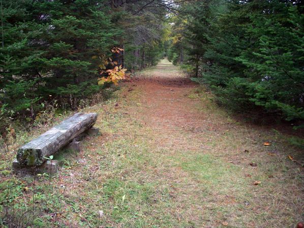
A greenway is a trail (and sometimes a wildlife corridor), found in both urban and rural settings, that is frequently created, out of a disused railway, canal towpath, utility, or similar right of way, or derelict industrial land. Rail trails are one of the most common forms of greenway, and they also resemble linear parks.
In Southern England the term also refers to ancient trackways or green lanes, especially those found on chalk downlands, like the Ridgeway.
Terminology
The American author Charles Little in his 1990 book, Greenways for America defines a greenway as
The term greenway comes from the green in green belt and the way in parkway, implying a recreational or pedestrian use rather than a typical street corridor, as well as an emphasis on introducing or maintaining vegetation, in a location where such vegetation is otherwise lacking. Some greenways include community gardens as well as typical park-style landscaping of trees and shrubs. They also tend to have a mostly contiguous pathway. Greenways resemble linear parks, but the latter are only found in an urban and suburban environment..
Though a wild life corridors are also a greenways, because they have conservation as their primary purpose, they are not necessarily managed as parks for recreational use, and may not include facilities such as public trails.
Tom Turner analyzed greenways in London, looking for common patterns among successful examples. He was inspired by the pattern language technique of architect Christopher Alexander. Turner concluded there are seven types, or 'patterns', of greenway which he named: parkway, blueway, paveway, glazeway, skyway, ecoway and cycleway.
The European Greenways Association defines it as "communication routes reserved exclusively for non-motorised journeys, developed in an integrated manner which enhances both the environment and quality of life of the surrounding area. These routes should meet satisfactory standards of width, gradient and surface condition to ensure that they are both user-friendly and low-risk for users of all abilities." (Lille Declaration, European Greenways Association, 12 September 2000).
Characteristics
Charles Little, describes five general types of greenways:
Greenways are vegetated, linear, and multi-purpose. They incorporate a footpath or bikeway within a linear park. In urban design they are a component of planning for bicycle commuting and walkability.
Greenways are found in rural areas as well as urban. Corridors redeveloped as greenways often travel through both city and country, connecting them together. Even in rural areas greenways serve the purpose of providing residents access to open land managed as parks, as contrasted with land that is vegetated but inappropriate for public use, such as agricultural land. Where the historic rural road network has been enlarged and redesigned to favor highspeed automobile travel, greenways provide an alternative for people who are elderly, young, less mobile, or seeking a reflective pace.
Greenways are a global phenomenon. However, most examples are in Europe and North America.
Foreshoreway
In Australia, a foreshoreway is a greenway that provides a public right-of-way along the edge of the sea, open to both walkers and cyclists. Foreshoreways include oceanways, and resemble promenades and boardwalks.
Foreshoreways are usually concerned with the idea of sustainable transport and the term is used to avoid the suggestion that the route favours either pedestrians (footpath) or cyclists (bikeway). A foreshoreway is accessible to both pedestrians and cyclists and gives them the opportunity to move unimpeded along the seashore. Dead end paths that offer public access only to the ocean are not part of a foreshoreway.
A foreshoreway corridor often includes a number of traffic routes that provide access along an oceanfront, including:
A major example is The Gold Coast Oceanway along beaches in Gold Coast, Queensland, a shared use pedestrian and cyclist pathway on the Gold Coast, connecting the Point Danger lighthouse on the New South Wales and Queensland border to the Gold Coast Seaway. The network includes 36 kilometres (22 mi) of poor, medium and high quality pathways. Others include: The Chicago Lakefront Trail, the Dubai Marina, the East River Greenway, New Plymouth Coastal Walkway, and the Manhattan Waterfront Greenway.
Public rights of way frequently exist on the foreshore of beaches throughout the world. In legal discussions the foreshore is often referred to as the wet-sand area (see Right of way for a fuller discussion).