
 | ||
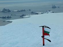
Williams Point is the point forming both the north extremity of Varna Peninsula and the northeast tip of Livingston Island in the South Shetland Islands, Antarctica. Separated from Zed Islands to the north by Iglika Passage.
Contents
The discovery of the South Shetland Islands was first reported in 1819 by William Smith, Master of the brig Williams who had sighted the point on 19 February that year. An 1820 publication suggests that Smith gave the name ‘Williams’ to a point of land in this vicinity. In recent years the place name Williams Point has been established in international usage for the point described.
Location
The point is located at 62°27′08″S 60°08′11″W which is 9.47 km north of Miziya Peak in Vidin Heights, 8.8 km east of Desolation Island, 1.5 km south of Zed Islands and 5.5 km west of Duff Point on Greenwich Island. British mapping in 1822, Chilean in 1971, Argentine in 1980, Spanish in 1991, and Bulgarian in 2005 and 2009.