
Country United States FIPS code 30-79900 Elevation 1,329 m Zip code 59759 Local time Sunday 4:44 AM | Time zone Mountain (MST) (UTC-7) GNIS feature ID 0793224 Area 174 ha Population 1,077 (2013) Area code 406 | |
 | ||
Weather 7°C, Wind W at 6 km/h, 62% Humidity | ||
Whitehall is a town in Jefferson County, Montana, United States. The population was 1,038 at the 2010 census. It is part of the Helena Micropolitan Statistical Area.
Contents
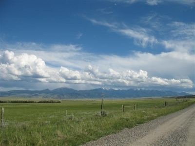
- Map of Whitehall MT 59759 USA
- History
- Geography
- Climate
- Schools
- 2010 census
- 2000 census
- Notable natives and residents
- References
Map of Whitehall, MT 59759, USA
The town is nestled in the Jefferson Valley, which is shadowed by the Tobacco Root and Highland Mountain ranges and sits in the heart of the Deerlodge National Forest. It is also within 23–60 miles of three major airports, four colleges, five ski resorts, seven major rivers, mountain lakes for fishing and backpacking, four lakes for boating, and three hot springs. There are numerous snowmobiling trails for winter riding and summer trail rides. The mountain ranges surrounding the valley, provide excellent opportunitiy for hunting big game.
Newscaster Chet Huntley graduated from Whitehall High School in 1929.
Whitehall's local attractions include: Lewis and Clark Caverns State Park, Jefferson River, Ringing Rocks, Whitehall Lewis & Clark Murals and Jefferson Valley Museum to name a few.
History
Whitehall began as a rail depot created by the Northern Pacific and Montana Railroad on September 25, 1889. The name for the depot came from E.G. Brooke, who was inspired by a similar town he stayed in Illinois while making his way westward. On September 3, 1890, the Jefferson County Commissioners accepted and filed the Townsite of Whitehall.
Geography
Whitehall is located at 45°52′13″N 112°5′54″W (45.870238, -112.098464).
According to the United States Census Bureau, the town has a total area of 0.67 square miles (1.74 km2), all of it land.
Climate
According to the Köppen Climate Classification system, Whitehall has a semi-arid climate, abbreviated "BSk" on climate maps.
Schools
Public education in the town of Whitehall is provided by Whitehall School District. The district includes Whitehall Elementary School (grades K-6), Whitehall Middle School (grades 7-8), and Whitehall High School(grades 9-12).
Whitehall's mascot is the Trojans, with school colors of purple and gold.
2010 census
As of the census of 2010, there were 1,038 people, 473 households, and 283 families residing in the town. The population density was 1,549.3 inhabitants per square mile (598.2/km2). There were 538 housing units at an average density of 803.0 per square mile (310.0/km2). The racial makeup of the town was 94.0% White, 0.2% African American, 1.7% Native American, 0.5% Asian, 0.1% from other races, and 3.5% from two or more races. Hispanic or Latino of any race were 2.0% of the population.
There were 473 households, of which 26.8% had children under the age of 18 living with them, 44.4% were married couples living together, 9.7% had a female householder with no husband present, 5.7% had a male householder with no wife present, and 40.2% were non-families. 35.3% of all households were made up of individuals and 15.9% had someone living alone who was 65 years of age or older. The average household size was 2.19 and the average family size was 2.84.
The median age in the town was 45.7 years. 23% of residents were under the age of 18; 7% were between the ages of 18 and 24; 19.6% were from 25 to 44; 33% were from 45 to 64; and 17.4% were 65 years of age or older. The gender makeup of the town was 51.9% male and 48.1% female.
2000 census
As of the census of 2000, there were 1,044 people, 450 households, and 297 families residing in the town. The population density was 1,527.3 people per square mile (592.8/km²). There were 507 housing units at an average density of 741.7 per square mile (287.9/km²). The racial makeup of the town was 94.54% White, 2.49% Native American, 0.29% Asian, 0.10% Pacific Islander, 0.10% from other races, and 2.49% from two or more races. Hispanic or Latino of any race were 1.72% of the population.
There were 450 households out of which 27.3% had children under the age of 18 living with them, 54.2% were married couples living together, 9.3% had a female householder with no husband present, and 34.0% were non-families. 29.8% of all households were made up of individuals and 15.3% had someone living alone who was 65 years of age or older. The average household size was 2.32 and the average family size was 2.86.
In the town, the population was spread out with 25.2% under the age of 18, 5.7% from 18 to 24, 25.3% from 25 to 44, 23.9% from 45 to 64, and 20.0% who were 65 years of age or older. The median age was 41 years. For every 100 females there were 93.3 males. For every 100 females age 18 and over, there were 86.0 males.
The median income for a household in the town was $29,940, and the median income for a family was $38,833. Males had a median income of $30,682 versus $19,643 for females. The per capita income for the town was $15,527. About 8.8% of families and 12.0% of the population were below the poverty line, including 15.7% of those under age 18 and 7.6% of those age 65 or over.