
Governing body U.S. Forest Service | Established May 16, 1918 | |
 | ||
Area 750,852 acres (3,038.59 km) Website www.fs.usda.gov/whitemountain | ||
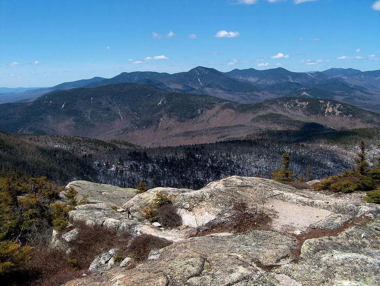
The White Mountain National Forest (WMNF) is a federally managed forest contained within the White Mountains in the northeastern United States. It was established in 1918 as a result of the Weeks Act of 1911; federal acquisition of land had already begun in 1914. It has a total area of 750,852 acres (303,859 ha) (1,225 sq mi). Most of the WMNF is in New Hampshire; a small part (about 5.65% of the forest) is in the neighboring state of Maine. While often casually referred to as a park, this is a National Forest, used not only for hiking, camping, and skiing, but for logging and other limited commercial purposes. The WMNF is the only National Forest located in either New Hampshire or Maine. Most of the major peaks over 4,000 feet high for peak-bagging in New Hampshire are located in the National Forest. Over 100 miles (160 km) of the Appalachian Trail traverses the White Mountain National Forest. In descending order of land area the forest lies in parts of Grafton, Coos, and Carroll counties in New Hampshire, and Oxford County in Maine.
The Forest Supervisor's office is located in Campton, and there are three ranger districts: the Pemigewasset District, with offices in Campton; the Androscoggin District, based in Gorham; and the Saco District, based in Conway. Furthermore, there are several visitor centers, including those located at Lincoln, Campton (off Interstate 93), and Lincoln Woods (on the Kancamagus Highway). The National Forest consists of three discontinuous areas. The area to the west of Franconia Notch (a narrow north-south valley primarily within a state park) consists of the regions surrounding Cannon Mountain, Kinsman Mountain, and Mount Moosilauke (though the majority of Moosilauke is privately owned). The main body of the National Forest includes the Presidential Range and many other ranges - most notably, the Franconia, Twin, Bond, Sandwich, Willey, and Carter-Moriah ranges. An exclave of the Forest lies to the north of U.S. Route 2 in Stark and Randolph, New Hampshire.
It is home to wildlife species including bald eagle, raccoon, beaver, white-tailed deer, moose, black bear, coyote, peregrine falcon, Canadian lynx, river otter, bobcat, gray and red foxes, fisher, mink, and porcupine.
Six designated Federal Wilderness Areas exist within the Forest: the 27,380-acre (11,080 ha) Presidential Range/Dry River Wilderness, the 5,552-acre (2,247 ha) Great Gulf Wilderness, the 45,000-acre (18,000 ha) Pemigewasset Wilderness, the 35,800-acre (14,500 ha) Sandwich Range Wilderness, the 12,000-acre (4,900 ha) Caribou/Speckled Mountain Wilderness, and the 23,700-acre (9,600 ha) Wild River Wilderness. These areas are protected from logging and commercial industries and are used solely for recreational and scientific purposes. They were formed under the Federal Wilderness Protection Act of 1984, and its amendments. The New England Wilderness Protection Act of 2006 increased the Sandwich Range Wilderness to its present size and created the Wild River Wilderness area.
Because of its beauty, its proximity to major metropolitan areas, its 1,200 miles (1,900 km) of hiking trails, 23 campgrounds, and the presence of a large number of ski areas within or near its boundaries, the WMNF is one of the most visited outdoor recreation sites east of the Mississippi.
Weather
US Forest Service signs on hiking trails at tree line state that the mountain summit areas have "the worst weather in America". The claim is also used by the observatory near the summit of Mount Washington which once recorded a surface wind speed of 231 miles per hour (372 km/h). Since 1849 over 135 people have died on Mount Washington.