
Highest point Carter Dome | ||
 | ||
Mountains Carter Dome, Wildcat Mountain, Mount Moriah, South Carter Mountain, Middle Carter Mountain Similar Carter Dome, Mount Moriah, Wildcat Mountain, Middle Carter Mountain, Carter Notch | ||
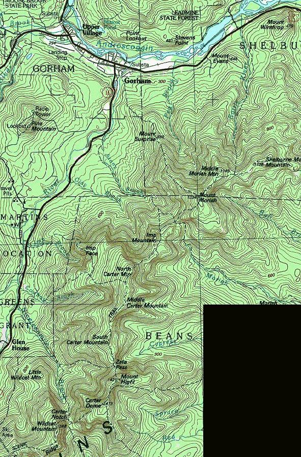
The Carter-Moriah Range of mountains is located in the White Mountains, in Coos County, New Hampshire. The range forms the northern east side of Pinkham Notch, opposite the northern Presidential Range. The range is also referred to as the Carter Range.
Contents
SummitsEdit
From north to south:
While not strictly part of the range, Wildcat Mountain (1,345 m / 4,422 ft) * stands southwest of Carter Dome, facing it across Carter Notch.
The summits marked with an asterisk (*) are included on the Appalachian Mountain Club's peak-bagging list of "Four-thousand footers" in New Hampshire; the others are excluded, in some cases because of insufficient elevation and in others because of insufficient topographic prominence.
WatershedsEdit
The Carter-Moriah Range drains to the northwest into the Peabody River and to the southeast into the Wild River. Both flow into the Androscoggin River—at Gorham, New Hampshire and Gilead, Maine respectively—and thence into the Atlantic Ocean on the coast of Maine.