
Population 6,883 (2015 est) Region Far West Local time Monday 2:38 PM | Established 23 January 1879 | |
 | ||
Area 26,269 km (10,142.5 sq mi) Weather 19°C, Wind S at 21 km/h, 31% Humidity Points of interest Buronga Riverside Tourist P, Old Wentworth Gaol, Australian Inland Botanic G, Perry Sandhills, Wentworth Pioneer Museum | ||
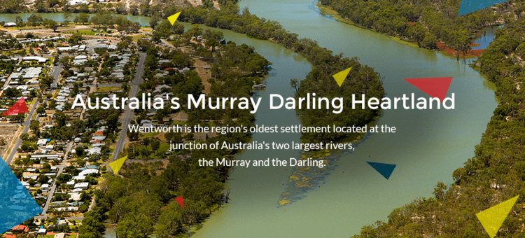
Wentworth Shire is a local government area in the far south-west Riverina region of New South Wales, Australia. This Shire is located adjacent to the Murray and Darling Rivers. The Shire's major roads are the Sturt and the Silver City Highways. The Shire includes the towns of Wentworth, Buronga, Gol Gol, Dareton and Pooncarie.
Contents
Map of Wentworth, NSW, Australia
The Mayor of Wentworth Shire Council is Cr. Melissa Hederics, an Independent politician.
Council
The area of Wentworth was proclaimed a municipality on 23 January 1879. The first Mayor was Mr. W. Gunn who held office from 1879 to 1880.
Current composition and election method
Wentworth Shire Council is composed of nine Councillors elected proportionally as a single ward. All Councillors are elected for a fixed four-year term of office. The Mayor is elected by the Councillors at the first meeting of the Council. The most recent election was held on 10 September 2016 and the makeup of the Council is as follows:
The current Council, elected in 2016, in order of election, is: