
Website www.gw.govt.nz | Established 1989 Time zone NZST (UTC+12) Area 8,049 km² | |
 | ||
Territorial authorities Clubs and Teams Wellington Phoenix FC, Hurricanes, Wellington Rugby Football Union, Team Wellington Colleges and Universities Victoria University of Welling, The Open Polytechnic of New Z, Universal College of Learning, New Zealand School of, Chanel College - Masterton Points of interest Museum of New Zealand, Zealandia, Space Place at Carter Ob, Wellington Cable Car, Wellington Botanic Garden | ||
The Wellington Region (also known as Greater Wellington) is a local government region of New Zealand that occupies the southern end of the North Island. The region covers an area of 8,049 square kilometres (3,108 sq mi), and is home to a population of 504,900 (June 2016).
Contents
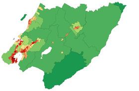
- Map of Wellington New Zealand
- Local government
- Term Wellington region
- History
- Geography
- Demographics
- Production and income
- Culture and identity
- Gender
- Education
- Telecommunications
- Economy
- Transport
- Biodiversity
- References
Map of Wellington, New Zealand
The region is named after Wellington, New Zealand's capital city and region's seat. The Wellington urban area, including the cities of Wellington, Porirua, Lower Hutt and Upper Hutt, accounts for 80 percent of the region's population; Other major urban areas include the Kapiti conurbation of Waikanae, Paraparaumu, Raumati and Paekakariki, and the town of Masterton.
Local government
The region is administered by the Wellington Regional Council, which uses the promotional name Greater Wellington Regional Council. The council region covers the conurbation around the capital city, Wellington, and the cities of Lower Hutt, Porirua, and Upper Hutt, each of which has a rural hinterland; it extends up the west coast of the North Island, taking in the coastal settlements of the Kapiti Coast District, which includes the southern fringe of the area commonly known as Horowhenua and the town of Otaki; east of the Rimutaka Range it includes three largely rural districts containing most of Wairarapa, covering the towns of Masterton, Carterton, Greytown, Featherston and Martinborough. The Wellington Regional Council was first formed in 1980 from a merger of the Wellington Regional Planning Authority and the Wellington Regional Water Board.
A proposal made in 2013 that nine territorial authorities amalgamate to form a single supercity met substantial local opposition and was abandoned in June 2015.
The governing body of the regional council is made up of 13 councillors, representing six constituencies:
Term Wellington region
In common usage the terms Wellington region and Greater Wellington are not clearly defined, and areas on the periphery of the region are often excluded. In its more restrictive sense the region refers to the cluster of built-up areas west of the Tararua ranges. The much more sparsely populated area to the east has its own name, Wairarapa, and a centre in Masterton. To a lesser extent, the Kapiti Coast is sometimes excluded from the region. Otaki in particular has strong connections to the Horowhenua District to the north.
Former Wellington City mayor Celia Wade-Brown is not in favour of the region adopting a 'super city' type council like the one in Auckland, though is in favour of reducing the number of councils from nine to "three or four".
History
The Māori who originally settled the region knew it as Te Upoko o te Ika a Māui, meaning "the head of Māui's fish". Legend recounts that Kupe discovered and explored the region in about the tenth century.
The region was settled by Europeans in 1839 by the New Zealand Company. Wellington became the capital of Wellington Province upon the creation of the province in 1853, until the Abolition of the Provinces Act came into force on 1 Nov 1876. Wellington became capital of New Zealand in 1865, the third capital after Russell and Auckland.
Geography
The region occupies the southern tip of the North Island, bounded to the west, south and east by the sea. To the west lies the Tasman Sea and to the east the Pacific Ocean, the two seas joined by the narrow and turbulent Cook Strait, which is 28 kilometres (17 mi) wide at its narrowest point, between Cape Terawhiti and Perano Head in the Marlborough Sounds.
The region covers 7,860 square kilometres (3,030 sq mi), and extends north to Otaki and almost to Eketahuna in the east.
Physically and topologically the region has four areas running roughly parallel along a northeast–southwest axis:
There are five parks owned by the regional council:
Demographics
Over three-quarters of the 504,900 people (June 2016) reside in the four cities at the southwestern corner. Other main centres of population are on the Kapiti Coast and in the fertile farming areas close to the upper Ruamahanga River in the Wairarapa.
Along the Kapiti Coast, numerous small towns sit close together, many of them occupying spaces close to popular beaches. From the north, these include Otaki, Waikanae, Paraparaumu, the twin settlements of Raumati Beach and Raumati South, Paekakariki and Pukerua Bay, the latter being a northern suburb of Porirua. Each of these settlements has a population of between 2,000 and 10,000, making this moderately heavily populated.
In the Wairarapa the largest community by a considerable margin is Masterton, with a population of almost 20,000. Other towns include Featherston, Martinborough, Carterton and Greytown.
Production and income
The region is by a large margin the wealthiest in the country. The most up-to-date estimates for regional GDP prepared by the Ministry for Economic Development put it at $17.5 billion in the year to March 2004, $36,700 per capita, 19% more than the Auckland Region ($30,750); 38% more than the poorest region, Northland ($26,600); and 3% more than the second-highest region, Northern South Island ($35,800).
At the 2006 census the region had the largest percentages of people in the four highest income groupings ($40,001-$50,000: 8.9%, $50,001-$70,000: 10.5%, $70,001-$100,000: 5.9% and $100,001+: 5.2%) and the lowest percentage of residents in the 'loss' group (0.37%). As at December 2007 people in the region has a significantly higher average weekly income from all sources ($812/week) than other regions (18% more than second-placed Auckland, $687/week).
In 2006 25.8% of employed Wellingtonians worked in professional occupations and 14.3% in clerical occupations, the largest percentage for each category of any region. Excluding 369 people in areas not covered by an official region, Wellington has the lowest percentage of technicians and trades workers (10.6%), the lowest percentage of machinery operators and drivers (4.1%) and the lowest percentage of labourers (7.1%).
Culture and identity
The region is second only to Auckland in many statistics related to breadth of ethnicity. In the 2006 census Wellington had the second-highest Asian population (8.4%, Auckland 18.9%) and the second-highest Pacific Islander population (8.0%, Auckland 14.4%).
Around 25.3 percent of the Wellington region's population was born overseas, second only to Auckland (39.1 percent) and on par with the New Zealand average (25.2 percent). The British Isles is the largest region of origin, accounting for 36.5 percent of the overseas-born population in the region. Significantly, the Wellington region is home to over half of New Zealand's Tokelauean-born population.
Around 47.7 percent of Wellingtonians affiliate with Christianity and 6.1 percent affiliate with non-Christian religions, while 43.9 percent are irreligious. Catholicism is the largest Christian denomination in Wellington with 14.8 percent affiliating, while Anglicanism is the second-largest with 11.9 percent affiliating. Hinduism (2.4 percent) and Buddhism (1.6 percent) are the largest non-Christian religions.
Gender
The region has the second-highest proportion of women at 51.52% (Nelson 51.53%, West Coast 49.21%), age 16-29 48.86% with Otago next at 49.11%, followed by Gisborne at 49.18%, contrasting with Marlborough at 52.61%.
Education
In 2006 21.1% of Wellingtonians had a degree, compared to 6.6% on the West Coast, 17.7% for Auckland and 14.5% for Otago (though 0.97% of Otago residents have doctorate level degrees, compared with 0.87% for Wellington). Auckland and Wellington are equal lowest for "No Qualification" at 18.1%.
Telecommunications
Mobile phone use at 76.3% is exceeded only by Auckland (76.4%), followed by Waikato (75.3%). Access to the internet is 65.5%, highest equal with Auckland, followed by Canterbury (61.3%). Wellingtonians are least likely to have access to a fax machine (21.1%), after Gisborne (20.5%).
Economy
GDP was estimated at US$19.3 billion in 2003, 15% of New Zealand GDP.
Transport
Public transport in the Region is well developed compared to other parts of New Zealand. It consists of buses, trolleybuses, trains, cars, ferries and a funicular (the Wellington Cable Car). It also included trams until 1964. Buses and ferries are privately owned, with the infrastructure owned by public bodies, and public transport is often subsidised. The Regional Council is responsible for planning and subsidising public transport. The services are marketed under the name Metlink. Tranz Metro operates the metropolitan train network, running from the Wellington CBD as far as Waikanae in the north and Masterton in the east. In the year to June 2015, 36.41 million trips were made by public transport with passengers travelling a combined 460.7 million kilometres, equal to 73 trips and 927 km per capita.
The Wellington region has the lowest rate of car ownership in New Zealand; 11.7 percent of households at the 2013 census did not have access to a car, compared to 7.9 percent for the whole of New Zealand. The number of households with more than one car is also the lowest: 44.4 percent compared to 54.5 percent nationally.
Biodiversity
From 2005 to 2015 there has been increase in the variety and number of native forest bird species, as well as an increase in the range of areas inhabited by these species, in Greater Wellington.