
Basin size 3,470 km (1,340 sq mi) Basin area 3,470 km² | Length 124 km Mouth elevation 0 | |
 | ||
Main source Mount Dundas, Tararua Ranges1,504 m (4,934 ft) Tributaries | ||
The Ruamahanga River runs through the southeastern North Island of New Zealand.
Map of Ruamahanga River, Wellington, New Zealand
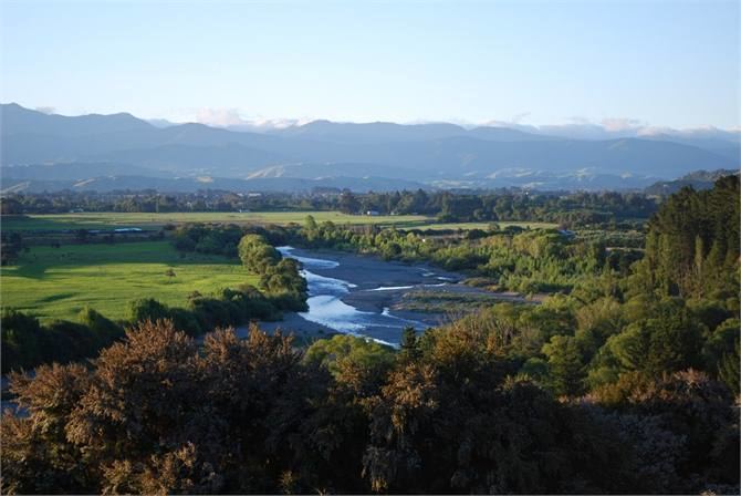
The river's headwaters are in the Tararua Ranges northwest of Masterton. From there it runs firstly south and then southwest for 130 kilometres (81 mi) before emptying into the Cook Strait. The towns of Masterton and Martinborough are close to the banks of the river. It is joined by many other rivers, including the Tauweru River near Gladstone.
In its lower reaches, the river meanders across a large floodplain, culminating in the wetlands around the edges of Lake Wairarapa. The river once flowed into the lake, but has now has been diverted. The river drains at Palliser Bay 10 kilometres (6 mi) further south.
Trout fishing is a popular activity and there are many swimming holes in the upper reaches.
In popular Maori legend a Taniwha (Mythical monster) lives in the river, he has been angered since the river was diverted and is believed to have been responsible for the death of many people.
The river has now become generally polluted from sewage and farming that prevents people from swimming in the river or its tributaries.