
 | ||
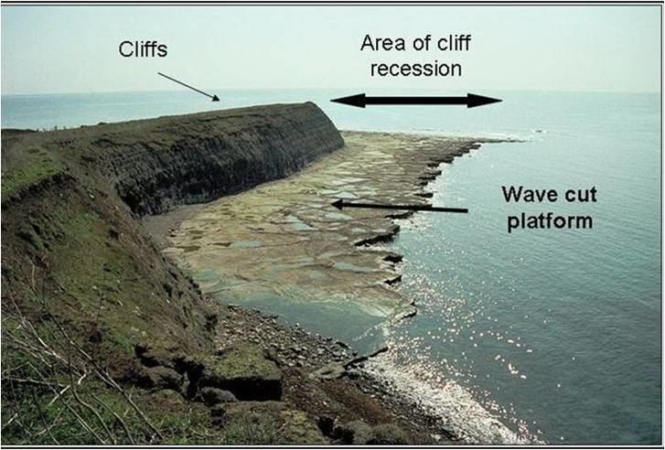
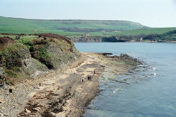
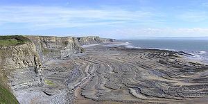
A wave-cut platform, coastal benches, or wave-cut benches is the narrow flat area often found at the base of a sea cliff or along the shoreline of a lake, bay, or sea that was created by the erosion of waves. Wave-cut platforms are often most obvious at low tide when they become visible as huge areas of flat rock. Sometimes the landward side of the platform is covered by sand, forming the beach, and then the platform can only be identified at low tides or when storms move the sand.
Contents
Formation
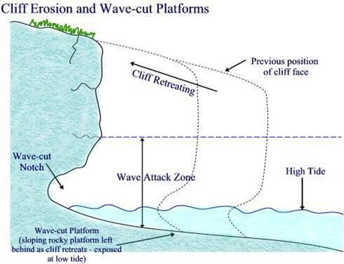
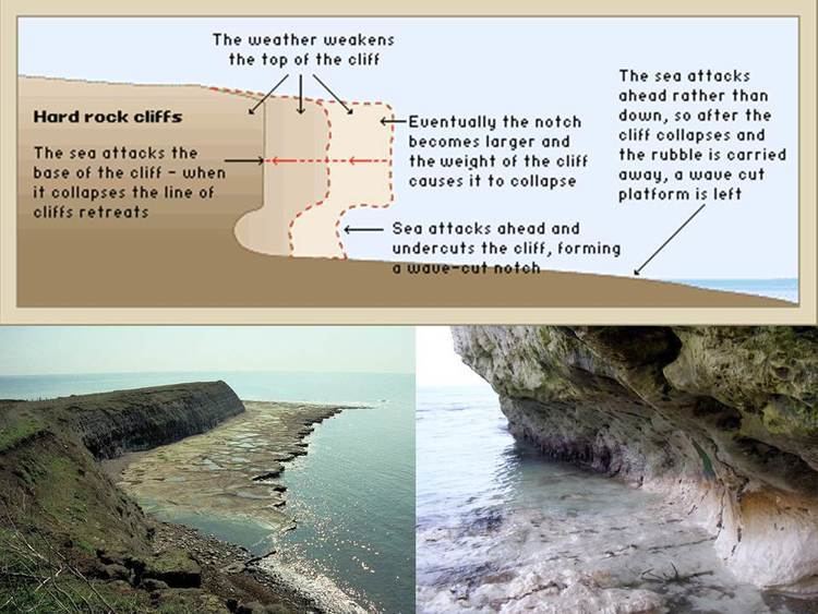
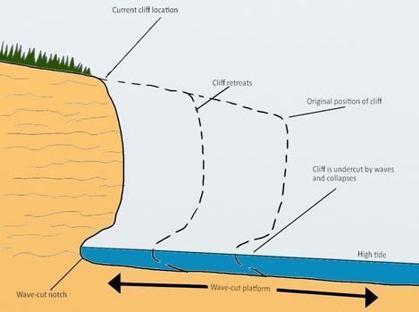
Wave-cut platforms form when destructive waves hit against the cliff face, causing undercutting between the high and low water marks, mainly as a result of corrosion and hydraulic power, creating a wave-cut notch. This notch then enlarges into a cave. The waves undermine this portion until the roof of the cave cannot hold due to the pressure and freeze-thaw weathering acting on it, and collapses, resulting in the cliff retreating landward. The base of the cave forms the wave-cut platform as attrition causes the collapsed material to be broken down into smaller pieces, while some cliff material may be washed into the sea. This may be deposited at the end of the platform, forming an off-shore terrace.
Because of the continual wave action, a wave-cut platform represents an extremely hostile environment and only the toughest of organisms can utilize such a niche.
Use of ancient examples
Ancient wave-cut platforms provide evidence of past sea and lake levels. Raised and abandoned platforms, sometimes found behind modern beaches, are evidence of higher sea levels in the geological past, and have been used to identify areas of isostatic adjustment. By using scientific dating methods, or examination of marine fossils found on the platform, it is possible to work out when the platform was formed, thus giving geographers and geologists information about sea levels at known times in the past. This has been used in the United Kingdom and other previously glaciated areas to calculate the rate at which land is rising now that it is no longer covered in ice.
Where the coastline itself is changing due to seismic action, there may be a series of platforms showing earlier sea levels and indicating the amount of uplift caused by various earthquakes.
Usage of term 'wave-cut'
According to Trenhaile, Sunamura, and Massalink and Hughes, the term 'wave-cut platform' should no longer be used as it assumes that shore platforms are the result of wave action, which is not always true. Shore platforms, like comparable river and lake platforms, are erosional features that develop when removal of saprock and other debris by waves and currents leaves behind a bedrock surface below the water table.