
Existed: 1964 – present Constructed 1964 | Length 34.25 km North end I‑5 in Bellingham | |
 | ||
Counties | ||
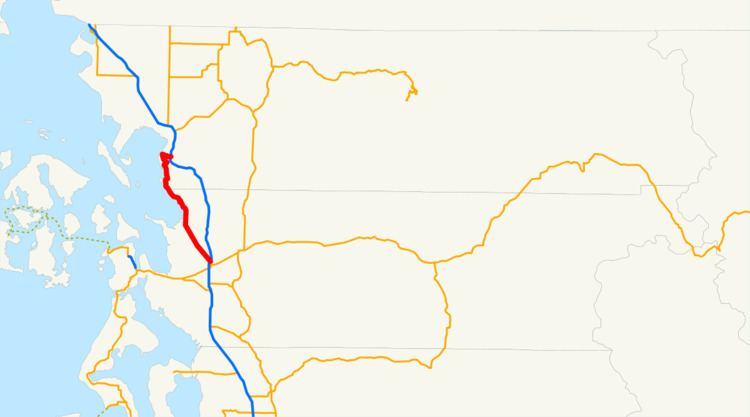
State Route 11 (SR 11) is a 21.28-mile (34.25 km) long state highway that serves Skagit and Whatcom counties in the U.S. state of Washington. SR 11, known as Chuckanut Drive, begins at an interchange with Interstate 5 (I-5) north of Burlington and continues northwest through several small towns and the Chuckanut Mountains to the Fairhaven district of Bellingham, where the highway turns east and ends again at I-5.
Contents
Map of WA-11, Washington, USA
A segment of what is now SR 11 was originally added to the state highway system in 1895 as a Blanchard – Whatcom County line road. The highway became State Road 6 in 1905 and was named Waterfront Road in 1907. The road was incorporated into the Pacific Highway in 1913 and U.S. Route 99 (US 99) in 1926. After an inland bypass was designated by the state to become US 99 in 1931, Chuckanut Drive became U.S. Route 99 Alternate. During the 1964 highway renumbering, the road became SR 11. In 1987, SR 11 was realigned through Bellingham, shifting its northern terminus south to Fairhaven.
Route description
SR 11, named Chuckanut Drive for its whole route, begins at a partial cloverleaf interchange with I-5 north of Burlington. From the interchange, the highway travels northwest through farmland, closely paralleling a BNSF Railway route from Mount Vernon to Bellingham, also used by the Amtrak Cascades service. The road turns north to intersect Bow Hill Road, formerly SR 237 until 1991, east of Edison. SR 11 continues north to Blanchard, where it begins to traverse a narrow strip of land between the Chuckanut Mountains and Samish Bay. Midway between Blanchard and the Skagit–Whatcom county line, the highway travels through a hairpin turn at Oyster Creek.
In Whatcom County, SR 11 travels generally northward through part of the oldest state park in Washington, the 2,683-acre (10.86 km2) Larrabee State Park.
Just past the park, the route travels through the Chuckanut Bay Community, situated on a small, fairly level peninsula separating Samish and Chuckanut bays. The steep mountainsides return north of the community, however, as SR 11 follows Chuckanut Bay to the southern outskirts of Bellingham. Here, the highway briefly parallels Bellingham Bay as it leaves the rural mountains for the city's densely populated Fairhaven district.
The route initially heads northwest through Fairhaven, passing the district's middle school and park before becoming 12th Street and crossing over the Interurban Trail. Two blocks north of the trail, SR 11 turns to travel east on Old Fairhaven Parkway, a wide two-lane highway with a center left-turn lane. The route continues past residential and commercial areas for about 1 mile (1.6 km) to a diamond interchange with I-5. While SR 11 ends here, Old Fairhaven Parkway continues east as Connelly Avenue.
History
Parts of modern SR 11 have been part of the state highway systems in Washington since 1895, when a road from Blanchard to Whatcom County became a state-maintained roadway. The road became State Road 6 in 1905 and was named Waterfront Road in 1907. A survey of a north–south highway from Blaine to Vancouver was approved in 1909, and the highway was built as the Pacific Highway in 1913. In Skagit County, the Pacific Highway utilized the pre-existing State Road 6. Chuckanut Drive, a 20-mile-long (32 km) section of the Pacific Highway in the Chuckanut Mountains, was opened as a gravel road during the spring of 1916 and paved in 1921. The Pacific Highway became State Road 1 in a 1923 restructuring of the highway system, at which time State Road 6 was completely replaced. When the U.S. route system was formed in 1926, the Pacific Highway became US 99. In 1931, an inland bypass via Lake Samish was added to State Road 1 and US 99. The former route of US 99 on Chuckanut Drive became US 99 Alternate.
US 99 became Primary State Highway 1 (PSH 1) in 1937 and US 99 Alternate became the Chuckanut Drive branch of the main highway, running from Burlington to downtown Bellingham. A 1964 renumbering introduced a new system of sign routes that was scheduled to go into effect in 1970. As originally planned, the Chuckanut Drive branch of PSH 1—already US 99 Alternate—would be co-signed as SR 11. In 1967, Secondary State Highway 1F (SSH 1F) was established, connecting US 99 Alternate to US 99 via Fairhaven. During the same year, I-5 replaced US 99, leading to the removal of the US 99 Alternate designation from what would become SR 11. In 1970, the SR 11 designation went into effect, running from Burlington to Downtown Bellingham.
SR 11 originally continued northeast through Downtown Bellingham to a terminus at a partial cloverleaf interchange with I-5 just northeast of the downtown district. From Old Fairhaven Parkway, the route continued north on 12th Street in Fairhaven before turning northeast on Boulevard Street. The street split into a pair of one-way streets, Forest Street and State Street, south of downtown. Forest Street merged into State Street in downtown Bellingham, and State Street subsequently merged into Iowa Street soon after. From here, Iowa Street carried SR 11 east for three blocks to a junction with I-5. In 1987, the northernmost portion of SR 11 was realigned to follow the route of former SSH 1F, then known as Old Fairhaven Parkway.