
Elevation 228 m Local time Monday 2:08 AM | Time zone IST (UTC+5:30) Population 58,820 (2011) Vehicle registration MH29 | |
 | ||
Website www.yavatmal.nic.in/wani Weather 29°C, Wind N at 8 km/h, 19% Humidity Neighborhoods Sevanagar, Ward Number 3, Choriya Layout | ||
Wani pronunciation is a town and a municipal council in Yavatmal district in the Indian state of Maharashtra.
Contents
- Map of Wani Maharashtra 445304
- History
- Demographics
- Geography
- Coal mining and economy
- Schools in town
- Temples
- Road
- Railway
- Language and culture
- References
Map of Wani, Maharashtra 445304
History
In earlier times, Wani was known as 'Wun'. Wani was a district headquarters in Berar Province during British Raj. Later on Wani became a taluka with Yavatmal as district head.
Demographics
As of the 2011 census of India, Wani had a population of 58,820. Males constituted 51% of the population and females 49%. Wani had an average literacy rate of 74%, higher than the national average of 59.5%: male literacy was 80%, and female literacy was 68%. In 2011 in Wani, 13% of the population was under 6 years of age.
Geography
Wani is located at the eastern edge of Yavatmal District about 105 km from Yavatmal. It is on the Yavatmal-Chandrapur Road, nearly 55 km from Chandrapur and 135 km from Nagpur. List of villages and towns in Wani Taluka of Yavatmal, Maharashtra at Census website.
Coal mining and economy
Western Coalfields Ltd., A subsidiary of Coal India Ltd. has a coal mining area - Wani North Area in the surroundings of Wani city. There are coal mines like Ukni, Pimpalgaon, Junad, Kolarpimpri, Rajur, Kumbarkhani, Ghonsa, Kartikay Coal Washeries and some new upcoming mining projects near the city.
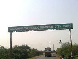
The economy of the town is mostly driven by agriculture and mining businesses in the surrounding area. The town received the name "Black Diamond City" due to the huge coal deposits and many coal mines in the adjacent area. Limestone is also quarried in the area. The principal crops are cotton and soyabeans.
Schools in town
Temples
Road
The distance between district head Yavatmal and wani is about 103 km (64 mi), where as the division head Nagpur is about 140 km (87 mi). The adjacent district head Chandrapur is about 51 km (32 mi) away from Wani.
Railway
Wani is a regular type railway station, under Nagpur division of Central Railway. It has one platform, with signle diesel-engine line.
Language and culture
Marathi language is the most used language, among few other languages including Hindi.
An annual fair takes place in the city during Navratri every year.