
Established 1670 Zip code 06492 Local time Friday 9:18 PM | Region South Central Region Elevation 151 ft (46 m) Population 45,135 (2010) | |
 | ||
Weather 6°C, Wind W at 21 km/h, 59% Humidity | ||
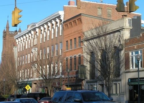
Tour of wallingford connecticut
Wallingford is a town in New Haven County, Connecticut, United States. The population was 45,135 at the 2010 census.
Contents
- Tour of wallingford connecticut
- Map of Wallingford CT 06492 USA
- Wallingford connecticut a great place to live
- History
- Education
- Geography
- Principal communities
- Demographics
- Sports
- Points of interest
- National Register of Historic Places
- References
Map of Wallingford, CT 06492, USA
Wallingford connecticut a great place to live
History
The Connecticut General Assembly created the town on October 10, 1667. This original plot of land near the Quinnipiac River is now considered Main Street. Starting on May 12, 1670 there were 126 people who lived in temporary housing, and five years later in 1675 there were 40 permanent homes.
In 1697 Wallingford was the site of the last witchcraft trial in New England. Winifred Benham was thrice tried for witchcraft and acquitted all three times.
Wallingford has diversified its commercial and industrial base over the past decade attracting high-technology industries as compared to traditional heavy manufacturing. It is the home of a large variety of industries and major corporations spanning the spectrum of the medical, health care, service, high-tech specialty metal manufacturing and research development. The development of the Barnes Industrial Park, Casimir Pulaski Industrial Park, Wharton Brook Industrial Park, and the South Turnpike Road area have greatly contributed to this transition. The Bristol-Myers Squibb Company, the town’s largest taxpayer, has established a research and development facility in Wallingford’s MedWay Industrial Park. An Interchange Zone which permits very restrictive commercial development of office parks, research and development centers and hotels has been created at the intersection of Interstate 91 and Route 68.
In terms of Wallingford's manufacturing and design history, silver-producing companies like Simpson, Hall, Miller & Co. and R. Wallace & Sons are of particular note. Simpson, Hall, Miller & Co. as well as Wallingford's Watrous Manufacturing later became part of the International Silver Company, which was headquartered in the neighboring city of Meriden.
Education
The town of Wallingford has both public and private education. The Wallingford Public School System consists of eight elementary schools, two middle schools, and two high schools. Wallingford has a private sector of schools offering the following: Choate Rosemary Hall, Heritage Baptist Academy, and Holy Trinity School.
Geography
According to the United States Census Bureau, the town has a total area of 39.9 square miles (103.3 km²), of which 39.0 square miles (101.1 km²) is land and 0.9 square miles (2.2 km²), or 2.16%, is water.
The town of Wallingford sits astride the Quinnipiac River in northern New Haven County. It is 5 miles (8 km) south of Meriden and about 13 miles (21 km) north of New Haven. Towns bordering Wallingford are Cheshire, Durham, Hamden, Meriden, Middlefield, North Branford and North Haven. Situated in the Hartford-New Haven-Springfield corridor, Wallingford is traversed by U.S. Route 5, Interstate 91, and State Highways Route 15 (Wilbur Cross Parkway), Route 68, Route 71 and Route 150.
Principal communities
Demographics
As of the census of 2000, there were 43,026 people, 16,697 households, and 11,587 families residing in the town. The population density was 1,102.7 people per square mile (425.7/km²). There were 17,306 housing units at an average density of 443.5 per square mile (171.2/km²). The racial makeup of the town was 94.77% White, 1.02% African American, 0.17% Native American, 1.75% Asian, 1.16% from other races, and 1.14% from two or more races. Hispanic or Latino of any race were 4.52% of the population.
There were 16,697 households out of which 32.3% had children under the age of 18 living with them, 57.3% were married couples living together, 9.0% had a female householder with no husband present, and 30.6% were non-families. Of all households 25.6% were made up of individuals and 10.3% had someone living alone who was 65 years of age or older. The average household size was 2.52 and the average family size was 3.07. The median household income in Wallingford is $91,317. The median family income is $101,239. The per capita income in Wallingford is $40,903.
In the town, the population was spread out with 24.0% under the age of 18, 6.0% from 18 to 24, 30.7% from 25 to 44, 24.0% from 45 to 64, and 15.2% who were 65 years of age or older. The median age was 39 years. For every 100 females there were 93.0 males. For every 100 females age 18 and over, there were 89.7 males.
Sports
From 1943 to 1944 the Boston Braves held spring training in Wallingford at Choate's Winter Exercise Building. The town is the home of the Connecticut Bearcats, a New England Football League team.
Points of interest
National Register of Historic Places
Ten buildings and districts in Wallingford are listed on the National Register of Historic Places: