
Length 38 km Basin size 2,252 sq mi (5,830 km2) | ||
 | ||
River mouth | ||
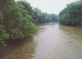
The Walhonding River is a principal tributary of the Muskingum River, 23.5 miles (37.8 km) long, in east-central Ohio in the United States. Via the Muskingum and Ohio Rivers, it is part of the watershed of the Mississippi River. It drains an area of 2,252 square miles (5,833 km²).
Contents
Map of Walhonding River, Coshocton, OH, USA
The Walhonding flows for its entire length in Coshocton County. It is formed by the confluence of the Mohican River and the Kokosing River and flows generally east-southeast, passing through Mohawk Dam, which was built in the 1930s by the U.S. Army Corps of Engineers for the purpose of flood control in the Muskingum River watershed, and through the towns of Nellie and Warsaw. Downstream of Warsaw it collects Killbuck Creek. It meets the Tuscarawas River at the city of Coshocton to form the Muskingum River.
Variant namesEdit
According to the Geographic Names Information System, the Walhonding River has also been known historically as: