
Founded March 23, 1850 Area 1,075 km² | Named for Samuel Finley Vinton Population 13,276 (2013) Congressional district 15th | |
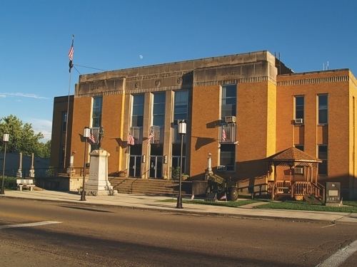 | ||
Points of interest | ||
Vinton County is a county located in the U.S. state of Ohio. As of the 2010 census, the population was 13,435, making it the least populous county in the state. Its county seat is McArthur. The county is named for Samuel Finley Vinton, a 19th-century United States Congressman from Ohio.
Contents
- Map of Vinton County OH USA
- Geography
- Waterways
- Adjacent counties
- 2000 census
- 2010 census
- Government and infrastructure
- Emergency services
- Post Offices
- Utilities
- Phone Internet and cable
- Gas and electricity
- Water and garbage disposal
- Education
- Airports
- Media
- Covered bridges
- State Parks and Recreation Areas
- Lake Hope Bike Trails
- Zaleski Backpack Trails
- Quilt barns
- Wild Turkey Festival
- Ridgetop Music Festival
- Vinton County Air Show
- Villages
- Ghost towns
- References
Map of Vinton County, OH, USA
Geography
According to the U.S. Census Bureau, the county has a total area of 415 square miles (1,070 km2), of which 412 square miles (1,070 km2) is land and 2.6 square miles (6.7 km2) (0.6%) is water.
Waterways
Most of Vinton County is in the Raccoon Creek watershed. Most of the rest of the county, to the west, is in the Salt Creek watershed.
Adjacent counties
2000 census
As of the census of 2000, there were 12,806 people, 4,892 households, and 3,551 families residing in the county. The population density was 31 people per square mile (12/km²). There were 5,653 housing units at an average density of 14 per square mile (5/km²). The racial makeup of the county was 98.08% White, 0.35% Black or African American, 0.45% Native American, 0.09% Asian, 0.08% from other races, and 0.95% from two or more races. 0.47% of the population were Hispanic or Latino of any race.
There were 4,892 households out of which 34.00% had children under the age of 18 living with them, 57.20% were married couples living together, 10.20% had a female householder with no husband present, and 27.40% were non-families. 23.60% of all households were made up of individuals and 9.40% had someone living alone who was 65 years of age or older. The average household size was 2.59 and the average family size was 3.04.
In the county, the population was spread out with 26.90% under the age of 18, 8.80% from 18 to 24, 29.00% from 25 to 44, 23.10% from 45 to 64, and 12.10% who were 65 years of age or older. The median age was 36 years. For every 100 females there were 99.10 males. For every 100 females age 18 and over, there were 95.50 males.
The median income for a household in the county was $29,465, and the median income for a family was $34,371. Males had a median income of $30,936 versus $21,257 for females. The per capita income for the county was $13,731. About 15.10% of families and 20.00% of the population were below the poverty line, including 27.60% of those under age 18 and 13.50% of those age 65 or over.
2010 census
As of the 2010 United States Census, there were 13,435 people, 5,260 households, and 3,640 families residing in the county. The population density was 32.6 inhabitants per square mile (12.6/km2). There were 6,291 housing units at an average density of 15.3 per square mile (5.9/km2). The racial makeup of the county was 97.9% white, 0.4% American Indian, 0.3% black or African American, 0.2% Asian, 0.1% from other races, and 1.1% from two or more races. Those of Hispanic or Latino origin made up 0.5% of the population. In terms of ancestry, 17.0% were German, 16.2% were American, 14.2% were Irish, and 7.5% were English.
Of the 5,260 households, 32.9% had children under the age of 18 living with them, 51.0% were married couples living together, 12.1% had a female householder with no husband present, 30.8% were non-families, and 26.1% of all households were made up of individuals. The average household size was 2.54 and the average family size was 3.03. The median age was 39.6 years.
The median income for a household in the county was $34,242 and the median income for a family was $37,409. Males had a median income of $36,598 versus $28,226 for females. The per capita income for the county was $16,736. About 17.3% of families and 19.5% of the population were below the poverty line, including 25.8% of those under age 18 and 13.3% of those age 65 or over.
Government and infrastructure
Vinton County has a three-member Board of County Commissioners that administers and oversees the various county departments, similar to all but two of the 88 Ohio counties. The elected commissioners serve four-year terms. The elected commissioners are Michael Bledsoe, Tim Eberts, and Jerry Zinn.
Emergency services
The following emergency services, with their locations, serve the county:
Post Offices
There are post offices in the following Vinton County communities:
Utilities
The following utilities serve Vinton County:
Phone, Internet and cable
Gas and electricity
Water and garbage disposal
Education
The entire county is served by the Vinton County Local School District which operates the following schools:
Airports
Vinton County has one public airport, the Vinton County Airport (K22I/22I). The runway is a 3725' x 75' asphalt, east-west (09/27) runway with a single intersecting taxiway. Navigation and radio equipment includes a two-light PAPI for runway 27, Pilot Controlled Lighting and UNICOM.
The airport is leased to the Vinton County Pilots & Booster Association by the County, who raise funds to maintain and update the airport. As of 2015, the boosters are raising funds to finance a 2000-foot runway extension and resurfacing project. The airport is equipped to provide basic service to piston-engined general aviation aircraft. Flight instruction services are also available.
Media
Vinton County is served by one local newspaper outlet, the Vinton County Courier, a print newspaper and website.
Covered bridges
There are four covered bridges located around Vinton County. The most famous bridge was the Ponn Bridge, also known as the Humpback Bridge. It was built in 1874 and was the longest one in the county. The bridge's name came from the shape of the bridge and there are only a few 'humpback' bridges left around the world. This bridge was burned down in June, 2013 by arsonists. In 1875, the Mt. Olive Bridge was built by a Civil War veteran named George Washington Pilcher. This bridge is open to foot traffic and goes over the Middle Fork Salt Creek. The Bay Bridge is located on the Vinton County Fairgrounds. It was moved to the fairgrounds in 1967 and is still open to pedestrians. The Cox Bridge was built in 1884. The bridge is open to foot traffic and has a picnic area near it. The Arbaugh Bridge was built in 1871, making it the oldest covered bridge in the county. The bridge is the only one open to vehicles thanks to a grant that allowed for renovations.
State Parks and Recreation Areas
There are eight recreation areas in Vinton County. The state parks consist of Lake Alma State Park located in Wellston, Ohio and Lake Hope State Park located in McArthur, Ohio. There are also three state forests consisting of Richland Furnace State Forest, Tar Hollow State Forest, and Zaleski State Forest. Along with these, there is the Wayne National Forest, which covers many other counties in Ohio besides Vinton County, Raccoon Ecological Management Area located on State Route 160, and the Wellston Wildlife Area and Lake Rupert located on State Route 683. There are also many more public areas within a short distance of Vinton County.
Lake Hope Bike Trails
Lake Hope State Park is located in Vinton and Athens Counties. There are five loop trails in the park ranging from 4.5 miles to 16 miles. The Hope Furnace Trail loop is the shortest of the trails at 4.5 miles. The Sidewinder Loop is 5.5 miles, the Copperhead Loop is 10 miles, and the New Big Loop is 15 miles. The longest of the trails in the Old Big Loop at 16 miles.
Zaleski Backpack Trails
There are two trails in Zaleski State Forest, a trail of 23.5 miles and a day trail of 10 miles.
Quilt barns
Throughout Vinton County, 27 quilt barns are scattered by the roadways. They are located on Vinton County's Quilt Trail.
Wild Turkey Festival
The Wild Turkey Festival is a music festival held in McArthur, Ohio, on the first weekend of May, beginning on the Thursday evening and concluding on the Sunday afternoon. A parade runs through the town on the Saturday night.
Ridgetop Music Festival
Every August, the Ridgetop Music Festival is held at the Vinton County Airport which offers music and airplane rides throughout the festival.
Vinton County Air Show
The air show is held on the third Sunday in September. The show is the biggest free air show in Ohio and includes food and aerial acts.