
Time zone CET (UTC+1) Area 110.6 km² Dialling code 0472 | Dialing code 0472 Local time Monday 10:21 PM Postal code 39030 | |
 | ||
Frazioni Niedervintl (Vandoies di Sotto), Obervintl (Vandioes di Sopra), Weitental (Vallarga), Pfunders (Fundres) Demonym(s) German: Vintler or VintilaItalian: di Vandoies Weather 12°C, Wind N at 6 km/h, 65% Humidity Region Trentino-Alto Adige/South Tyrol | ||
Meisschneiden in vintl
Vintl ( [fɪntl]; Italian: Vandoies [vanˈdɔːjes]; Ladin: Vandoies), is a comune (municipality) in South Tyrol in northern Italy, located about 45 kilometres (28 mi) northeast of Bolzano.
Contents
- Meisschneiden in vintl
- Map of 39030 Vintl Province of Bolzano South Tyrol Italy
- Rieper shop vintl
- Geography
- Pfunderer Mountains
- Linguistic distribution
- Twin towns
- References
Map of 39030 Vintl, Province of Bolzano - South Tyrol, Italy
Rieper shop vintl
Geography
As of November 30, 2010, it had a population of 3,264 and an area of 110.6 square kilometres (42.7 sq mi).
The municipality of Vintl contains the frazioni (subdivisions, mainly villages and hamlets) Niedervintl (Vandoies di Sotto), Obervintl (Vandioes di Sopra), Weitental (Vallarga) and Pfunders (Fundres).
Vintl borders the following municipalities: Kiens, Mühlbach, Rodeneck, Mühlwald, Terenten, and Pfitsch.
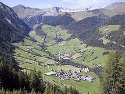
Pfunderer Mountains
The ridges south-west of the main chain of the Zillertal are called the Pfunderer Mountains and occupy an area of about 300 km². The Pfunderer valley is embedded in them. They also enclose the Valler Valley in the west, form the mountain chain with the Pfitscher Valley and extend eastwards into the municipalities of Mühlwald and Terenten. The most prominent peaks in the municipality of Vintl include the Niederer Weißzint (3,263 m) and the Grabspitze (3,068 m s.l.m.) near the Pfunderer Joch, the highest peak on the ridge between the Pfitscher valley and Weitenberger Kar, the Wurmaulspitze (3,022 m s.l.m.), the highest summit west of the Weitenberger Alm, the Napfspitze (2,888 m s.l.m.) south of the Eisbruggjoch col, the Hochgrubbachspitze (2,819 m), the highest point in the eastern Pfunderer and, in front of it, the Eidechsspitze (2,738 m s.l.m.), der Hausberg of Vintl. A well-known hiking trail is the Pfunderer Ridgeway starting from Sterzing and leading up through the Pfunderer mountains to the area of Bruneck.
Linguistic distribution
According to the 2011 census, 98.23% of the population speak German, 1.26% Italian and 0.52% Ladin as first language.
Twin towns
Vintl is twinned with: