
Elevation 1,132 m (3,714 ft) Local time Monday 6:26 PM | ||
 | ||
Region Trentino-Alto Adige/Südtirol Frazioni Koll (Colle), St. Jakob (San Giacomo), St. Magdalena (Santa Maddalena), St. Peter (San Pietro), St. Valentin (San Valentino) and Teis (Tiso) Demonym(s) German: VillnößerItalian: funesini Weather 15°C, Wind NE at 13 km/h, 33% Humidity Points of interest Puez‑Geisler Nature Park, Furchetta, Monte Tullen, Santa Maddalena Church, Museo Mineralogico Tiso | ||
Graf zeppelin carl teike musikkapelle villn osterkonzert 2010
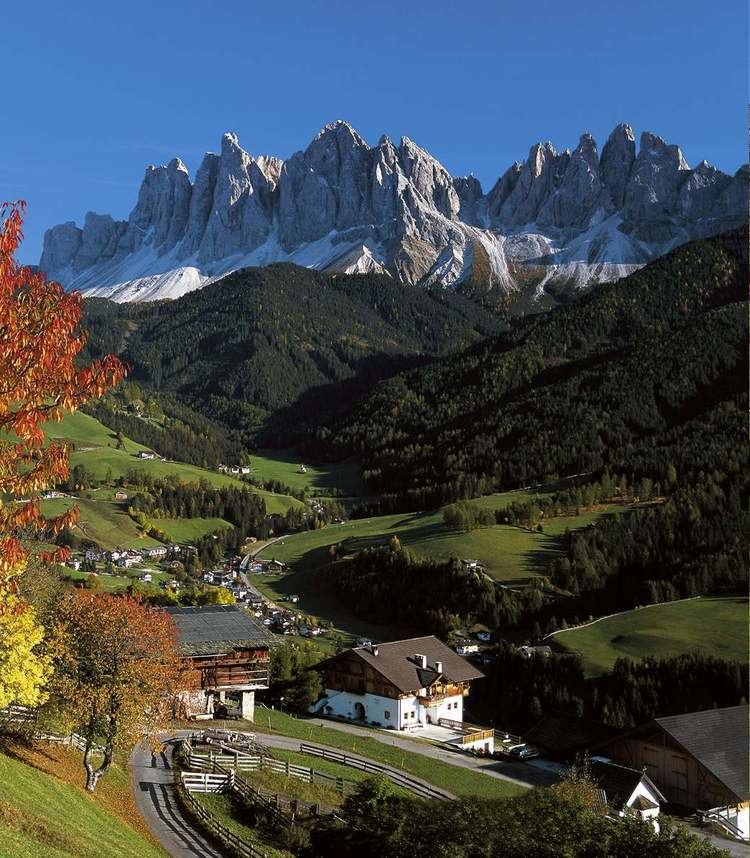
Villnöß ( [fɪlˈnœs]; Italian: Funes [fuˈnɛs]; Ladin: Funès) is a comune (municipality) in South Tyrol in northern Italy, located about 30 kilometres (19 mi) northeast of the city of Bolzano.
Contents
- Graf zeppelin carl teike musikkapelle villn osterkonzert 2010
- Map of 39040 VillnC3B6C39F Province of Bolzano South Tyrol Italy
- Telefunken marsch johannes evert musikkapelle villn osterkonzert 2010
- Geography
- Coat of arms
- Linguistic distribution
- References
Map of 39040 Villn%C3%B6%C3%9F, Province of Bolzano - South Tyrol, Italy
Telefunken marsch johannes evert musikkapelle villn osterkonzert 2010
Geography
As of November 30, 2010, it had a population of 2,552 and an area of 81.2 square kilometres (31.4 sq mi).
The municipality of Villnöß contains the frazioni (subdivisions, mainly villages and hamlets) Koll (Colle), St. Jakob (San Giacomo), St. Magdalena (Santa Maddalena), St. Peter (San Pietro), St. Valentin (San Valentino) and Teis (Tiso).
Villnöß borders the following municipalities: Brixen, Klausen, Lajen, Urtijëi, San Martin de Tor, Santa Cristina Gherdëina and Feldthurns.
Coat-of-arms
The emblem represents three piles of argent on azure, the three peaks symbolize the Odle Group in the head to the Valley of Funes. The emblem was adopted in 1967.
Linguistic distribution
According to the 2011 census, 97.69% of the population speak German, 1.99% Italian and 0.32% Ladin as first language.