
Elevation 357 m Width 800 m Inflow source Okanogan River | Length 3.8 km | |
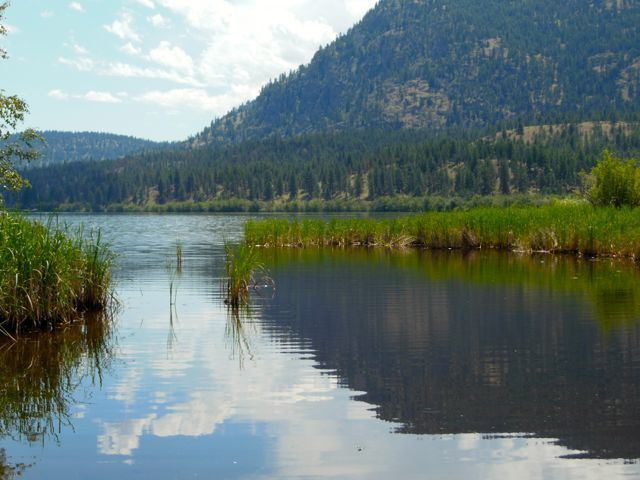 | ||
Smallmouth bass on vaseux lake kayak fishing
Vaseux Lake is a freshwater lake located along the course of the Okanagan River in the Okanagan Valley of British Columbia, Canada. It is a designated Migratory Bird Sanctuary.
Contents
- Smallmouth bass on vaseux lake kayak fishing
- Map of Vaseux Lake British Columbia Canada
- Syl s finds vaseux lake bc great bass here
- Name origin
- Geographical context
- References
Map of Vaseux Lake, British Columbia, Canada
Syl s finds vaseux lake bc great bass here
Name origin
The name "vaseux" is French, meaning muddy or murky, which is descriptive of the lake's silty water. The lake was likely named by French Canadian fur traders.
The lake was misspelled as Vasuix Lake on Joseph Trutch's maps from 1866 and 1871. For many years the name was later spelled Vaseaux Lake; in 1945 the Geographic Board of BC corrected the official name to its present form.
Geographical context
The town of Okanagan Falls is to the north, and the town of Oliver is to the south. The lake lies to the west of Mount Keogan, while British Columbia Highway 97 runs alongside the east shore of the lake, and has a sharp hairpin turn at the Vaseaux Lake Rock Cut which has been the scene of many accidents and deaths. McIntyre Bluff, Vaseux Creek and the associated alluvial fan are to the south; however, it does not flow into Vaseux Lake. Both the north and south ends of the lake are shallow; there is an oval-shaped depression in the center where the lake reaches its maximum depth. The largest island on the lake is Hatfield Island. The lake stage is controlled by McIntyre Dam.