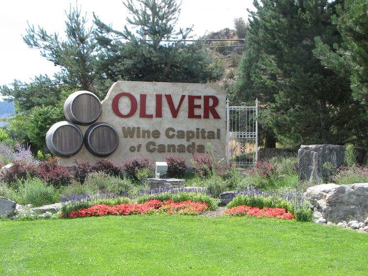
Oliver is a town near the south end of the Okanagan Valley in the Southern Interior of British Columbia, Canada, with a population of over 4,000 people. It is located between Osoyoos and Okanagan Falls, and is labeled as the Wine Capital of Canada by Tourism British Columbia.
The community of Oliver is made up of land governed by three different bodies: the Town of Oliver, the Regional District of Okanagan-Similkameen and the Osoyoos Indian Band.
Local industries include grape and fruit production, agri-tourism, wine production, ranching, golfing and recreation, retail and service trades. Some of the largest employers include Osoyoos Indian Band, School District #53, Interior Health and Okanagan Tree Fruit Cooperative.
Named after John Oliver (1856–1927), Premier of British Columbia. "Honest John" and his government brought irrigation water and settlement lots to the area with the South Okanagan Lands Project.
The First Nations of the South Okanagan settled near the river, creeks and valley lakes. The first encroachment from the outside world came circa 1811, when fur traders came to the area with the establishment of Fort Okanagan (now in the US) and first penetrated the area for trade.
In the 1880s, free gold-bearing quartz was found at Camp McKinney (east of Oliver) which became a busy gold mine, attracting miners, con men, and outlaws. Fairview (just west of and above Oliver) miners found gold and fueled the growth of a boomtown but it lasted just a few years and no remnants of the town survive today, other than a heritage marker.
Established in 1918, Oliver was a settlement for unemployed veterans of the First World War. A gravity-fed canal was constructed to provide irrigation to the semi-arid area.On January 30, 1919, the SOLP (South Okanagan Lands Project) began work on the Intake Dam at the base of McIntyre Bluff. Over the next eight years the 23 concrete-lined miles of the main canal were dug southward to the boundary. Eighteen and a half feet across the top, five feet deep and delivering 230 cubic feet per second, SOLP designed it to enable farmers to put nearly a foot of water per month on every acre of bottom land in the southern Valley. To get the canal from the east side of the Valley to the benches on the west, the “big siphon”—now concrete, but originally a 1,940-foot (590 m)-long wood-stave pipe of six and a half-foot-diameter—was constructed. It runs directly beneath the centre of Oliver. The offices of the land project and the building that housed the BC Police built circa 1924 stand today in Oliver as preserved heritage sites.A post office was established in 1921 and the BC government administered the area until 1945 when a village was incorporated and a council elected. In 1991, the community's municipal incorporation was upgraded to Town, its current status.In 1922 electrical power was brought to Oliver by the West Kootenay Power and Light Co.In 1923 the Kettle Valley Railway (CPR) constructed Oliver station and rails to transport fruit north to Penticton.SOLP (1919–1964) South Okanagan Lands Project – established by the Province of BC 1921 and run by provincial government employees for over forty years. In the spring of 1964 the Oliver/Osoyoos Fruit Growers' Association was informed that the province was getting out of the irrigation business.SOLID (1964–1989) South Okanagan Lands and Irrigation District – On June 25, 1964 the Fruit Growers' Association volunteered itself to be the cornerstone of the locally constituted South Okanagan Lands Irrigation District which operated the system until 1989.Oliver Water (1989 to present) Town of Oliver – The water district was divided into two parts to be run by municipal governments. The Towns of Oliver and Osoyoos now deliver nineteen billion imperial gallons—nearly one hundred billion litres—to the Valley’s parched soils annually. 1990 saw the election of Water Councillors in both communities—a first in BC.CAU3 Paved Hard Surface 3200 ft by 50 ftElevation: 1015 ftVFR - Lighted stripOwned by Town of OliverCoordinates:
Lat 49-10.24 NLon 119-33.04 WHome to Oliver Flying Club (terminal and hangars), Okanagan Kootenay Air Cadet Gliding Program, VMR Aviation, Transwest Helicopters, Oliver Fire Department, Oliver-Osoyoos Search and Rescue and Big Horn Squadron Royal Canadian Air CadetsAccording to the 2011 Census, 79.57% of Oliver's population have English as mother tongue; Punjabi is the mother tongue of 5.21% of the population, followed by German (2.87%), Portuguese (2.55%), French (2.45%), Spanish (0.96%), Dutch (0.74%), Hungarian (0.74%), Russian (0.53%), and Ukrainian (0.53%).
Town of Oliver: 4824Regional District Area 'C': 3473Osoyoos Indian Band: 900John Anderson, Admiral (Ret) Former Chief of Defense Staff, graduate of SOHSLaslo Babits, Competed in javelin at the 1984 Summer Olympics in Los Angeles, California, finishing in 8th place. Graduate of SOSSBill Barisoff, former Speaker of the British Columbia Legislative Assembly, graduate of SOSSGeorge Bowering, First Canadian Poet Laureate, graduate of SOHSPatricia Smith Churchland, philosopher and neuroscientist, born in OliverRoss Fitzpatrick, Canadian Senator (Okanagan-Similkameen), graduate of SOHSClarence Louie, Chief of Osoyoos Indian Band, Order of BCJulie Skinner, 2002 Bronze Medal at Winter Olympics in Salt Lake City, Utah (Kelly Law team)Alison Smith, CBC TV anchor, graduate of SOSSTravis Turner, actor, lead role in the 2011 film Marley & Me: The Puppy YearsOliver has a semi-arid climate (BSk) with hot, dry summers and cool winters.