
 | ||
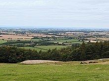
The Vale of Mowbray (sometimes mistakenly referred to as the Vale of York) is a stretch of low-lying land between the North York Moors and the Hambleton Hills to the east and the Yorkshire Dales to the west. To the north lie the Tees Valley lowlands and to the south the Vale of Mowbray becomes the Vale of York proper.
Contents
The Vale of Mowbray is distinguishable from the Vale of York by its meandering rivers and more undulating landscape.
The main characteristic of the vale of Mowbray is the fertile agricultural land used for crops and permanent grassland, though isolated pockets of woodland remain. The roads in the Vale of Mowbray are characteristically contained by low hedges with wide verges. The villages are often linear following the major through road, the houses are generally brick built with pantile roofs.