
Population 3,155 (2011) Civil parish Catterick Sovereign state United Kingdom Local time Monday 10:45 PM | OS grid reference SE240980 Dialling code 01748 | |
 | ||
Weather 6°C, Wind W at 14 km/h, 80% Humidity | ||
Catterick is a village, civil parish and electoral ward in the Richmondshire district of North Yorkshire, England. Historically part of the North Riding of Yorkshire, it is 8.5 miles (13.7 km) north-west of the county town of Northallerton just to the west of the River Swale. It lends its name to nearby Catterick Garrison and the nearby hamlet of Catterick Bridge, the home of Catterick Racecourse where the village Sunday market is held. It lies on the route of the old Roman Road of Dere Street and is the site of the Roman fortification of Cataractonium.
Contents
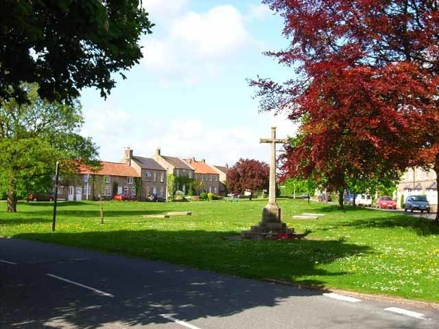
- Map of Catterick Richmond UK
- Toponymy
- History
- Governance
- Geography
- 2001 census
- 2011 census
- Culture and community
- Religion
- Notable residents
- References
Map of Catterick, Richmond, UK
Toponymy
The etymology of the name is derived from the Latin place name, "Cataractonium" looks like a Latin/Greek mixture meaning "place of a waterfall", but it might have been a Roman misunderstanding of the Celtic name Catu-rātis meaning "battle ramparts", as partly supported by the spelling Κατουρακτονιον on the Ptolemy world map.
History
The place is mentioned in Ptolemy's Geographia of c. 150 as a landmark to locate the 24th clime. It dates back to Roman times, when Cataractonium was a Roman fort protecting the crossing of Dere Street over the River Swale.
Catterick is thought to be the site of the Battle of Catraeth (c. 598) mentioned in the Welsh language poem Y Gododdin. This was fought between Celtic British or Brythonic kingdoms and the Anglo-Saxon kingdom of Bernicia. Paulinus of York performed baptisms nearby in the River Swale.
Catterick is mentioned in the Domesday Book as Catrice. The manor was held by Earl Edwin at the time of the Norman invasion, and was afterwards was granted to Count Alan of Brittany. Thereafter the demesne manor was held by the lords of Richmond. The manor has been held by John of Gaunt in the 14th century and the Earls of Salisbury in the 15th century. The manor was held for a while by Sir John Conyers from 1484. During the reign of Queen Mary I, the manor was granted to the youngest daughter of Henry Pole, 1st Baron Montagu, whose son Francis Barrington inherited the honour. The Barrington family passed the manor to Richard Braithwaite whose descendants inherited the manor and held it until the 18th century. Other lords of the manor included the Lawson family, who held it into the late 19th century.
Pallet Hill, just to the north of the village church, is the site of the earthwork remains of a motte and bailey castle. It is thought to have been built by King Stephen in the mid 12th century to control the Great North Road. It has been designated a Scheduled Ancient Monument. To the south of the village on the south side of the A1/A6163 interchange, is the site of a small Roman roadside settlement and cemetery on Bainesse farm. It has been designated a Scheduled Ancient Monument.
In later times, Catterick prospered as a coaching town where travellers up the Great North Road would stop overnight and refresh themselves and their horses; today's Angel Inn was once a coaching inn. A mile to the south-east are the surviving earthworks of Killerby Castle, a medieval motte-and-bailey castle.
Catterick was a large ancient parish, extending into three wapentakes (Hang East, Hang West and Gilling West) of the North Riding of Yorkshire. It included the townships of Appleton, Bolton upon Swale, Brough, Colburn, Ellerton upon Swale, Hipswell, Hudswell, Killerby, Kiplin, Scorton, Scotton, Uckerby and Whitwell. All these places became separate civil parishes in 1866.
In 1914 Catterick Camp (later Catterick Garrison) was established 4.7 miles (7.6 km) west of the village, in the ancient parish of Catterick but in the civil parishes of Hipswell and Scotton. RAF Catterick, the airfield to the south of the village also opened in 1914, was transferred to the Army and is now Marne Barracks, named after the site of two significant battles of the First World War.
In 1974 Catterick was transferred to the new county of North Yorkshire.
Governance
The village lies within the Richmond UK Parliament constituency. It also lies within the Catterick Bridge electoral division of North Yorkshire County Council and the Catterick ward of Richmondshire District Council. Catterick has a Parish council that covers the same area as the district ward and returns two councillors to the District Council.
Geography
The village lies along A6136 road to Richmond and is by-passed by the A1. The A1 bypass, which cost £1 million at the time, was opened in 1959 by Lord Chesham, the Joint Parliamentary Secretary to the Ministry of Transport. The River Swale turns southward just to the north of the village at Catterick Bridge and flows to the east side of the Catterick. Brough Beck runs east through the village to join the River Swale. There are several bodies of water that are the result of quarrying. Within 2.5 miles (4.0 km) of Catterick are the villages of Brompton-on-Swale, Catterick Bridge, Colburn, Tunstall, East Appleton, Ellerton-on-Swale, Whitwell, Scorton and Uckerby.
2001 census
The 2001 UK census showed that the population was split 52.6% male to 47.4% female. The religious constituency was made of 83.4% Christian, 0.25% Buddhist, 0.11% Jewish, 0.11% Other and the rest stating no religion or not stating at all. The ethnic make-up was 97.6% White British, 0.9% White Other/Irish, 0.4% Mixed Ethnic, 0.21% Black British, 0.21% Other Ethnic and 0.25% British Asian. There were 1,050 dwellings.
2011 census
The 2011 UK census showed that the population was split 58% male to 42% female. The religious constituency was made of 70.75% Christian, 0.16% Buddhist, 0.19% Muslim, 0.85% Hindu, 0.54% Other and the rest stating no religion or not stating at all. The ethnic make-up was 92.4% White British, 2.3% White Other/Irish, 1.2% Mixed Ethnic, 0.76 Black British, 0.38 Other Ethnic and other and 1.77% British Asian. There were 1,200 dwellings.
Culture and community
Marne Barracks borders the village to the south along Leeming Lane and Oran Lane. The base and Service quarters are separated from the village by a protective fence. There are a few local businesses, such as take-away food outlets, local store with Post Office, public house and a Car Service Station. There is a sports ground which is used for Cricket and Football.
BFBS Radio broadcasts from studios on Shute Road across the town and surrounding areas on 106.9FM as part of its UK Bases network
Michael Sydall CE Primary School provides education for a mixed gender pupil intake between the ages of four and eleven. The school has an official capacity of 252 pupils. The school is named after a vicar of the village church of St Anne who founded a school in the village in 1658. The school is in the catchment area of Risedale Sports & Community College in nearby Catterick Garrison for secondary education needs.
Religion
The church in the village is dedicated to St Anne and is a Grade I listed building. The current building was completed in 1412 and added to in both 15th and 19th centuries. A Wesleyan chapel was built in the village in 1842 on Low Green next to the local public house.