
Population 4,025 (2013) Area 277.1 sq mi | State Alaska Mayor Larry Weaver | |
Valdez (Alutiiq: Suacit) is a city in Valdez-Cordova Census Area in the U.S. state of Alaska. According to the 2010 US Census, the population of the city is 3,976. The city is one of the most important ports in Alaska. The port of Valdez was named in 1790 after the Spanish Navy Minister Antonio Valdes y Fernandez Bazan.
Contents
- Map of Valdez Alaska
- 2011 valdez alaska pinza for peace love powder
- Economy
- History
- Geography and climate
- Media and culture
- References
Map of Valdez, Alaska
2011 valdez alaska pinza for peace love & powder
Economy
Valdez is a fishing port, both for commercial and sport fishing. Freight moves through Valdez bound for the interior of Alaska. Sightseeing of the marine life and glaciers, together with both deep-sea fishing, and heli skiing support a tourist industry in Valdez. The oil from the Trans-Alaska pipeline is loaded onto ships at the Valdez oil terminal.
History
The port of Valdez was named in 1790 by the Spanish explorer Salvador Fidalgo after the Spanish naval officer Antonio Valdes y Fernandez Bazan. A scam to lure prospectors off the Klondike Gold Rush trail led to a town being developed there in 1898. Some steamship companies promoted the Valdez Glacier Trail as a better route for miners to reach the Klondike gold fields and discover new ones in the Copper River country of interior Alaska than that from Skagway. The prospectors who believed the promotion found that they had been deceived. The glacier trail was twice as long and steep as reported, and many men died attempting the crossing, in part by contracting scurvy during the long cold winter without adequate supplies. The town did not flourish until after the construction of the Richardson Highway in 1899, which connected Valdez and Fairbanks. With a new road and its ice-free port, Valdez became permanently established as the first overland supply route into the interior of Alaska. The highway was open in summer-only until 1950, when it was operated as a year-round route.
In 1907, a shootout between two rival railroad companies ended Valdezs hope of becoming the railroad link from tidewater to the Kennicott Copper Mine. The mine, located in the heart of the Wrangell-St.Elias Mountains, was one of the richest copper ore deposits on the continent. The exact location of the right-of-way dispute, in which one man was killed and several injured, is located at the southern entrance of the canyon on the Valdez side. A half-completed tunnel in the canyon marks the end of railroad days in Valdez. A rail line to Kennicott was later established from the coastal city of Cordova.
The city of Valdez was badly shaken but not destroyed in the 1964 Good Friday Earthquake. Liquefaction of the glacial silt that formed the citys foundation led to a massive underwater landslide, which caused a section of the citys shoreline to break off and sink into the sea. The underwater soil displacement caused a local tsunami 30 feet (9.1 m) high that traveled westward, away from the city and down Valdez Bay. Thirty-two men women and children were on the citys main freight dock to help with and watch the unloading of the SS Chena, a supply ship that came to Valdez regularly. All 32 people died as the dock collapsed into the ocean with the violent landslide. There were no deaths in the town.
Residents continued to live there for an additional three years while a new site was being prepared on more stable ground four miles (6 km) away. The new construction was supervised by the Army Corps of Engineers. They transported 54 houses and buildings by truck to the new site, to re-establish the new city at its present location. The original town site was dismantled and abandoned.
From 1975-1977, the Trans-Alaska pipeline was built to carry oil from the Prudhoe Bay oil fields in northern Alaska to a terminal in Valdez, the nearest ice-free port. Oil is loaded onto tanker ships for transport. The construction and operation of the pipeline and terminal boosted the economy of Valdez.
The 1989 Exxon Valdez oil spill occurred as the oil tanker Exxon Valdez was leaving the terminal at Valdez full of oil. The spill occurred at Bligh Reef, about 40 km (25 mi) from Valdez. Although the oil did not reach Valdez, it devastated much of the marine life in the surrounding area. The clean-up of the oil caused a short-term boost to the economy of Valdez.
Geography and climate
Valdez is located at 61°7?51?N 146°20?54?W. According to the United States Census Bureau, the city has a total area of 277.1 square miles (718 km2), of which, 222.0 square miles (575 km2) of it is land and 55.1 square miles (143 km2) of it (19.88%) is water.
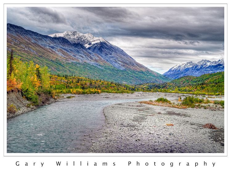
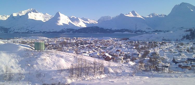
Valdez is located near the head of a deep fjord in the Prince William Sound in Alaska. It is surrounded by the Chugach Mountains, which are heavily glaciated. Valdez is the northernmost port in North America that is ice-free year-round. The northernmost point of the coastal Pacific temperate rain forest is in Valdez, on Blueberry Hill. Despite the presence of temperate rainforest, Valdez under the Koppen climate classification has a subarctic climate (Dfc): its winters, though much warmer than most climates of this type, are not sufficiently mild, as those of, say, Ketchikan or Kodiak are, to fit into the oceanic or subpolar oceanic climate category.
According to the Weather Channel and NOAA, Valdez is the snowiest place in the United States, with an average of almost 300 inches per year. In winters past, they have had years when more than 100 inches of snow fell in 5 separate months (not in the same year).
Media and culture
Despite its small size, Valdez was at one time home to two weekly newspapers, the Valdez Star and the Valdez Vanguard. In 2004, the Star bought out the Vanguard. Valdez is also home to radio broadcasters KCHU, KVAK, KVAK-FM.
Valdez is also home to the Last Frontier Theatre Conference, hosted by the Prince William Sound Community College. The annual conference attracts playwrights and actors from around the United States.
It is used as a loose base for a multiplayer level titled "Midnight Sun" in the Armored Fury expansion for the 2005 video game Battlefield 2.
In the 2010 video game Battlefield: Bad Company 2 under the name "Port Valdez" is an available multiplayer map. The map landscape is based on the Valdez Marine Terminal with some modifications.
On Deadly Ground (1994) was filmed near Worthington Glacier, Alaska, as well as the Valdez Civic Center and Valdez Airport, and 30 miles (48 km) outside Valdez on Thompson Pass in the Chugach Mountains.