
Length 82.08 km | ||
 | ||
Existed: 1918 as a state highway; 1927 as SR-18 – present North end: SR-56 at Beryl Junction | ||
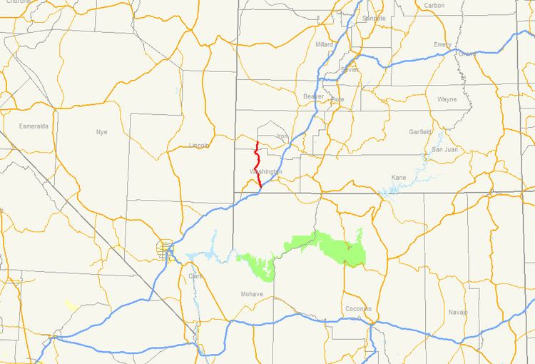
State Route 18 (SR-18) is a state highway in southern Utah, running for 51.005 miles (82.085 km) in Washington and Iron Counties from St. George to Beryl Junction. It forms part of the Legacy Loop Highway from St. George to Parowan. The highway closely follows the route of the Old Spanish Trail through Dixie National Forest.
Contents
Map of UT-18, Utah, USA
St. George to Veyo
SR-18 begins at Convention Center/Sunland Drive just south of the Bluff Street interchange with I-15 in St. George as an urban arterial and heads north through the west side of downtown St. George. It continues north through Snow Canyon State Park and continues northwest through Wide Canyon to Dammeron Valley and past Veyo Volcano. It then turns north into Veyo, running through the center of the town.
Veyo to Beryl Junction
SR-18 leaves Veyo heading northeast to Central, then continues north and northwest through mountainous terrain in the Dixie National Forest past the Mountain Meadows Massacre site and continues into Enterprise. It turns northeast in eastern Enterprise, then turns north through farmland outside of the town to Beryl Junction, where it ends at an intersection with SR-56.
History
The highway closely follows the route of the Old Spanish Trail through the extreme corner of southwestern Utah. This portion of the trail is known for the 1857 Mountain Meadows massacre, a controversial event in both Utah and Mormon history which occurred just off what is now SR-18.
The road from SR-1 (by 1926 US-91) at Enterprise Junction north through Enterprise to Modena was added to the state highway system in 1918. A 1927 law gave it the number and extended it west to the Nevada state line, where it became SR 25 to Panaca. In 1935, the portion from Beryl Junction west to Nevada became an extension of SR-56, which ran east from Beryl Junction to Cedar City. A branch from Enterprise west to Nevada, where SR 75 continued as a shortcut to Panaca, was added to SR-18 in 1941, but split off as SR-120 in 1945. At the southern end of the route, SR-18 was extended over US-91 in 1969 toward future I-15 (which was replacing US-91). A further extension to I-15 at exit 6 was made in 1974, replacing the south half of SR-34.