
Length 644.7 km | ||
 | ||
North end: | ||
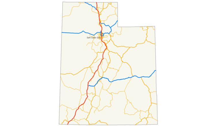
Interstate 15 (I-15) runs north–south in the U.S. state of Utah through the southwestern and central portions of the state, passing through many of the population centers of the state, including St. George, Provo, Salt Lake City, and Ogden, the latter three being part of the urban area known as the Wasatch Front. It is the primary north–south highway in Utah, as the majority of the state's population lives along its corridor. The only Metropolitan Statistical Area in Utah not connected by I-15 is the Logan Utah-Idaho Metropolitan Statistical Area. The entire length of I-15 within Utah (and south into Arizona) is designated as the Veterans Memorial Highway.
Contents
- Map of I 15 United States
- Route description
- Southern Utah
- Central Utah
- Salt Lake area
- Ogden area
- Box Elder County
- History
- Exit list
- References
Map of I-15, United States
Route description
The interstate passes through the fast-growing Dixie region, which includes St. George, Cedar City, and eventually most of the major cities and suburbs along the Wasatch Front, including Provo, Orem, Sandy, West Jordan, Salt Lake City, Layton, and Ogden. Around Cove Fort, Interstate 70 begins its journey eastward across the country. The interstate merges with I-80 for about 3 miles (4.8 km) from South Salt Lake to just west of Downtown Salt Lake City and merges with Interstate 84 from Ogden to Tremonton. Along nearly its entire length through the state, I-15 winds its way along the western edge of a nearly continuous range of mountains (including the Wasatch Range in the northern half of the state). The only exceptions are when it passes through the mountains south of Cedar City and again north of Cove Fort.
Southern Utah
From Las Vegas, Nevada, I-15 winds and slightly inclines through the Virgin River Gorge in northwest Arizona, then in Utah it crosses the border in Washington County. Heading north-northeast it continues with two lanes in each direction and maintaining this two-lane configuration until it reaches the Wasatch Front in the north central part of the state. Just past the border there is a port of entry on each side of the freeway. These ports of entry (weigh stations) are jointly operated by the states of Utah and Arizona and are the first northbound exit and last southbound exit on I-15 in Utah. The route turns north as it passes the Bloomington area of city of St. George and an interchange with Southern Parkway (SR-7) before it crosses the Virgin River. (SR-7 provides access to the new St. George Regional Airport.) Immediately north of the Virgin River, and partially spanning the Santa Clara River, is the new Dixie Drive interchange. After the interchange with Bluff Street (SR-18) I-15 turns northeast again and passes the eastern side of downtown St. George, with an interchange with St. George Boulevard (SR-34). These two interchanges are the southern and northern ends of the St. George I-15 Business Loop. From this point north I-15 generally follows the route of the Old US-91 to the northern border of Utah. (The route of Old US-91, in turn, followed the older Arrowhead Trail highway to Salt Lake City.)
After leaving St. George, I-15 continues northeast and passes through the northern part of the city of Washington, with interchanges at Green Springs Drive, Washington Parkway, and State Street (SR-9). Northeast of Washington I-15 passes through the northwestern side of the town of Leeds, with one-way interchanges on the southwest and northeast ends of town. After passing through the northwestern part of Toquerville, and an interchange with SR-17 (at Anderson Junction), I-15 resumes a more north-northeastern course as it ascends about 1,000 feet (300 m) higher on the Colorado Plateau. Along the way it passes through the areas of Browse and Pintura, with interchanges at both, as well as two more ranch exits further northeast. After its ascent, it passes by the east of side of Ash Creek Reservoir and then by the northwest corner of Zion National Park, with an interchange providing access to the Kolob Canyon area of the park. Next is an interchange that provides access to New Harmony (several miles west) and Kanarraville (several miles to the northeast). This interchange is also at the border of Washington County and Iron County.
Just after entering Iron County, I-15 reaches the southern most rest areas along its route within the state (with one each, northbound and southbound). After passing about a mile west of Kanarraville it reaches an interchange in Hamilton Fort. The freeway then briefly turns nearly east before turning north again to pass through the west side of Cedar City. The first interchange is at the southern end of SR-130 (Main Street) and the Cedar City I-15 Business Loop. Just north is the 200 South (SR-56) interchange, which provides access to downtown Cedar City as well as the Cedar City Regional Airport. After this interchange, the freeway turns northeast before the final Cedar City interchange with SR-130 (once again). This interchange is also the northern end of the Cedar City I-15 Business Loop, although no longer indicated as such by signage. The freeway then passes by the eastern edge of Enoch, but without an interchange within that city. After an interchange within the area of Summit I-15 heads east-northeast before passing by the northwest edge of Parowan, with interchanges on the west (200 South/SR-143) and north (Main Street/SR-274) sides of town. After Parowan, the freeway curves back to a northeast course as it passes about a mile west of Paragonah and reaches an interchange on the north side of that city (SR-271). Continuing northeast it reaches the next pair of rest areas before an interchange with SR-20 and then a ranch exit (exit 100) before leaving Iron County.
Central Utah
As I-15 enters Beaver County the interstate turns northwest and winds its way through the mountain pass before heading north again to pass along the western edge of the city of Beaver. Both the southern and northern interchanges in Beaver include the I-15 Business Loop and SR-160—the city streets are South Main Street on the south and 1400 North on the north. Off the 1400 North interchange there is an official rest stop courtesy of the Utah Department of Transportation UDOT and the local Texaco Station. The freeway then heads slightly west until it passes by the west side of the community of Manderfield and curving back to a north-northeast course. After several miles there is an interchange with Manderfield Road before I-15 winds through another mountain pass and reaches the Sulphurdale interchange. After passing west of the ghost town of Sulphurdale it reaches the interchange with the western end of I-70. This interchange is on the border of Beaver and Millard counties.
North of the I-15/I-70 interchange, I-70 heads east to Richfield and on though Denver, Colorado, while I-15 continues north to pass by Cove Fort on the east and reach the Cove Fort (SR-161/Black Rock Road) interchange. Off the Black Rock Road interchange there is an official rest stop courtesy of UDOT and the local Chevron Station. Continuing on, I-15 meanders to the north-northeast before straightening out to the northeast southwest of Kanosh. The freeway passes by the northwest side of both Meadow, having an interchange with North Main Street (SR-133). It then passes through the western side of Fillmore. SR-99 follows the length of the I-15 Business Loop through Fillmore, connecting at 850 South on the southwest part of town and North Main Street/Cedar Mountain Road on the northern city limits. Off the North Main Street interchange there is an official rest stop courtesy of UDOT and the local Chevron Station. Continuing north-northwest it has an interchange with 5400 North/Maple Hollow Road (SR-64) before passing by the southeast edge of Holden. Several miles northeast of Holden, US-50 merges with I-15 as it continues northeast and eventually heading through a low mountain pass just after another ranch exit. The US-50 overlap then ends as I-15 passes through the northwest corner of Scipio. Off the Scipio interchange is an official rest stop courtesy of UDOT and Flying J. (US-50 eastbound serves as a connector to I-70 for southbound I-15 motorists.)
Several miles north of Scipio, I-15 leaves Millard County and enters Juab County before turning northeast once again. After an interchange with the Yuba Lake Road is another interchange at Mills Junction/SR-78 just southeast of Chicken Creek Reservoir. The freeway then continues roughly north-northeast until it turns northeast to pass through the southern part of Nephi and an interchange with South Main Street (SR-28). The freeway then turns north to pass through the eastern side of Nephi, with an interchange with 100 North (SR-132). It then curves to the north-northwest before reach the interchange with the northern end of SR-28 about a mile north of town. The interstate then turns north and passes by the eastern side of Mona and has an interchange with SR-52 (300 North). Continuing north it passes by the eastern edge of Rocky Ridge before promptly leaving Juab County and entering Utah County.
Salt Lake area
As the freeway enters Utah County, it also enters Utah Valley, the Wasatch Front, and the Provo-Orem metropolitan area. Turning northeast, it enters the town of Santaquin, where US-6 begins its overlap with I-15 at the interchange with East Main Street/US-6/SR-198. Exiting Santaquin, the interstate turns north to pass by the western edge of Spring Lake before entering Payson, turning north east, and reaching the 800 South (SR-178) interchange. (Although not yet complete, construction began in late the spring of 2013 to add an additional lane of travel on both sides of I-15 from this interchange north to Spanish Fork.) Continuing northeast, the freeway reaches the interchange with North Main Street (SR-115/3200 West) in north Payson. Maintaining its course to the northeast it passes the eastern edge of Benjamin, with an interchange with SR-168 (8000 South), and enters Spanish Fork and gains one lane in each direction (the first time the interstate widens in the state). On the north side of Spanish Fork is an interchange with North Main Street (US-6 and SR-156), after which I-15 turns north and gains one more lane in each direction. This interchange also marks the northern end of the overlap with US-6. (The section between Spanish Fork and Lehi was rebuilt in 2010-12 as part of the I-15 CORE project.)
Continuing north with four lanes, it gains an additional Express Lane in both directions. It then passes through the far west side of Springville, with interchanges at 400 South (SR-77) and 1400 North (SR-75). Off the 1400 North interchange is an official rest stop courtesy of UDOT and Flying J. Curving northwest it passes the eastern edge of the Provo Bay of Utah Lake before reaching Provo. Upon entering Provo, it intersects with South University Avenue (the southern terminus of US-189) and East Lakeview Parkway. The interstate then continues northwest, bisecting the west side of Provo, with an interchange with Center Street (SR-114) before leaving Provo and entering Orem. After an interchange with West University Parkway (SR-265), immediately southwest of Utah Valley University, the freeway heads north along the western side of Orem. After interchanges with Center Street, and then 800 North (SR-52) the interstate curves northwest and immediately reaches the interchange with SR-241 (1600 North/600 South). This interchange on the border of Orem and Lindon.
Continuing northwest I-15 passes through the western side of Lindon before passing by the southwest edge of Pleasant Grove, with an interchange at Pleasant Grove Boulevard. Next the freeway enters American Fork with interchanges with at 500 East (SR-180) on the south end of town and West Main Street/Pioneer Crossing (SR-145) on the west end of town. After American Fork, the freeway enters Lehi with it first interchange at East Main Street (SR-73). At this point the interstate narrows to just three lanes (plus an Express Lane) in each direction (however, UDOT anticipates beginning construction on additional lanes in this area in the spring of 2014). The next interchange in Lehi is with 2100 North/1200 West (US-89/SR-85). This also begins the first of two I-15/US-89 overlaps. The final interchange in Lehi with Timpanogos Highway/Clubhouse Drive (SR-92), which is just east of Thanksgiving Point. Past Lehi, the interstate exits the Provo metropolitan area and Utah County to enter the Salt Lake City metropolitan area as it passes through the Point of the Mountain.
As the route enters the Salt Lake Valley from only one of three other points connecting Salt Lake County and Utah County (the others being SR-68 and Traverse Ridge Road), it turns northeast to pass by the eastern edge of Bluffdale. It then enters Draper and heads north to pass through the western part of that city, with four interchanges along the way. The first is with Highland Drive/14600 South (SR-140). The next interchange is with Bangerter Highway (SR-154), after which the freeway widens to a total of four lanes (plus an Express Lane) in each direction. The third interchange in Draper is with 12300 South (US-89/SR-71). This interchange is also where US-89 ends its first overlap with the interstate and where I-15 curves slightly to the west. The final interchange in town is on the northern city limits at 11400 South (SR-175). This interchange is on the southern border of Sandy, and is the first of three within that city. The next interchange is with 10600 South (SR-151), after which the interstate gains an additional lane in each direction. The final interchange in Sandy is with 9000 South (SR-209).
Shortly after the last interchange in Sandy it leaves that city and enters Midvale, with the only interchange in that city being with 7200 South (SR-48). After leaving Midvale, I-15 enters Murray and immediately reaches the junction with I-215, a beltway running through many of Salt Lake City's suburbs. Past this interchange, there are two more interchanges in Murray. The first is at 5400 South (SR-173) and the second is with 4500 South/Taylorsville Expressway (SR-266). After this interchange the freeway leave Murray and passes through the western end of Millcreek (an unincorporated suburb of Salt Lake City) before entering South Salt Lake. After an interchange with 3300 South (SR-171) the interstate reaches the Spaghetti Bowl, which is an interchange with I-80 and SR-201 (21st South Freeway). The southern overlap of I-80 begins at this point as well as the collector roads. The collectors, but not the main I-15 travel lanes, have interchanges with 2100 South and 1300 South, as well as West Temple Street (SR-270) for northbound traffic only. (The West Temple Street off ramps are signed as 900 South.) The Spaghetti Bowl is also where the freeway leaves South Salt Lake enters Salt Lake City.
After entering Salt Lake City, the interstate jogs to the west for the next three interchanges. The first is with SR-269 and includes the off ramps from northbound I-15/I-80 to eastbound 600 South and the on ramps from westbound 500 South to southbound I-15/I-80. The next two interchanges are overlain and include I-80 (the northern end of the I-80 overlap) and 400 South (West University Boulevard). (The later interchange only permits HOV or toll use of the northbound off ramp and the southbound on ramp from and to the respective Express Lanes of I-15/I-80.) North of the ramps with I-80, I-15 loses one lane, leaving three lanes, plus the Express Lane, in both directions. the next interchange is with 600 North (SR-268), following which the freeway jogs to the west for the next two interchanges. After the 900 West interchange (which does not include a northbound off ramp) is the Warm Springs Road (northbound) and 2300 North (southbound) interchange. The freeway then returns to is northern course, but before leaving Salt Lake City and Salt Lake County, it has northbound on and off ramps for the Beck Street (US-89) interchange.
Ogden area
After entering Davis County, the city of North Salt Lake, and the Ogden-Clearfield metropolitan area, I-15 has the southbound on and off ramps for the Beck Street (US-89) interchange. This point is also where the Express Lanes end, leaving just the four lanes in each direction. Next is the junction between I-15 and I-215 (Belt Route), which only provides a southbound off ramp from I-15 to I-215 and a northbound on ramp from I-215 to I-15. Just after this another partial interchange that only includes a southbound off ramp to West Center Street. The freeway then heads northwest to the 2600 South (SR-93) interchange, which is centered on the border of North Salt Lake and Woods Cross. Continuing north once again, the interstate reaches its next interchange, which is with 500 South (SR-68). Parts of this interchange are spread over three cities, with Woods Cross on the south, a panhandle of Bountiful in the middle, and West Bountiful on the north. Continuing north it comes to another partial interchange with 400 North, which only includes a northbound off ramp and a southbound on ramp. After a slight jog to the east comes the junction with US-89 (500 West). This junction straddles the north-south border between West Bountiful and Bountiful. It is also a partial interchange in that it has only a southbound off ramp and a northbound on ramp. It also is the beginning of the second 1-15/US-89 overlap.
Continuing north it leaves West Bountiful and enters Centerville before reaching the Parish Lane (400 North/SR-105) interchange About a mile north I-15 begins a stretch where the Legacy Parkway (SR-67) parallels the interstate on the west, with little more than train tracks in between. About another mile north the freeway leaves Centerville and enters Farmington and then gain and Express Lane once again in both directions. Next comes the partial interchange with 200 West (SR-227), which only includes a northbound off ramp and a southbound on ramp. Heading north-northeast it reaches the I-15/Legacy Highway/US-89/Park Lane (SR-225) interchange. This sprawling interchange provides a northbound off ramp and southbound on ramp for US-89, a southbound off ramp and a northbound on ramp for Legacy Parkway, as well connection with Park Lane. The interchange is just west of the Lagoon amusement park and is the end of the second I-15/US-89 overlap. From this interchange it heads northwest before leaving Farmington and entering Kaysville.
Just inside Kaysville are two former rest areas. While the ramps and parking areas are still intact, there are no signage or facilities remaining. Further on is the Kaysville (200 North/SR-273) interchange. Continuing northwest I-15 leaves Kaysville and enters Layton, along with its three interchanges. The first interchange is with Layton Parkway and just north of it the Express Lanes end once again, leaving just three lanes in each direction. (However, construction on an additional lane each way began in the summer of 2012.) The next two interchanges are with Hill Field Road (SR-232) and then Antelope Drive (2000 North/SR-108). After leaving Layton the interstate enters Clearfield and reaches the 700 South SR-193 interchange. From this interchange north I-15 runs along the western edge of Hill Air Force Base. The next interchange is with 650 North, which also provides direct access to the west part of the air force base. Just after this interchange the freeway leaves Clearfield, turns north, and enters Sunset, but has no further interchanges before leaving that city and Davis County.
Just prior to the next interchange I-15 enters Weber County and the city of Roy. After curving slightly to the east the freeway reaches the 5600 South (Utah State Route 97) interchange, which provides access to the north end of the air force base, including the Hill Aerospace Museum that located immediately north of the base. The next interchange is with Riverdale Road (SR-26). As a partial interchange, there is only a northbound off ramp to east bound SR-26 and a southbound on ramp from westbound SR-26. (Eastbound SR-26 provides the only access to eastbound I-84.) At this interchange the interstate also transitions from Roy to Riverdale. Heading northwest, I-15 then merges with I-84, but there is no northbound access to I-84, nor westbound access from I-84 to I-15. This also begins the I-15/I-84 overlap. Immediately northwest of this interchange is the Ogden-Hinckley Airport, however since the airport is on hill slightly above, it is not visible from the freeway. An additional lanes are also added north of this junction for a total of four in each direction. Just after leaving Riverdale, the interstate enters Ogden and reaches the 31st Street (3100 South/SR-79) interchange. Curving back to the northwest, the freeway comes to the 24th South (SR-53) interchange. Although the signage specifies “24th Street”, this partial interchange (which only provides a northbound off ramp and a southbound on ramp) is actually with Pennsylvania Avenue (also SR-53) which promptly connects with 24th Street (2400 South) northeast of the interchange.
As it leaves Ogden and enters West Haven, I-15 curves to the north-northwest before coming to the 21st Street (2100 South/SR-104) interchange. The freeway then leaves West Haven and enters Marriott-Slaterville and immediately crosses the Weber River. The next interchange is with 12th Street (1200 South/SR-39, at which point the freeway losses one lane in each direction. Continuing on with three lanes in each direction the interstate reaches the 400 North interchange. Similar to the 24th Street interchange, although signage indicates “400 North”, this interchanges actually connects with Pioneer Road, which promptly connects with 400 North just east of the interchange. North of this interchange, I-15 heads directly north to leave Marriott-Slaterville and enter Farr West. Continuing north it reaches the 2700 North (SR-134) before it curves to the north-northwest and leaves Farr West and Weber County. At the 2700 North interchange, the freeway also reduces to two lanes of travel in each direction and remains so for the remainder of its route in Utah.
Box Elder County
Upon entering the final county (Box Elder) along its route in Utah, I-15 also enters the area of South Willard and then reaches the Willard (2000 West/SR-126) interchange. (SR-126 connects with US-89 just west of the interchange.) Before leaving the South Willard area and entering the city of Willard, I-15 begins about a two-mile stretch that runs along the western shore of the Willard Bay of the Great Salt Lake. Its next interchange is with 750 North SR-315. Straddling the northern border between Willard and Perry ports of entry for both directions of traffic. Continuing north through Perry it passes a rest area for northbound traffic before it reaches the next interchange, which is with 1100 South (US-91). This interchange straddles the northern border of Perry and the southern border of Brigham City. (US-91 continues northeast to Logan and points northward.) Curving slight to the west, the interstate reaches the Forrest Street interchange followed by the 900 North (SR-13) interchange. Immediately north of 900 North the freeway passes immediately to the west of the Brigham City Airport. West of the airport there is also a rest area for southbound traffic. At the north end of the airport, the freeway leaves Brigham City and before continuing on a slight more westerly, northern course.
After about a mile in unincorporated Box Elder County, I-15 enters Honeyville and then reaches the Honeyville/Bear River (6900 North/SR-240) interchange. Continuing northwest the interstate leaves Honeyville and immediately crosses the Bear River. It then enters the town of Elwood and reaches the Tremonton/Garland (5200 West/SR-13) interchange. The freeway then leaves Elwood and enters Tremonton shortly thereafter. Just inside Tremonton, is the I-15/I-84/SR-30 junction. From this junction, I-84 and SR-30 head northwest to Snowville and on to Burley and Boise, Idaho, while I-15 continues north through Tremonton. This interchange is also the northern end of the I-15/I-84 overlap and the southern end of the I-15/SR-30 overlap. Straddling the northern city limits of Tremonton is another interchange signed as “Tremonton/Garland”. This second interchange of the same name is with 1000 North. Curving slightly to the east, it passes by the western edge of Garland before coming to the Riverside (15200 North/SR-30) interchange, which is just southwest of that city and is the northern end of the I-15/SR-30 overlap. Continuing a slightly winding course north, the interstate reaches the Plymouth (20800 North/SR-13) interchange, which is just northwest of that town. Heading north, and then to the north east the freeway reaches the Portage (25800 North/Center Street), which is the last interchange in the state and is just east of that town. About a mile north of the last interchange is the Utah-Idaho border, where I-15 leaves the Ogden-Clearfield metropolitan area. From there I-15 continues north to Malad City and on to Pocatello.
History
The southwest-north alignment followed by I-15 was a major transportation corridor in the early 20th century, followed by auto trails such as the Arrowhead Trail (south from Salt Lake City), Evergreen National Highway (entire length), and Banff-Grand Canyon Road (north from Nephi). In 1926, when the numbered system of U.S. highways was created, this route was signed U.S. Route 91
The route of I-15 from St. George to Brigham City was built along the corridor of what was U.S. Route 91 from 1926-1974. In 1974 I-15 was reasonably intact and US-91 was deleted, with the unfinished segments signed as Temporary I-15. The route north of Brigham City was built along the corridor of an old routing of U.S. Route 191. This highway was also deleted once I-15 was reasonably intact. However, a different route in Utah was re-designated US-191 in 1982. Also, by the time it completed the section, UDOT recalibrated the mileposts and renumbered the exits, reducing the overall distance by approximately three miles.
Prior to 1977 the route of I-15 (and US-91 before) was also designated State Route 1 by the state of Utah, but no portion of the route was signed with this number.
In January 2009, the speed limit on two sections of I-15 together totaling 34 miles (55 km) was raised to 80 miles per hour (130 km/h) as a "test," making Utah the second state to currently have speed limits greater than 75 miles per hour (121 km/h). In September 2013, with a few brief exceptions, the speed limit north of Leeds (other than the Wasatch Front, between Santaquin and Brigham City) was raised to 80 miles per hour (130 km/h).
In 2015, the UDOT raised the speed limit on the Wasatch Front urban stretch through Salt Lake City to 70 miles per hour (110 km/h). Also, in 2016, the speed limit through the St. George metro area was raised to 70 miles per hour (110 km/h).
The UDOT Utah County I-15 Corridor Expansion was a design-build project that reconstructed 24 miles (39 km) of I-15 in Utah County, Utah. The $1.725 billion project was the fastest billion-dollar public highway project ever completed in the United States. The project was completed on December 15, 2012—35 months from the original notice to proceed—and finished $260 million under budget (coming in at $1.465 billion total). I-15 CORE widened the freeway by two lanes in each direction and replaced the original asphalt with new 40-year concrete pavement; rebuilt 63 bridges; reconstructed ten freeway interchanges; and extended the Express Lanes (HOV/toll) from Orem to Spanish Fork. (Prior to I-15 CORE, Express Lanes had already been installed from Lehi to Orem.)
Exit list
New exit numbers were implemented for interchanges in the northern counties of Juab, Utah, Salt Lake, Davis, Weber, and Box Elder.