
Parent range Sierra Nevada Elevation 4,142 m Mountain range Sierra Nevada | Topo map USGS Mount Williamson Prominence 362 m | |
 | ||
Listing SPS Mountaineers peakWestern States Climbers Star peak First ascent July 12, 1896 by J. N. Le Conte, Helen M. Gompertz, Belle J. Miller, Estelle Miller Easiest route South Slopes, cross county hike Similar Junction Peak, Mount Keith, Mount Stanford, Mount Barnard, Mount McAdie | ||
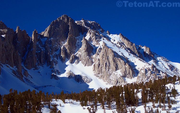
University Peak is a thirteener in the Sierra Nevada. It is named for the University of California. It is on the Sierra crest between Mount Gould to the north, and Mount Bradley to the south. It lies partly in Tulare County and partly in Inyo County. Its west side is in Kings Canyon National Park while the east face is in the John Muir Wilderness.
Map of University Peak, California 93526, USA
The nearest trailhead to University Peak is Onion Valley. The least technical route to its summit is an off-trail hike up the south slopes. It offers a variety of other routes from easy scrambles to rock climbing. The more challenging routes led the Sierra Club's Sierra Peaks Section to list University as a Mountaineers Peak.
References
University Peak (California) Wikipedia(Text) CC BY-SA