
Parent range Sierra Nevada Elevation 4,206 m Prominence 146 m Mountain range Sierra Nevada | First ascent 1922 | |
 | ||
Listing SPS Mountaineers peakWestern States Climbers Star peak Easiest route Exposed scramble, class 3 Similar Mount Mallory, Mount Barnard, Junction Peak, Norman Clyde Peak, Mount Keith | ||
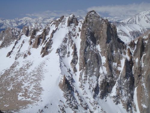
Mount McAdie is summit on the crest of the Sierra Nevada and is located 2.1 miles (3.4 km) south of Mount Whitney. It has three summits with the north peak being the highest. The summit ridge marks the boundary between Sequoia National Park and the John Muir Wilderness. It is also on the boundary between Inyo and Tulare counties. Lone Pine, 12.4 miles (20.0 km) to the northeast, is in the Owens Valley on U.S. 395.
Map of Mt Mcadie, California, USA
In 1905, the mountain was named in honor of Alexander G. McAdie by James E. Church. McAdie ran the U.S. Weather Bureau in San Francisco at the time, and had visited the summit of Mount Whitney in 1903. The name first appeared on a map in 1956 with the publication of the USGS, 15 minute, Mount Whitney Quadrangle topographic map.
The north summit can be reached from Arc Pass and was first climbed by Norman Clyde in 1922. The west face was first climbed in 1954 and is a class 4 ascent.