
Country United States County Hunterdon Named for Union Furnace Local time Friday 2:02 PM | Incorporated February 17, 1853 Population 6,160 (2000) | |
 | ||
Area rank 138th of 566 in state14th of 26 in county Weather 4°C, Wind E at 19 km/h, 94% Humidity Points of interest Spruce Run Recreatio, Hoffman Park, Clinton Wildlife Manage | ||
Union Township is a township in Hunterdon County, New Jersey, United States. As of the 2010 United States Census, the township's population was 5,908, reflecting a decline of 252 (-4.1%) from the 6,160 counted in the 2000 Census, which had in turn increased by 1,082 (+21.3%) from the 5,078 counted in the 1990 Census. The southwest half of the township lies on what is known as the Hunterdon Plateau, the northwest corner consists of the Musconetcong Ridge and the northeast section is part of the lower-lying Newark Basin around Spruce Run Reservoir.
Contents
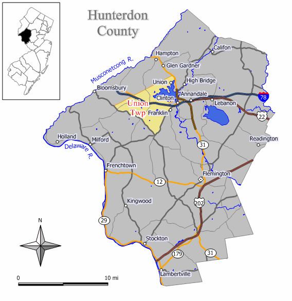
- Map of Union Township NJ USA
- Geography
- 2010 Census
- 2000 Census
- Local government
- Federal state and county representation
- Politics
- Education
- Transportation
- Notable people
- References
Map of Union Township, NJ, USA
Union was incorporated as a township by an act of the New Jersey Legislature on February 17, 1853, from portions of Bethlehem Township. Clinton Town was formed on April 5, 1865, within portions of the township, and became an independent municipality in 1895. The township was named for Union Furnace, which was producing iron from 1742 until the 1780s. The name "Union" was chosen over the alternative "Rockhill", which was a community at the southern end of the township.
Union Furnace and its forge produced cannonballs for the Revolutionary War and shoes for horses and oxen, as well as farm implements. Forests gave way to farm fields as trees were cut down to stoke the furnace. A farm community developed, together with basket making and tanning industries.
New Jersey Monthly magazine ranked Union Township as its 21st best place to live in its 2008 rankings of the "Best Places To Live" in New Jersey.
Geography
According to the United States Census Bureau, the township had a total area of 20.609 square miles (53.378 km2), including 18.737 square miles (48.528 km2) of land and 1.872 square miles (4.850 km2) of water (9.09%).
Unincorporated communities, localities and place names located partially or completely within the township include Coles Mills, Grandin, Hensfoot, Jutland, Kingtown, Mechlings Corner, Mount Salem, Norton, Pattenburg, Perryville, Polktown and Van Syckel.
Pittstown is an unincorporated community that is also spread across Alexandria Township and Franklin Township.
2010 Census
The 2010 United States Census counted 5,908 people, 1,752 households, and 1,221 families residing in the township. The population density was 315.3 per square mile (121.7/km2). The township contained 1,830 housing units at an average density of 97.7 per square mile (37.7/km2). The racial makeup of the township was 83.21% (4,916) White, 9.06% (535) Black or African American, 0.15% (9) Native American, 4.13% (244) Asian, 0.05% (3) Pacific Islander, 1.61% (95) from other races, and 1.79% (106) from two or more races. Hispanics or Latinos of any race were 6.08% (359) of the population.
Out of a total of 1,752 households, 33.8% had children under the age of 18 living with them, 61.6% were married couples living together, 5.5% had a female householder with no husband present, and 30.3% were non-families. 24.8% of all households were made up of individuals, and 7.2% had someone living alone who was 65 years of age or older. The average household size was 2.57 and the average family size was 3.12.
In the township, 18.4% of the population were under the age of 18, 6.5% from 18 to 24, 27.8% from 25 to 44, 37.6% from 45 to 64, and 9.6% who were 65 years of age or older. The median age was 43.7 years. For every 100 females the census counted 77.5 males, but for 100 females at least 18 years old, it was 73.2 males.
The Census Bureau's 2006-2010 American Community Survey showed that (in 2010 inflation-adjusted dollars) median household income was $103,304 (with a margin of error of +/- $11,761) and the median family income was $126,157 (+/- $23,039). Males had a median income of $97,548 (+/- $31,580) versus $62,130 (+/- $7,607) for females. The per capita income for the borough was $33,753 (+/- $7,431). About 0.0% of families and 12.5% of the population were below the poverty line, including 0.0% of those under age 18 and 13.8% of those age 65 or over.
2000 Census
As of the 2000 United States Census there were 6,160 people, 1,666 households, and 1,162 families residing in the township. The population density was 324.8 people per square mile (125.4/km²). There were 1,725 housing units at an average density of 90.9 per square mile (35.1/km²). The racial makeup of the township was 81.83% White, 13.36% African American, 0.18% Native American, 1.59% Asian, 0.02% Pacific Islander, 1.59% from other races, and 1.43% from two or more races. Hispanic or Latino of any race were 5.13% of the population.
There were 1,666 households out of which 35.9% had children under the age of 18 living with them, 62.4% were married couples living together, 4.6% had a female householder with no husband present, and 30.2% were non-families. 24.3% of all households were made up of individuals and 5.4% had someone living alone who was 65 years of age or older. The average household size was 2.61 and the average family size was 3.18.
In the township the population was spread out with 19.2% under the age of 18, 5.9% from 18 to 24, 43.4% from 25 to 44, 25.0% from 45 to 64, and 6.6% who were 65 years of age or older. The median age was 38 years. For every 100 females there were 71.0 males. For every 100 females age 18 and over, there were 65.2 males.
The median income for a household in the township was $81,089, and the median income for a family was $102,146. Males had a median income of $64,375 versus $41,795 for females. The per capita income for the township was $29,535. About 0.4% of families and 1.6% of the population were below the poverty line, including 1.3% of those under age 18 and 4.2% of those age 65 or over.
Local government
Union Township is governed under the Township form of government. The five-member Township Committee is elected directly by the voters at-large in partisan elections to serve three-year terms of office on a staggered basis, with either one or two seats coming up for election each year as part of the November general election in a three-year cycle. At an annual reorganization meeting, the Township Committee selects one of its members to serve as Mayor and another as Deputy Mayor.
As of 2016, members of the Union Township Committee are Mayor Frank T. Mazza (R, term on committee ends December 31, 2017; term as mayor ends 2016), Deputy Mayor Matt Severino (R, term on committee ends 2018; term as deputy mayor ends 2016), William F. Bischoff Jr. (R, 2018), Bruce Hirt (R, 2017), and Michele McBride (R, 2016).
In 2010, the Township's Environmental Commission earned Union Township the distinction of becoming the first community in Hunterdon County to achieve certification under the Sustainable Jersey program, which works to help communities reduce waste, cut greenhouse gas emissions and improve environmental equity.
Federal, state and county representation
Union Township is located in the 7th Congressional District and is part of New Jersey's 23rd state legislative district.
New Jersey's Seventh Congressional District is represented by Leonard Lance (R, Clinton Township). New Jersey is represented in the United States Senate by Cory Booker (D, Newark, term ends 2021) and Bob Menendez (D, Paramus, 2019).
For the 2016–2017 session (Senate, General Assembly), the 23rd Legislative District of the New Jersey Legislature is represented in the State Senate by Michael J. Doherty (R, Washington Township, Warren County) and in the General Assembly by John DiMaio (R, Hackettstown) and Erik Peterson (R, Franklin Township, Hunterdon County). The Governor of New Jersey is Chris Christie (R, Mendham Township). The Lieutenant Governor of New Jersey is Kim Guadagno (R, Monmouth Beach).
Hunterdon County is governed by a five-member Board of Chosen Freeholders, who serve three-year terms of office at-large on a staggered basis, with either one or two seats up for election each year on a partisan basis as part of the November general election. At an annual reorganization meeting held each January, the freeholders select one member to serve as the board's Director and another to serve as Deputy Director. As of 2015, Hunterdon County's Freeholders are Freeholder Director John King (R; Raritan Township, 2015), Freeholder Deputy Director Suzanne Lagay (R; Holland Township, 2016), J. Matthew Holt (R; Clinton Town, 2015), John E. Lanza (R; Flemington, 2016) and Robert G. Walton (R; Hampton, 2017). Constitutional officers elected on a countywide basis are County Clerk Mary H. Melfi (R; Flemington, 2017), Sheriff Fredrick W. Brown (R; Alexandria Township, 2016) and Surrogate Susan J. Hoffman (R; Kingwood Township, 2018).
Two state facilities, the New Jersey Department of Corrections Edna Mahan Correctional Facility for Women, and the New Jersey Department of Human Services Hunterdon Developmental Center, are located in Union Township.
Politics
As of March 23, 2011, there were a total of 3,226 registered voters in Union Township, of which 574 (17.8%) were registered as Democrats, 1,335 (41.4%) were registered as Republicans and 1,312 (40.7%) were registered as Unaffiliated. There were 5 voters registered to other parties.
In the 2012 presidential election, Republican Mitt Romney received 60.8% of the vote (1,545 cast), ahead of Democrat Barack Obama with 37.6% (955 votes), and other candidates with 1.7% (42 votes), among the 2,560 ballots cast by the township's 3,416 registered voters (18 ballots were spoiled), for a turnout of 74.9%. In the 2008 presidential election, Republican John McCain received 58.9% of the vote here (1,568 cast), ahead of Democrat Barack Obama with 38.7% (1,030 votes) and other candidates with 1.3% (35 votes), among the 2,662 ballots cast by the township's 3,265 registered voters, for a turnout of 81.5%. In the 2004 presidential election, Republican George W. Bush received 64.3% of the vote here (1,566 ballots cast), outpolling Democrat John Kerry with 35.3% (860 votes) and other candidates with 1.1% (34 votes), among the 2,437 ballots cast by the township's 2,992 registered voters, for a turnout percentage of 81.5.
In the 2013 gubernatorial election, Republican Chris Christie received 77.2% of the vote (1,179 cast), ahead of Democrat Barbara Buono with 21.0% (321 votes), and other candidates with 1.8% (28 votes), among the 1,549 ballots cast by the township's 3,409 registered voters (21 ballots were spoiled), for a turnout of 45.4%. In the 2009 gubernatorial election, Republican Chris Christie received 70.9% of the vote here (1,303 ballots cast), ahead of Democrat Jon Corzine with 19.9% (366 votes), Independent Chris Daggett with 7.6% (139 votes) and other candidates with 0.4% (7 votes), among the 1,837 ballots cast by the township's 3,214 registered voters, yielding a 57.2% turnout.
Education
The Union Township School District serves students in kindergarten through eighth grade. As of the 2014-15 school year, the district and its two schools had an enrollment of 752 students and 44.0 classroom teachers (on an FTE basis), for a student–teacher ratio of 17.1:1. Schools in the district (with 2014-15 enrollment data from the National Center for Education Statistics) are Union Township Elementary School (grades K-4; 235 students) and Union Township Middle School (5-8; 240).
Public school students in ninth through twelfth grades attend North Hunterdon High School in Annandale, which also serves students from Bethlehem Township, Clinton Town, Clinton Township, Franklin Township and Lebanon Borough. As of the 2014-15 school year, the high school had an enrollment of 1,747 students and 134.8 classroom teachers (on an FTE basis), for a student–teacher ratio of 13.0:1. The school is part of the North Hunterdon-Voorhees Regional High School District, which also includes students from Califon, Glen Gardner, Hampton, High Bridge, Lebanon Township and Tewksbury Township, who attend Voorhees High School in Lebanon Township.
Transportation
As of May 2010, the township had a total of 64.00 miles (103.00 km) of roadways, of which 43.08 miles (69.33 km) were maintained by the municipality, 11.51 miles (18.52 km) by Hunterdon County and 9.41 miles (15.14 km) by the New Jersey Department of Transportation.
Union is accessible by a variety of roads. CR 513 runs along the southeastern border while CR 579 goes along the southwestern border. Route 173 passes through the center and eventually merges briefly with both Interstate 78 and U.S. 22 which also run through the center.
The Norfolk Southern Railway's Lehigh Line (formerly the mainline of the Lehigh Valley Railroad), runs through Union Township.
Notable people
People who were born in, residents of, or otherwise closely associated with Union Township include: