
Country United States County Warren Named for Samuel Hackett Local time Tuesday 8:14 AM | Incorporated March 9, 1853 Zip code 07840 Population 9,607 (2013) | |
 | ||
Area rank 307th of 566 in state18th of 22 in county Weather -5°C, Wind NE at 21 km/h, 94% Humidity | ||
Hackettstown is a town in Warren County, New Jersey, United States. As of the 2010 United States Census, the town's population was 9,724, reflecting a decline of 679 (-6.5%) from the 10,403 counted in the 2000 Census, which had in turn increased by 2,283 (+28.1%) from the 8,120 counted in the 1990 Census. The town is located in the easternmost region of the Lehigh Valley.
Contents
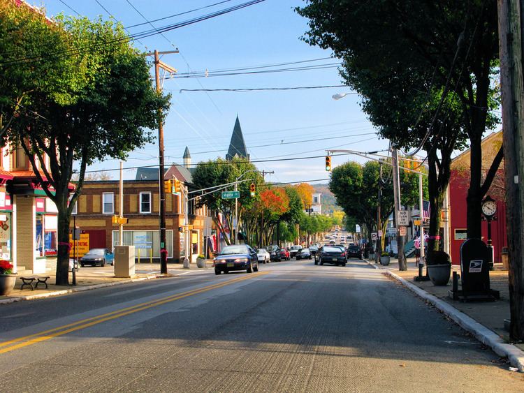
- Map of Hackettstown NJ 07840 USA
- History
- Geography
- Census 2010
- Census 2000
- Sports
- Local government
- Federal state and county representation
- Politics
- Education
- Media
- Roads and highways
- Public transportation
- Airports
- Notable people
- References
Map of Hackettstown, NJ 07840, USA
Hackettstown was incorporated as a town by an act of the New Jersey Legislature on March 9, 1853, from portions of Independence Township. Portions of territory were exchanged with Mansfield Township in 1857, 1860, 1872 and 1875.
Hackettstown houses the headquarters of Mars Chocolate USA, the American division of Mars, Incorporated, makers of Milky Way, Mars, M&M's, Twix and Snickers candy bars, as well as pet foods (such as the well-known Whiskas and Pedigree brands), human foods (including Uncle Ben's) and non-confectionery snack foods (including Combos).
It is believed that Hackettstown was named after Samuel Hackett, an early settler and large landowner. Hackett is said to have "contributed liberally to the liquid refreshments on the christening of a new hotel, in order to secure the name which, before this, had been Helms' Mills or Musconetcong".
Hackettstown was named #72 of the top 100 towns in the United States to Live and Work In by Money Magazine in 2005; it has not been included since.
History
William Johnson (1817 - 1891) was a prime mover in getting the town incorporated in 1853. He and his brother George (1815 - 1889) were successful merchants in the town beginning in 1839 when they began operating the W.L. & G.W Johnson dry good store. The two men were very active in community affairs. George was a member of First Presbyterian Church, a director of the Hackettstown National Bank, and a member of the Hackettstown Water Board. Both men were involved in the establishment of the Union Cemetery.
In 1886, Tillie Smith, an 18-year-old kitchen worker from a poverty-stricken family, was raped, murdered and left lying in an open field on the campus of the Centenary Collegiate Institute, where she worked. A janitor at the school named James Titus was tried and convicted of the rape and murder, based on circumstantial evidence and public opinion shaped by yellow journalism. Titus was sentenced to hang, but he signed a confession and served 19 years of hard labor and lived from 1904 to 1952 in Hackettstown, among many of the same residents who championed his conviction.
In 1925, a train wreck in the town killed 45 people and injured about 50 others en route to New York City from Chicago. The derailment occurred on Rockport road in the early morning at approximately 3:30AM. The event made national headlines and stands as the deadliest event in Warren County history.
Geography
According to the United States Census Bureau, the town had a total area of 3.712 square miles (9.613 km2), including 3.607 square miles (9.341 km2) of land and 0.105 square miles (0.272 km2) of water (2.83%). The town is located in a valley along the banks of the Musconetcong River.
Upper Pohatcong Mountain extends northeast of Washington approximately 6 mi (9.7 km).
Unincorporated communities, localities and place names located partially or completely within the town include Warren Furnace.
Hackettstown borders the townships of Washington to the southeast, Mansfield to the southwest, Allamuchy to the north, Mount Olive to the northeast, and Independence to the west.
Census 2010
The 2010 United States Census counted 9,724 people, 3,575 households, and 2,256 families residing in the town. The population density was 2,696.1 per square mile (1,041.0/km2). The town contained 3,755 housing units at an average density of 1,041.1 per square mile (402.0/km2). The racial makeup of the town was 85.08% (8,273) White, 2.46% (239) Black or African American, 0.24% (23) Native American, 4.97% (483) Asian, 0.05% (5) Pacific Islander, 5.19% (505) from other races, and 2.02% (196) from two or more races. Hispanics or Latinos of any race were 15.16% (1,474) of the population.
Out of a total of 3,575 households, 29.4% had children under the age of 18 living with them, 49.5% were married couples living together, 8.6% had a female householder with no husband present, and 36.9% were non-families. 30.0% of all households were made up of individuals, and 12.3% had someone living alone who was 65 years of age or older. The average household size was 2.48 and the average family size was 3.09.
In the town, 20.3% of the population were under the age of 18, 14.5% from 18 to 24, 25.5% from 25 to 44, 25.5% from 45 to 64, and 14.1% who were 65 years of age or older. The median age was 37.3 years. For every 100 females the census counted 91.8 males, but for 100 females at least 18 years old, it was 91.4 males.
The Census Bureau's 2006-2010 American Community Survey showed that (in 2010 inflation-adjusted dollars) median household income was $62,215 (with a margin of error of +/- $6,907) and the median family income was $82,216 (+/- $10,611). Males had a median income of $51,489 (+/- $5,850) versus $41,822 (+/- $5,248) for females. The per capita income for the borough was $29,433 (+/- $2,122). About 4.4% of families and 7.7% of the population were below the poverty line, including 11.4% of those under age 18 and 6.4% of those age 65 or over.
Census 2000
As of the 2000 United States Census there were 10,403 people, 4,134 households, and 2,530 families residing in the town. The population density was 2,809.5 people per square mile (1,085.6/km2). There were 4,347 housing units at an average density of 1,174.0 per square mile (453.6/km2). The racial makeup of the town was 90.25% White, 2.18% African American, 0.12% Native American, 2.91% Asian, 0.06% Pacific Islander, 2.00% from other races, and 2.47% from two or more races. Hispanic or Latino of any race were 8.01% of the population.
There were 4,134 households out of which 30.2% had children under the age of 18 living with them, 48.0% were married couples living together, 9.3% had a female householder with no husband present, and 38.8% were non-families. 31.7% of all households were made up of individuals and 11.0% had someone living alone who was 65 years of age or older. The average household size was 2.41 and the average family size was 3.10.
In the town, the population was spread out with 22.7% under the age of 18, 10.0% from 18 to 24, 33.9% from 25 to 44, 21.2% from 45 to 64, and 12.2% who were 65 years of age or older. The median age was 35 years. For every 100 females there were 92.8 males. For every 100 females age 18 and over, there were 89.6 males.
The median income for a household in the town was $51,955, and the median income for a family was $64,383. Males had a median income of $44,420 versus $31,110 for females. The per capita income for the town was $24,742. About 2.3% of families and 4.8% of the population were below the poverty line, including 4.9% of those under age 18 and 7.1% of those age 65 or over.
Sports
Local government
The Town of Hackettstown operates under a mayor-council form of government. It was created by a special charter adopted by the New Jersey Legislature and approved by the voters in 1970, under which the town is governed by a strong mayor who serves a three-year term of office and six councilpersons who are elected at large to three-year terms of office on a staggered basis, with two seats up for election each year. The mayor is the town's chief executive officer, overseeing its day-to-day operation and presenting an annual budget. The council is the town's legislative body. The mayor attends town council meetings, but may only vote in the event of a tie. The mayor may veto ordinances passed by the council, which can be overridden with the votes of four council members.
As of 2016, the mayor of Hackettstown is Republican Maria DiGiovanni, whose term of office ends December 31, 2017. Members of the Hackettstown Town Council are Gerald DiMaio Jr. (Acting Mayor, when necessary; R, 2016), Matt Engelau (Alternate Acting Mayor, when necessary; R, 2016), William Conforti (R, 2018), Leonard Kunz (R, 2017), Scott Sheldon (R, 2018) and Eric Tynan (R, 2017).
Federal, state and county representation
Hackettstown is located in the 5th Congressional District and is part of New Jersey's 23rd state legislative district.
New Jersey's Fifth Congressional District is represented by Josh Gottheimer (D, Wyckoff). New Jersey is represented in the United States Senate by Cory Booker (D, Newark, term ends 2021) and Bob Menendez (D, Paramus, 2019).
For the 2016–2017 session (Senate, General Assembly), the 23rd Legislative District of the New Jersey Legislature is represented in the State Senate by Michael J. Doherty (R, Washington Township, Warren County) and in the General Assembly by John DiMaio (R, Hackettstown) and Erik Peterson (R, Franklin Township, Hunterdon County). The Governor of New Jersey is Chris Christie (R, Mendham Township). The Lieutenant Governor of New Jersey is Kim Guadagno (R, Monmouth Beach).
Warren County is governed by a Board of Chosen Freeholders whose three members are chosen at-large on a staggered basis in partisan elections with one seat coming up for election each year as part of the November general election. At an annual reorganization meeting held in the beginning of January, the board selects one of its members to serve as Freeholder Director and other as Deputy Director. As of 2014, Warren County's Freeholders are Freeholder Director Edward J. Smith (R, Asbury / Franklin Township, 2015), Freeholder Deputy Director Richard D. Gardner (R, Asbury / Franklin Township, 2014) and Freeholder Jason Sarnoski (R, Lopatcong Township, 2016). Constitutional officers elected on a countywide basis are County Clerk Patricia J. Kolb (Blairstown Township), Sheriff David Gallant (Blairstown Township) and Surrogate Kevin O'Neill (Hackettstown). The County Administrator, Steve Marvin, is responsible for overseeing the day-to-day operation of the county and its departments.
Politics
As of March 23, 2011, there were a total of 5,410 registered voters in Hackettstown, of which 1,169 (21.6% vs. 21.5% countywide) were registered as Democrats, 1,764 (32.6% vs. 35.3%) were registered as Republicans and 2,468 (45.6% vs. 43.1%) were registered as Unaffiliated. There were 9 voters registered to other parties. Among the town's 2010 Census population, 55.6% (vs. 62.3% in Warren County) were registered to vote, including 69.8% of those ages 18 and over (vs. 81.5% countywide).
In the 2012 presidential election, Republican Mitt Romney received 1,973 votes (52.2% vs. 56.0% countywide), ahead of Democrat Barack Obama with 1,661 votes (44.0% vs. 40.8%) and other candidates with 77 votes (2.0% vs. 1.7%), among the 3,777 ballots cast by the town's 5,516 registered voters, for a turnout of 68.5% (vs. 66.7% in Warren County). In the 2008 presidential election, Republican John McCain received 2,090 votes (52.7% vs. 55.2% countywide), ahead of Democrat Barack Obama with 1,724 votes (43.4% vs. 41.4%) and other candidates with 64 votes (1.6% vs. 1.6%), among the 3,969 ballots cast by the town's 5,437 registered voters, for a turnout of 73.0% (vs. 73.4% in Warren County). In the 2004 presidential election, Republican George W. Bush received 2,368 votes (60.3% vs. 61.0% countywide), ahead of Democrat John Kerry with 1,492 votes (38.0% vs. 37.2%) and other candidates with 48 votes (1.2% vs. 1.3%), among the 3,928 ballots cast by the town's 5,241 registered voters, for a turnout of 74.9% (vs. 76.3% in the whole county).
In the 2013 gubernatorial election, Republican Chris Christie received 72.5% of the vote (1,543 cast), ahead of Democrat Barbara Buono with 25.6% (545 votes), and other candidates with 1.9% (41 votes), among the 2,166 ballots cast by the town's 5,608 registered voters (37 ballots were spoiled), for a turnout of 38.6%. In the 2009 gubernatorial election, Republican Chris Christie received 1,547 votes (61.1% vs. 61.3% countywide), ahead of Democrat Jon Corzine with 662 votes (26.1% vs. 25.7%), Independent Chris Daggett with 250 votes (9.9% vs. 9.8%) and other candidates with 30 votes (1.2% vs. 1.5%), among the 2,533 ballots cast by the town's 5,321 registered voters, yielding a 47.6% turnout (vs. 49.6% in the county).
Education
The Hackettstown School District serves students in kindergarten through twelfth grade. As of the 2012-13 school year, the district's four schools had an enrollment of 1,842 students and 141.9 classroom teachers (on an FTE basis), for a student–teacher ratio of 12.98:1. Schools in the district (with 2012-13 enrollment data from the National Center for Education Statistics) are Hatchery Hill School (K-4; 230 students), Willow Grove School (K-4; 298), Hackettstown Middle School (5-8; 358) and Hackettstown High School (9-12; 956). Students from the townships of Allamuchy, Independence, and Liberty, attend the district's high school as part of sending/receiving relationships. For the 2001-02 school year, Hackettstown Middle School was recognized with the National Blue Ribbon Award from the United States Department of Education, the highest honor that an American school can achieve.
Students from the town and from all of Warren County are eligible to attend Ridge and Valley Charter School in Frelinghuysen Township (for grades K-8) or Warren County Technical School in Washington borough (for 9-12), with special education services provided by local districts supplemented throughout the county by the Warren County Special Services School District in Oxford Township (for PreK-12).
Centenary University, a private college affiliated with the United Methodist Church, was founded in 1867 and received approval in 1995 to grant master's degrees.
Media
Roads and highways
As of May 2010, the town had a total of 34.47 miles (55.47 km) of roadways, of which 28.83 miles (46.40 km) were maintained by the municipality, 2.96 miles (4.76 km) by Warren County and 2.68 miles (4.31 km) by the New Jersey Department of Transportation.
Passing through Hackettstown are U.S. Route 46, Route 57, and County Route 517. Route 182 exists completely within the boundaries of Hackettstown.
Public transportation
The Hackettstown station is the western terminus of the NJ Transit Morristown Line and the Montclair-Boonton Line, which both provide service to Hoboken Terminal with connections to Pennsylvania Station in Midtown Manhattan via Midtown Direct trains. New Jersey Transit bus service used to be provided on the MCM5 and 973 local routes before they were discontinued.
Warren County operates a shuttle along Route 57 to Washington Township that operates on an hourly loop on weekdays, with connections available to a shuttle to Philipsburg.
Airports
Hackettstown is located 49.3 miles (79.3 km) from Newark Liberty International Airport in Newark / Elizabeth. Lehigh Valley International Airport, near Allentown, Pennsylvania, is 39.0 miles (62.8 km) away.
Hackettstown Airport, a small general aviation airport with the official database designation of (FAA LID: N05) is located in adjoining Mansfield Township, only a few hundred yards from the municipal border with Hackettstown proper.
Notable people
People who were born in, residents of, or otherwise closely associated with Hackettstown include: