
Existed: 1932 – present Constructed 1932 | Length 1,261 km | |
 | ||
North end: US-83 at OK state line near Perryton | ||
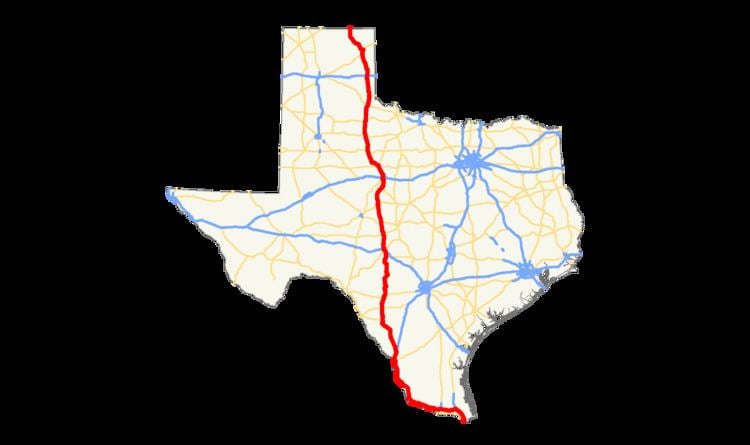
U.S. Highway 83 (US 83), dedicated as the Texas Vietnam Veterans Memorial Highway, is a U.S. Highway in the U.S. state of Texas that begins at US 77 (Interstate 69E, I-69E) in Brownsville and follows the Rio Grande to Laredo, then heads north through Abilene to the Oklahoma border north of Perryton, the seat of Ochiltree County. It is the longest highway in Texas at a length of about 895 miles (1,440 km), besting the east–west I-10, which has a length of 879 miles (1,415 km).
Contents
Map of US-83, Texas, USA
In the Lower Rio Grande Valley, US 83 is a freeway that is at or close to interstate standards from Brownsville to Penitas. In May 2013, the Texas Department of Transportation applied to the American Association of State Highway and Transportation Officials (AASHTO) to designate this 48-mile (77 km) section as I-2. After the Special Committee on Route Numbering initially disapproved the application, the AASHTO Board of Directors approved the I-2 designation, conditional on the concurrence of the Federal Highway Administration. On May 29, 2013, the segment of US 83 was approved as an I-69 connector using the I-2 designation extending approximately 46 miles (74 km) from Harlingen to west of Mission.
Route description
US 83's southern terminus is at a concurrency with I-69E/US 77 on the south side of Brownsville at the Brownsville – Veterans Port of Entry at the US/Mexico border. It remains co-signed with I-69E/US 77 until Harlingen, where I-69E/US 77 makes a sharp turn northward and US 83 maintains a westerly route to McAllen, concurrent with I-2 until Palmview. From there, the highway roughly parallels the Rio Grande until Laredo where it makes a northwesterly turn toward Carrizo Springs, the seat of Dimmit County. The speed limit on US 83 is briefly 75 mph through Dimmit County.
Merging with I-35 just south of downtown, US 83 remains co-signed with the interstate until an exit at Botines, Texas. From there, it continues northward, intersecting with I-10 just south of Junction. US 83 is co-signed with I-10 for approximately 8 miles (13 km), turning northward and leaving I-10 at the Kimble County Airport.
After continuing northward through several rural western Texas towns, US 83 then merges with US 84 east of Tuscola, where it makes a sharp turn back to the north. US 83/84 remains a co-signed route until Abilene, where US 84 turns to the northwest and US 83 remains northbound, merging with US 277 on the west side of the city. US 83/277 remains a co-signed route until approximately 2 miles (3.2 km) north of Anson, where US 277 turns northeast, and US 83, northwest.
After merging with US 380 in Aspermont and briefly sharing a route, US 83 continues northward, merging with US 62 in Paducah. US 83/62 continues as a co-signed route until approximately 15 miles (24 km) south of Wellington, where US 62 makes a sharp turn eastward, leaving US 83 to continue northward, where it crosses into Oklahoma approximately 6 miles (9.7 km) north of Perryton.